2023 Indiana State Library varnished wall map project

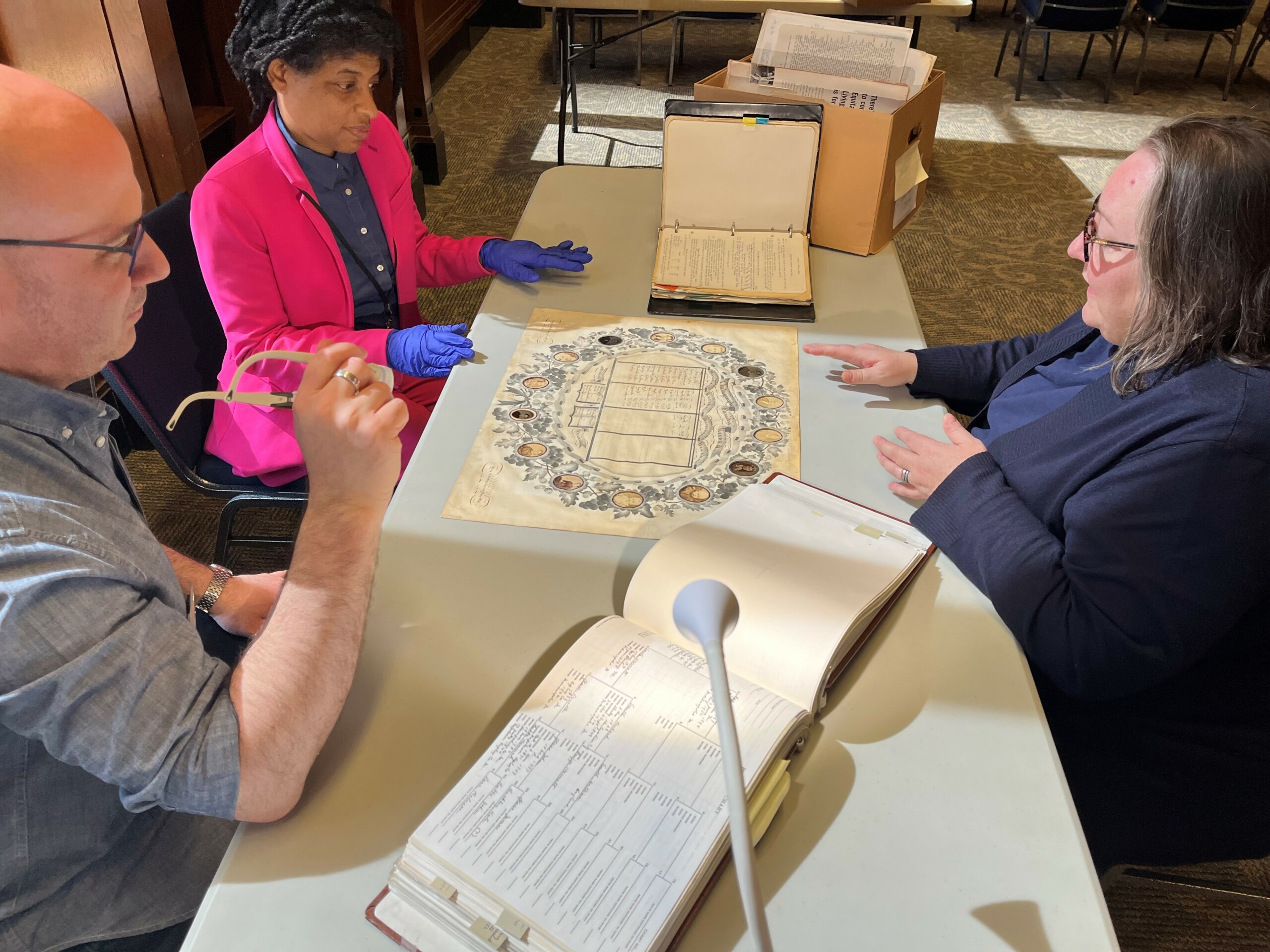
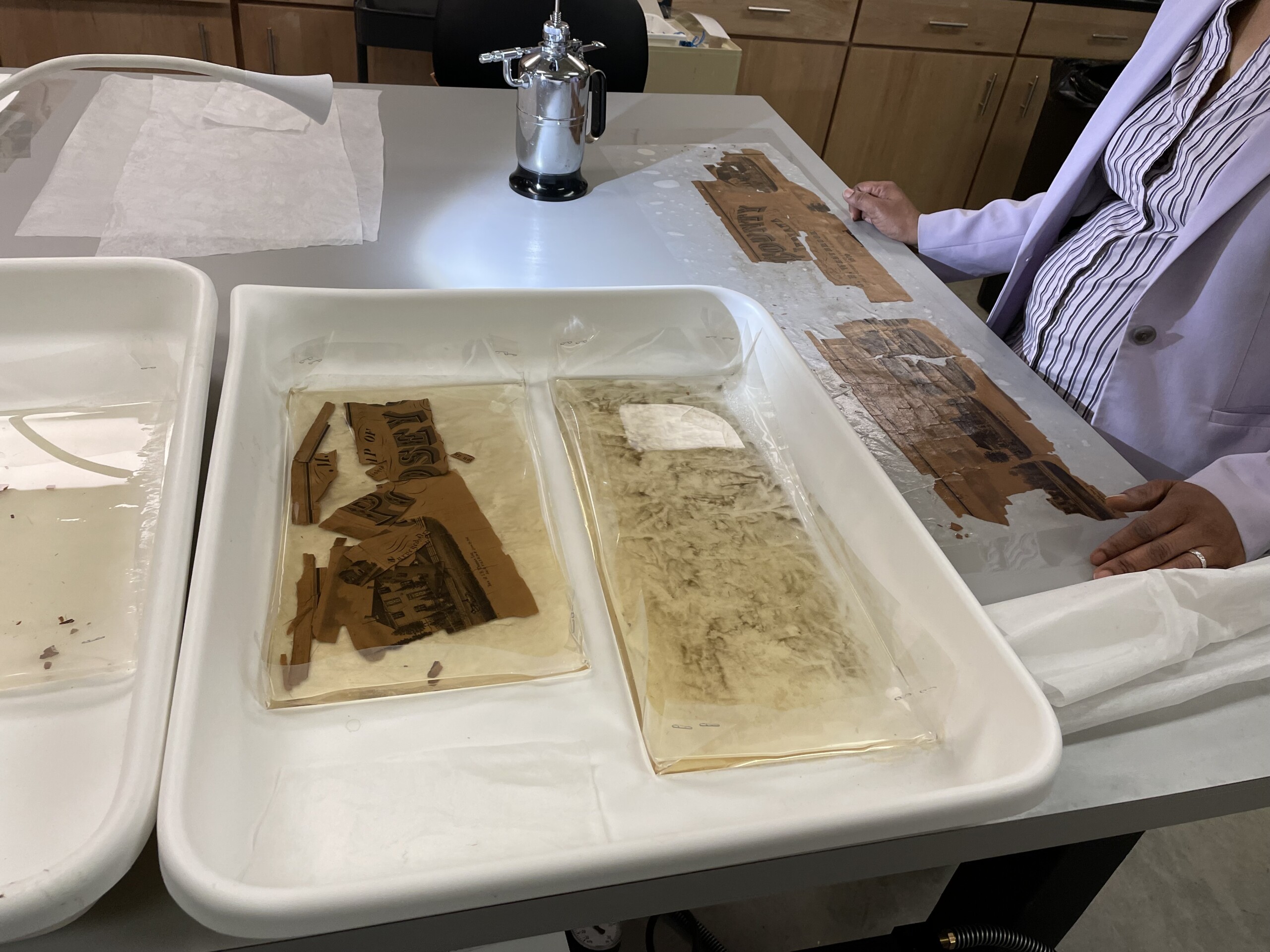
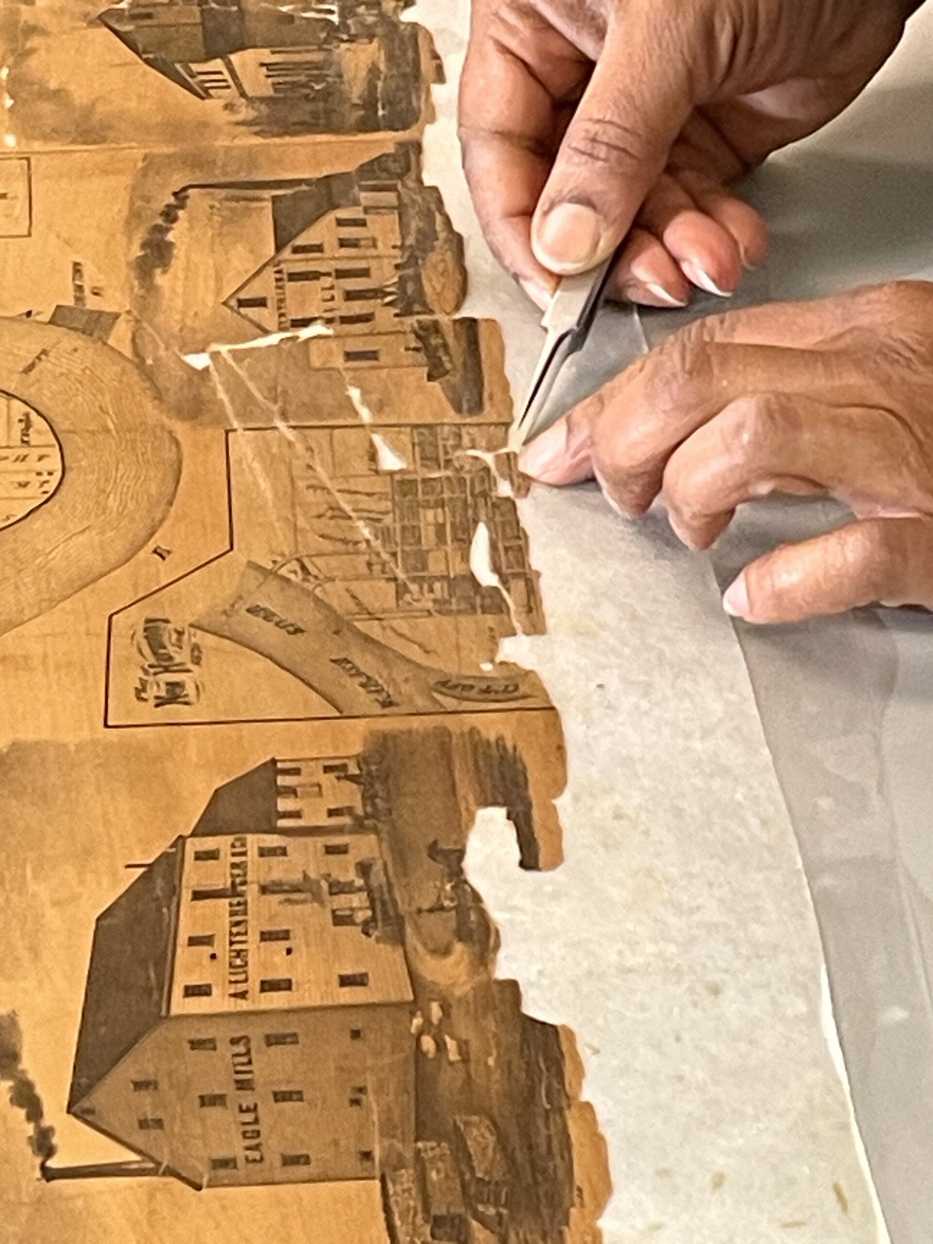
At the end of 2022, the Indiana State Library received the exciting news that it had received a $30,000 grant from the Nicholas Noyes Foundation to work on some of the most important and condition critical Indiana maps in the Indiana Division’s collection. The maps at issue comprised mid-19th century wall maps of Indiana cities and counties. Most of the maps were varnished and in an extremely deteriorated condition, making them completely unusable for any purpose. These maps are historically very important, often showing details such as property owners, churches, businesses and population information.

For many of the maps, the Indiana State Library has the only copy left in existence and the condition is in such a state that even the act of handling them causes pieces to fall off. The grant allowed the library to hire a project conservator, Valinda Carroll, for six months to work in the Indiana State Library Conservation Lab exclusively on some of the most vulnerable maps in the collection, stabilizing them and digitizing them for accessibility.

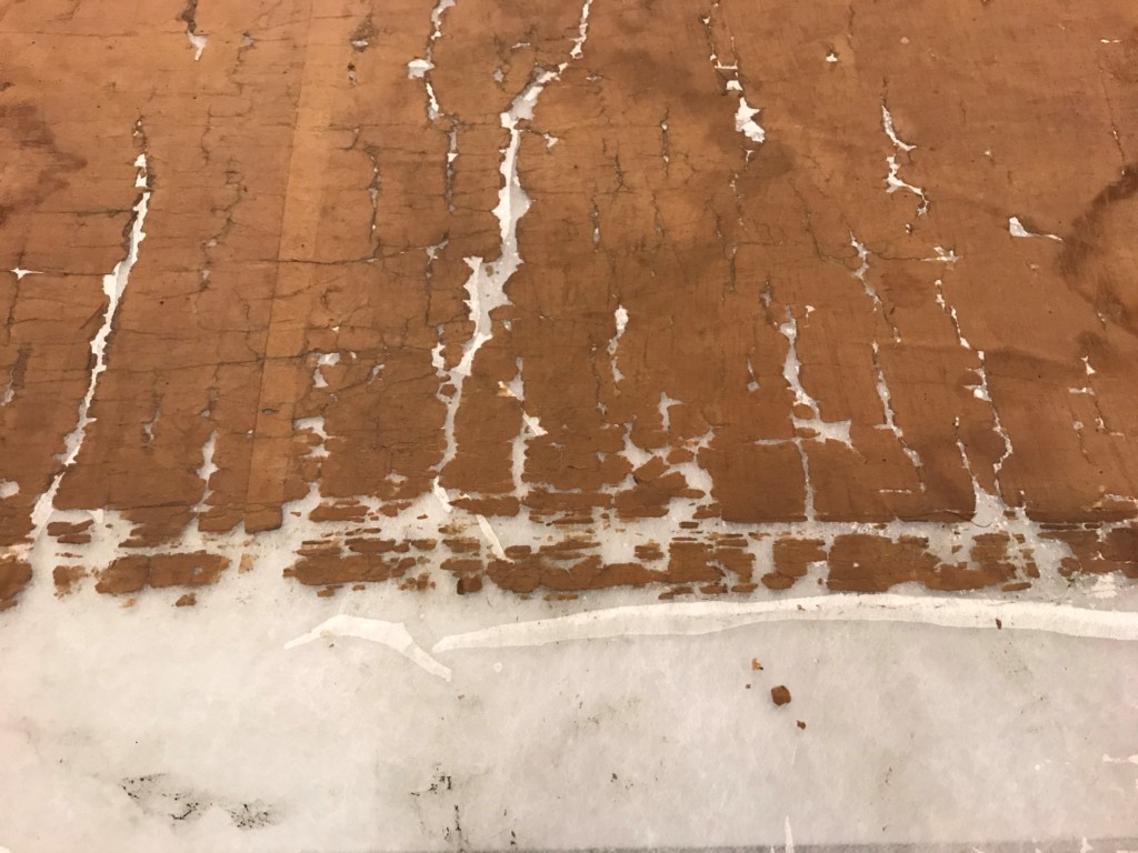
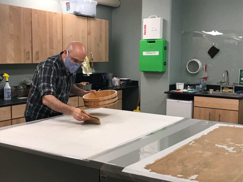
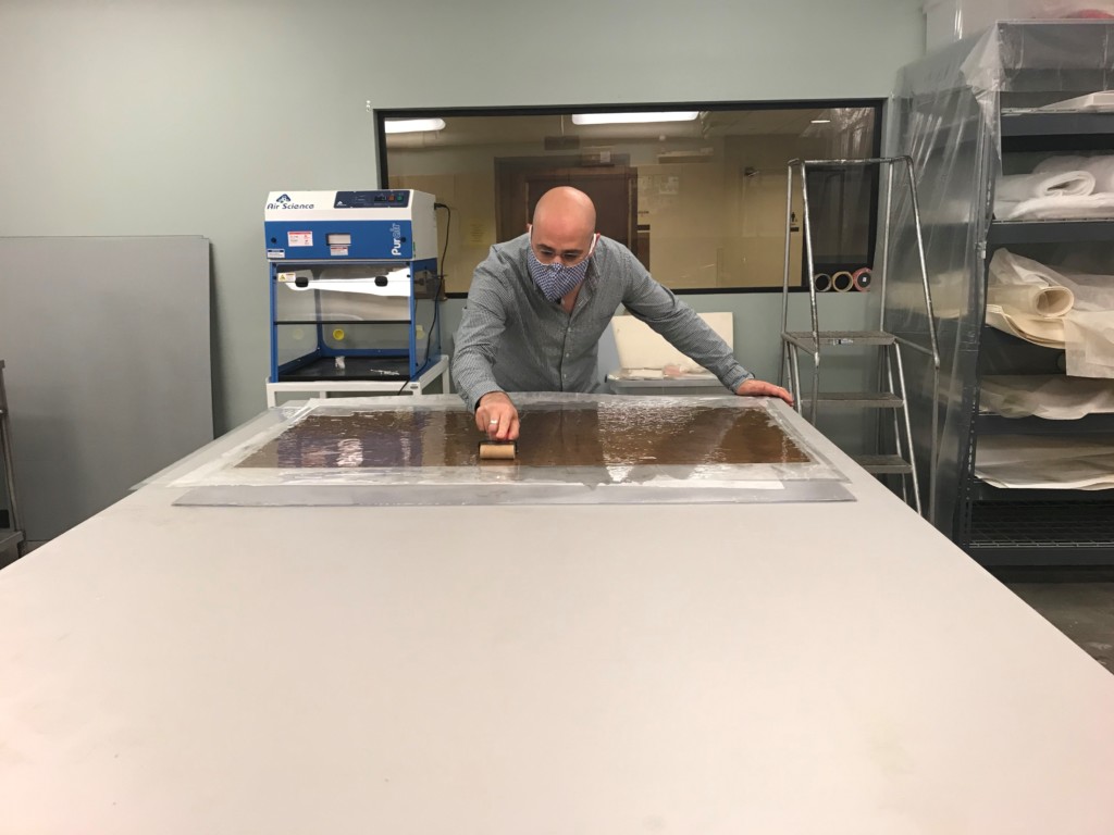
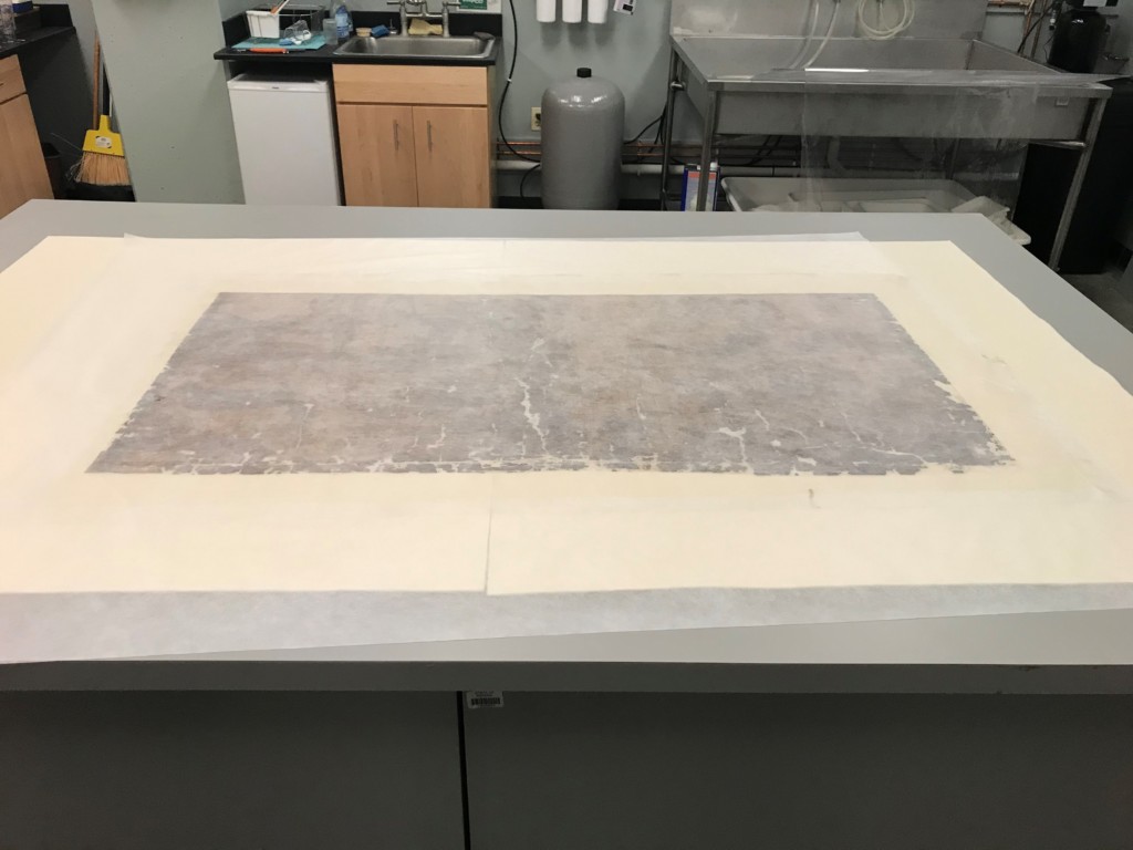
Being able to use the Indiana State Library’s varnished wall maps will support the work of several academic disciplines, local historians, railroad enthusiasts, students, genealogists and other researchers. We also hope to set an example for other institutions that might be holding these difficult to manage fragile, oversized historic collections. We are very excited to see the progress of the project as these important maps get completed and can be shared. The below pictures detail the process involved in repairing the maps.

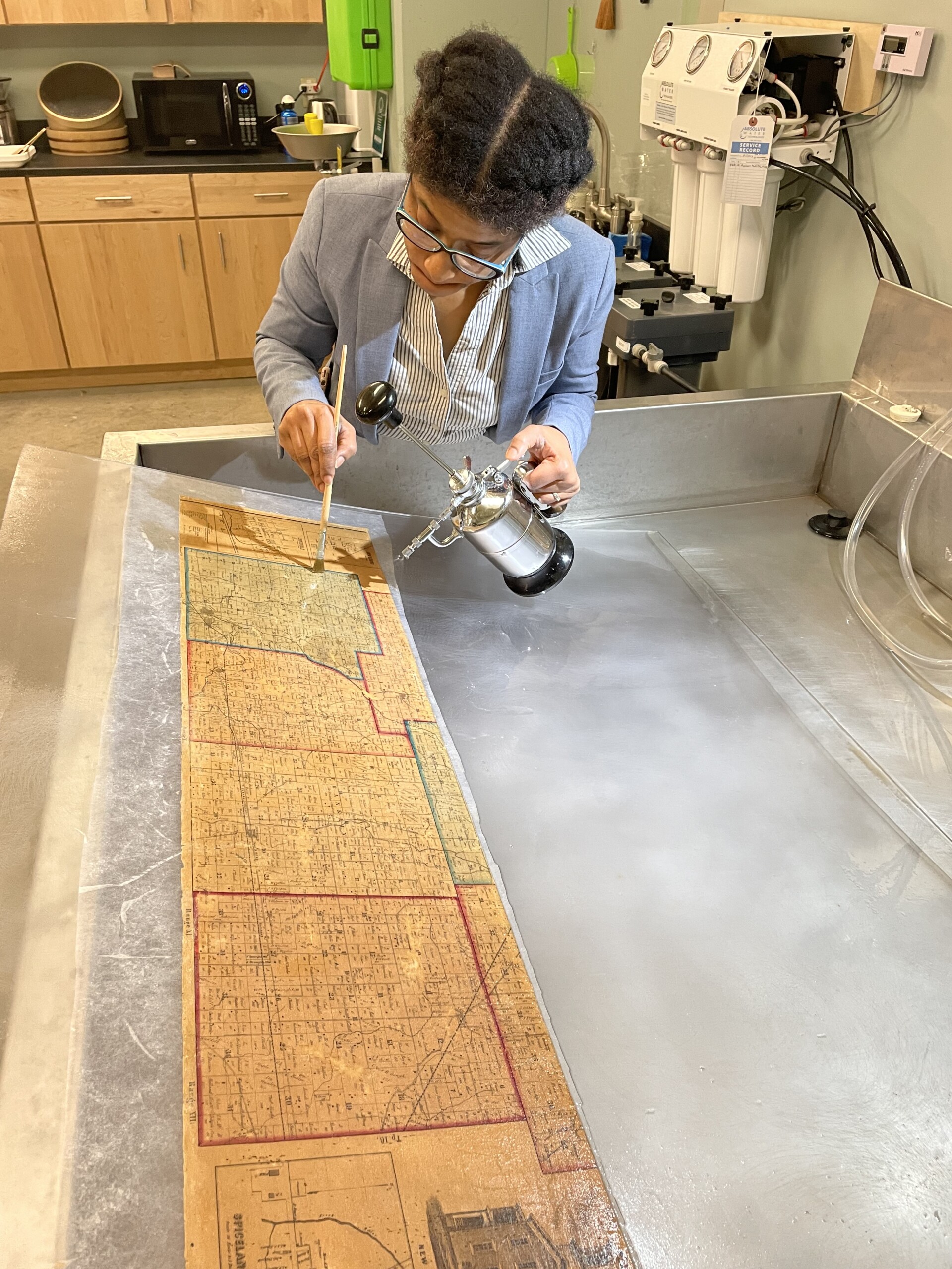
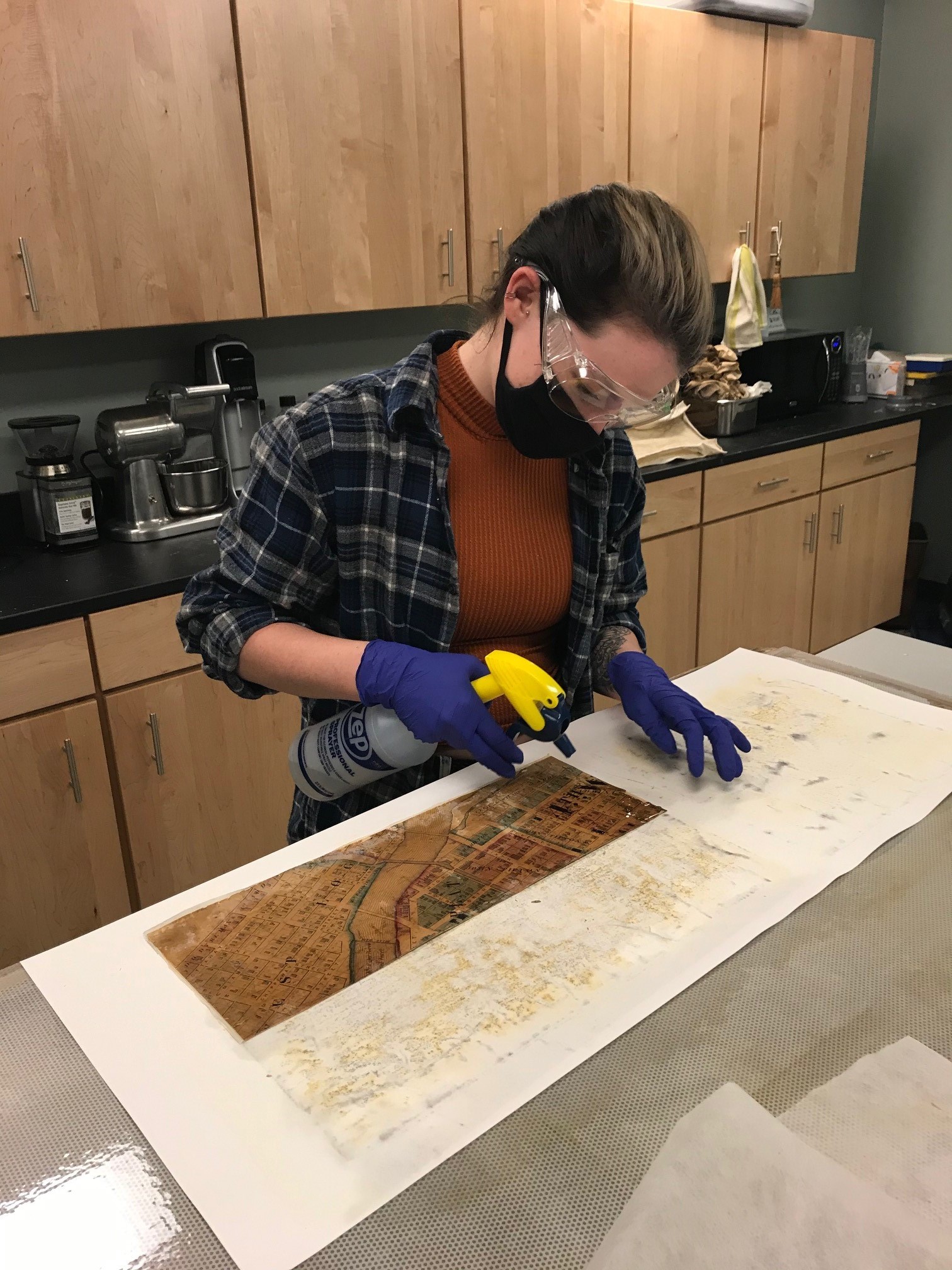
Valinda Carroll washing and cleaning a map with water.

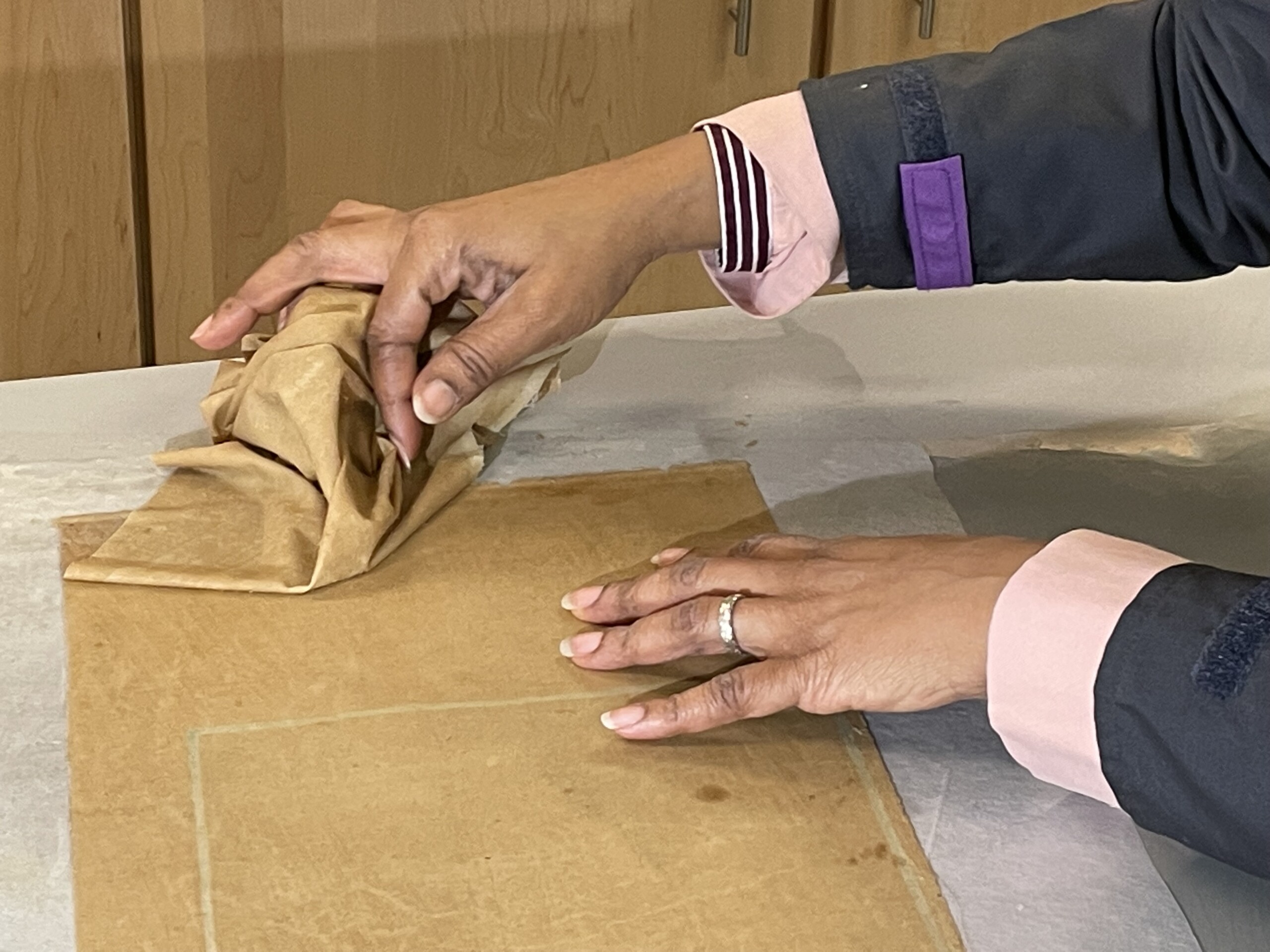
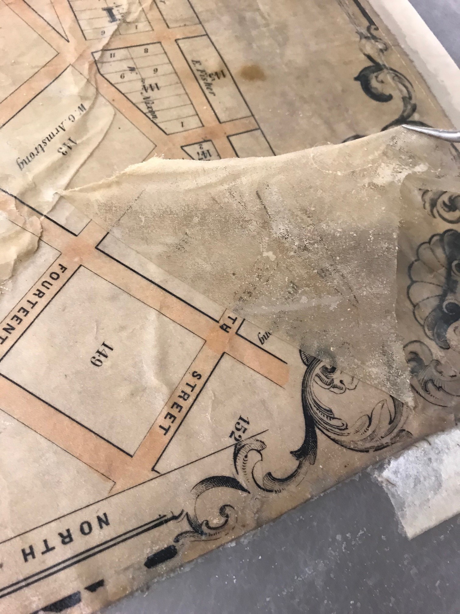
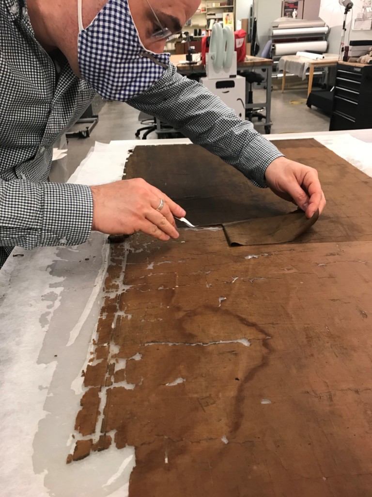
Valinda Carroll removing the deteriorated backing cloth from the back of a map.

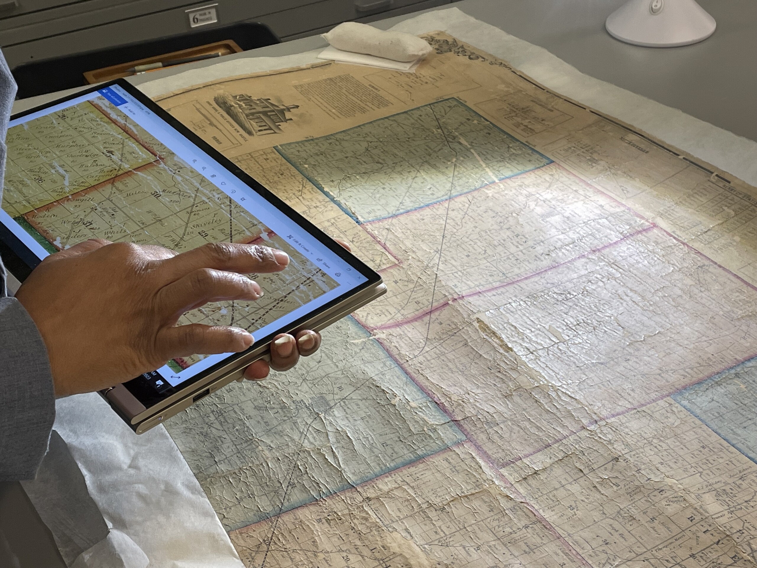
Valinda Carroll using a high resolution before treatment photograph of a map to check for locations for any remaining loose pieces.

Valinda Carroll washing loose pieces of a map section in custom made trays.

Valinda Carroll placing loose pieces of a map in their correct locations.

Before Treatment – 1855 Noble’s Map of Franklin County Indiana.

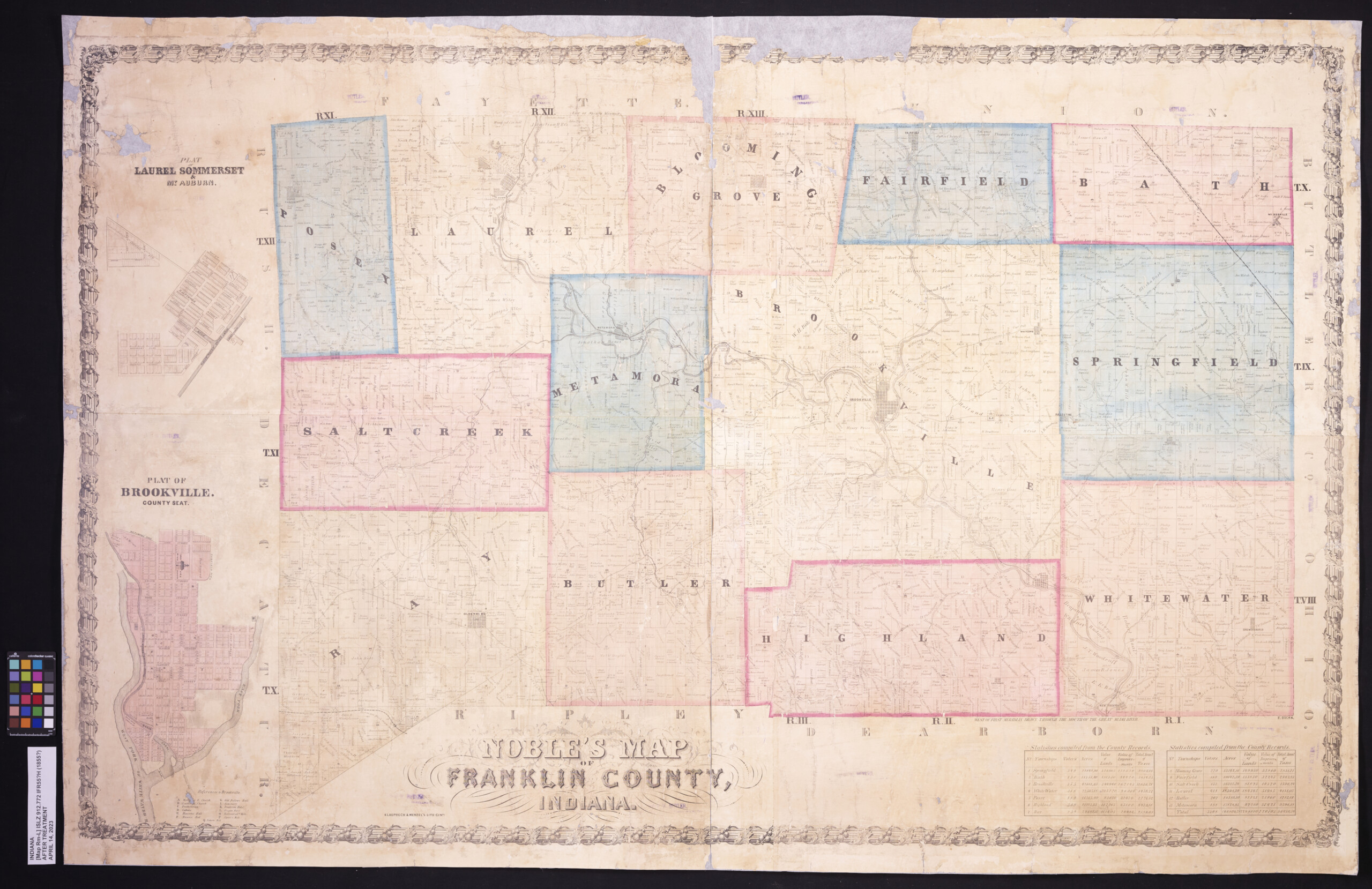
After Treatment – 1855 Noble’s Map of Franklin County Indiana.

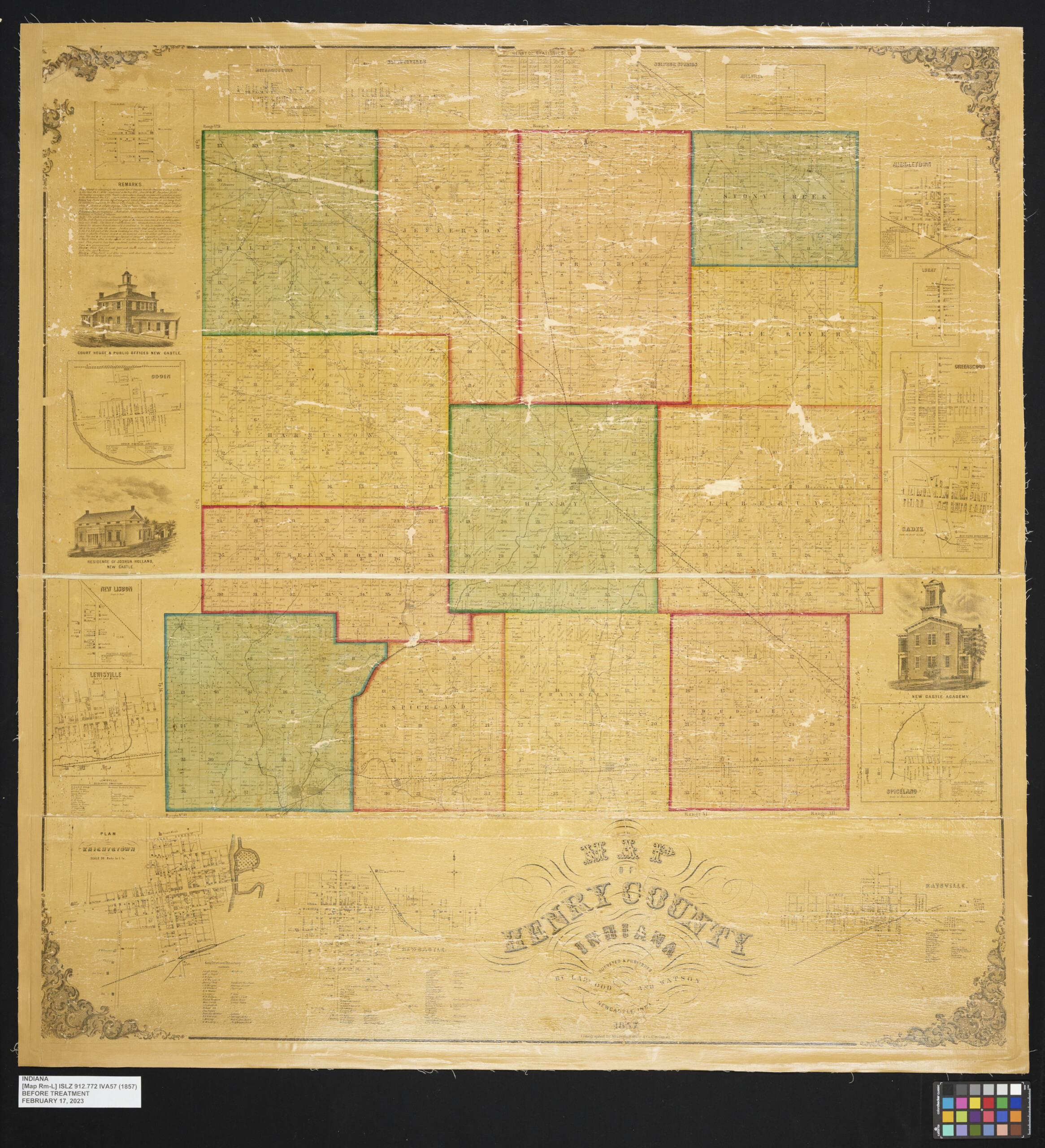
Before Treatment – 1857 Map of Henry County Indiana.

After Treatment – 1857 Map of Henry County Indiana.

This blog post was written by the Indiana State Library Conservator Seth Irwin.

William Kimberley Palmer scrapbook

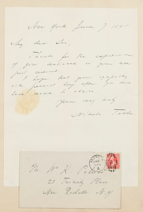
One of the recent items added to the Indiana State Library’s Digital Collection is the William Kimberley Palmer scrapbook (V149). The scrapbook contains autographs from many notable people from the late 19th and early 20th centuries, including this June 7, 1895 letter sent to Palmer by Nikola Tesla:

Nikola Tesla signature.

Palmer was born on March 19, 1856 in Crawfordsville to William and Clara Palmer. In 1865, the family moved to Chicopee, Massachussetts and following his graduation from local high school in 1872, William moved to New York City and secured a clerical position with Charles Scribner’s Sons. He rose to the position of cashier before failing health required him to leave the firm and move to Kansas. He married Louise A. Lesuere on June 16, 1886 and they had four children. By the early 1890s, he had moved back to New York and resumed his work at Scribner’s. Besides his work with the publishing company, he was also an author and poet and was active in may civic and patriotic societies. He passed away at the age of 82 on Aug. 1, 1938.

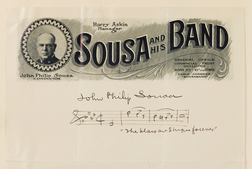
John Philip Sousa signature.

Before his death, he donated the book to the Indiana State Library. This is somewhat odd considering he didn’t live in Indiana long. It’s possible no one else wanted it, but there is another scrapbook at the University of California Berkley, which is even more strange. He also donated books to Indiana University and the Library of Congress.

J. Wells Champney drawing.

When the scrapbook arrived in the lab it was assessed for condition. The scrapbook only exhibited minor condition issues such as small tears, loose attachments and residual soot that most likely came from the Indiana State Library’s old heating system. The repairs to the scrapbook were minor and conducted first by former intern Meghanne Phillips, and then completed by Queen’s University graduate conservation intern Rebecca Clendinen. All the pages were cleaned, all the tears were repaired and all the loose attachments were secured. A new custom storage box was also made.

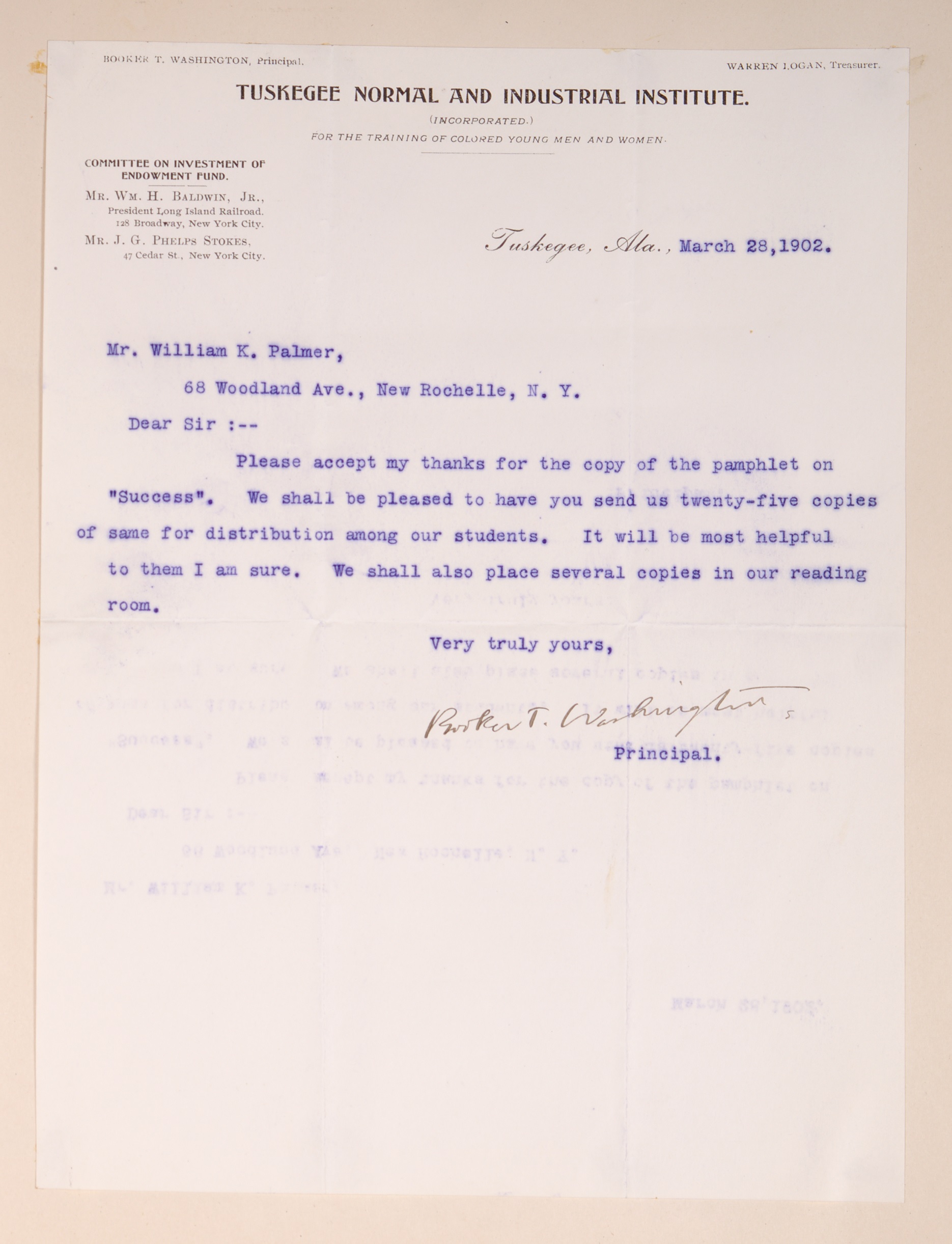
Booker T. Washington signature.

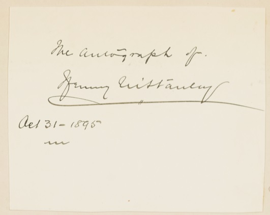
Now digitized, the entire scrapbook can be viewed here in the Indiana State Library’s Digital Collections. Items in the volume include a caricature by Thomas Nast; a small sketch by J. Wells Champney; notes for a sermon written by Henry Ward Beecher; a sketch of Palmer by artist Francis Lathrop; a letter from Henry Morton Stanley, the explorer who found David Livingstone; letters from Booker T. Washington, Mary Murray Washington and Robert R. Moton on Tuskegee Normal and Industrial Institute letterheads; John Philip Sousa’s signature with musical notes for “The Stars and Stripes Forever;” and Samuel Francis Smith’s signature and handwritten copy of the first stanza of “My Country, ‘Tis of Thee,” the song he wrote and originally titled “America” in 1832, that he sent to Palmer in 1895.

Henry Morton Stanley signature.

Other signatures include those of Katherine Lee Bates, George Washington Cable, Joseph Chamberlain, George M. Cohan, Calvin Coolidge, Frank Damrosch, Mary Mapes Dodge, Edward E. Hale, Benjamin Harrison, John M. Hay, Julia Ward Howe, John J. Ingalls, Tudor Jenks, Robert Underwood Johnson, Douglas MacArthur, William McKinley, Nelson A. Miles, D.L. Moody, J.P. Morgan, John Pershing, William C. Redfield, Whitelaw Reid, Jacob Riis, Theodore Roosevelt, Charles M. Schwab, John Sherman, Charles Dwight Sigsbee, Joshua Slocum, William H. Taft, James Tissot, Lew Wallace, Lilian Whiting, Kate Douglas Wiggin and many others.

Douglas MacArthur signature.

Those wishing to view the volume are encouraged to make an appointment with the Rare Books and Manuscripts Division via email or to call 317-232-3671.

This post was written by Victoria Duncan, Rare Books and Manuscripts supervisor; Laura Eliason, Rare Books and Manuscripts program coordinator; and Seth Irwin, conservator at the Indiana State Library. 

Rare Bible on display at the Indiana State Library

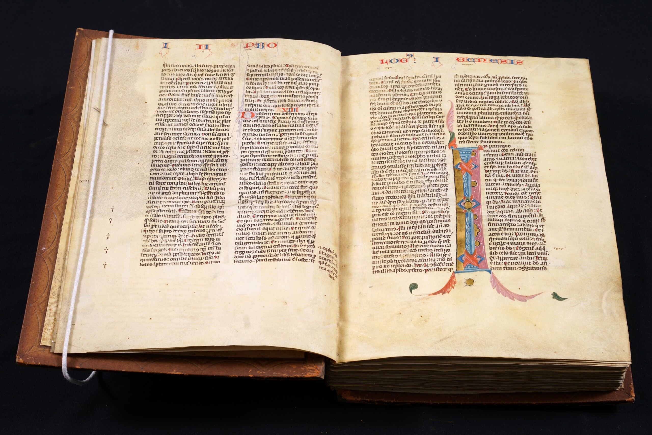
On Saturday, Aug. 13, from 1-3 p.m., the Indiana State Library will present “The Mystery of the Darlington Bible,” a free program that will focus on a 14th century medieval Bible held at the State Library.  

The lecture will investigate the origin of the book, including production techniques, as well as the manuscript’s movement from medieval Spain to Indiana. In particular, the manuscript’s rich decorative program and beautiful illuminations will be examined in the larger context of medieval Bibles. Those with an interest in book history, Bible history and the Middle Ages will be most welcome. The Bible will also be on display during and after the program. 

Presenters include David T. Gura, curator of ancient and medieval manuscripts at the Hesburgh Library at the University of Notre Dame and concurrent associate professor at the university’s Medieval Institute; Seth Irwin, conservator at the Indiana State Library; and Marcia Caudell, supervisor of the Reference and Government Services division at the Indiana State Library. 

Click here to read more about the program and to register. Registration is not necessary to attend. 

The Indiana State Library is located at 315 W. Ohio St. in downtown Indianapolis. 

This post was written by John Wekluk, communications director at the Indiana State Library.

Indiana State Library hosts the 2021 Midwest Regional Conservation Guild Annual Conference

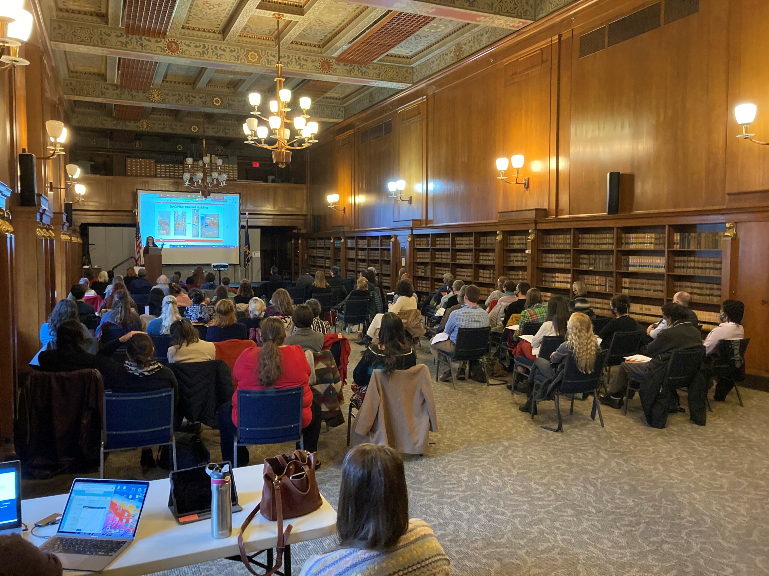
On Nov. 12-14, the Indiana State Library Preservation Division hosted the 2021 Annual Conference for the Midwest Regional Conservation Guild. MRCG is a professional association of art conservation and restoration professionals with the purpose of bringing together those individuals in the Midwest region -and beyond – interested in the preservation of historic and artistic works and to promote fellowship and exchange of ideas on a professional level. The Guild hosts annual meetings each autumn in cities around the Midwest.

The conference took place over three days and featured two pre-conference events, three conservation lab tours, two museum receptions and 22 professional talks. Hosting the conference here at Indiana State Library greatly helped to promote the library’s preservation program. Over the three days, in-person attendance was over 80 people, with another 25 attending virtually. Many of the large collecting cultural institutions in the Midwest, such as museums, libraries and historical societies, sent their conservation staff and collection staff. Many conservators in private practice also attended as well.

The pre-conference programs included a program by American Institute for Conservation Emerging Conservation Professional Network Specialty Group. The program worked with students interested in attending graduate school, show how to prepare their portfolios for their applications and interviews. The conference also included a program, hosted by Bruker Inc. and the Indiana State Museum Conservation Lab, on the use of X-ray florescence analysis to study and analyze cultural and historic artifacts. As part of the conference attendees were also able to get tours of the conservation labs at the Indiana State Library, the Indiana Historical Society and the Indiana State Museum. We were also fortunate to be able to hold receptions and programs at both the Eiteljorg Museum and the Kurt Vonnegut Museum and Library.

Professional talks are the core of any conference and the 2021 MRCG Conference featured 22 professional talks from conservators and other museum professionals on conservation topics from the conservation of paper collections to paintings and other cultural artifacts.

Read more about the Midwest Regional Conservation Guild here.

This blog post was written by the Indiana State Library Conservator Seth Irwin.

Treatment of 3 rare 19th century maps at the Indiana State Library

1855 Map of Jeffersonville, Clark Co. Indiana
Jeffersonville, being positioned along the Ohio River and just north of Louisville, came out of the pioneer era as a metropolis by Indiana standards. This map shows the Jeffersonville and Indiana railroad, as well as the Clark County Plank Road. Jeffersonville was a gateway to southern markets; and later the movement of troops and supplies during the Civil War. Notice all the commerce along the riverfront: sawmills, meat packing and shipyards. Hart and Mapother Lithographers out of Louisville, have a rich body of work surviving in maps, but also print ads, pamphlet cover illustrations and letterhead. The detail on this map is really engaging.

This map came to the lab in extremely poor condition. Like most large 19th century maps, it had been adhered to a large sheet of fabric, which was very dirty. The map was also very deteriorated with lots of missing pieces. It was extremely fragile. Even handling it would cause pieces to fall off. The front of the map was also varnished, which had caused the entire map to darken and discolor. At some point, book cloth was glued to all four edges of the front. Finally, to the entire map had been “silked.” A large sheet of silk had been glued to the entire front of the map making the map appear cloudy and discolored.

The goal for treating this map was to get it to a state where it was stable and could be handled and eventually digitized. The varnish and silk were first removed, along with all the book cloth. The map was then washed, and all the fabric was then removed. The map was then lined onto a sheet of Japanese tissue.

Before treatment image of the front of the map.

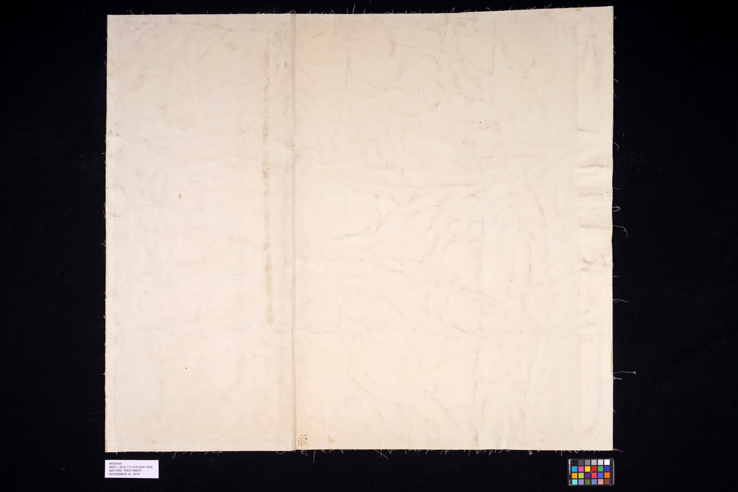
Before treatment image of the back of the map.

Removal of silk from the front of the map.

After treatment image of the front of the map.

After treatment image of the back of the map.

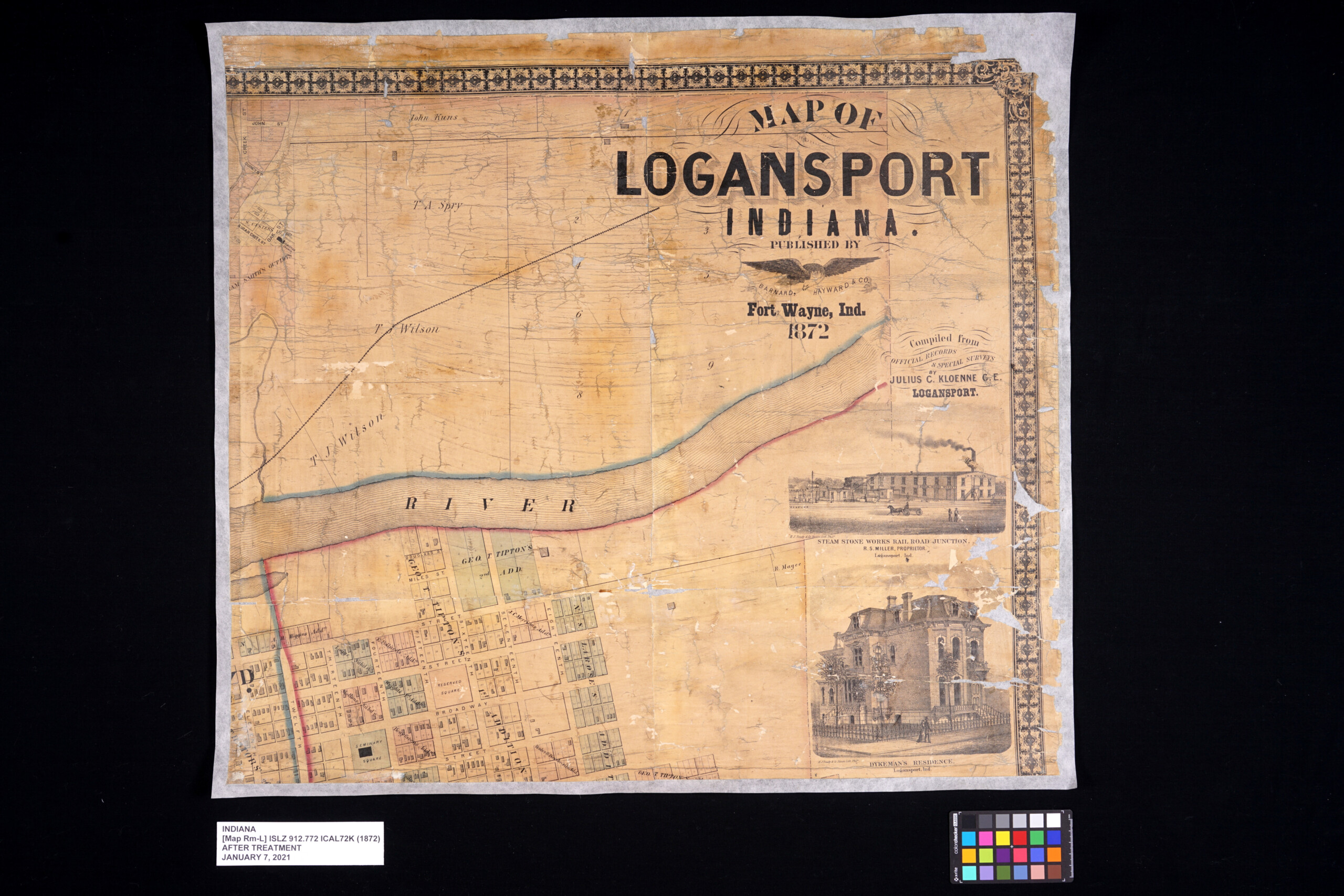
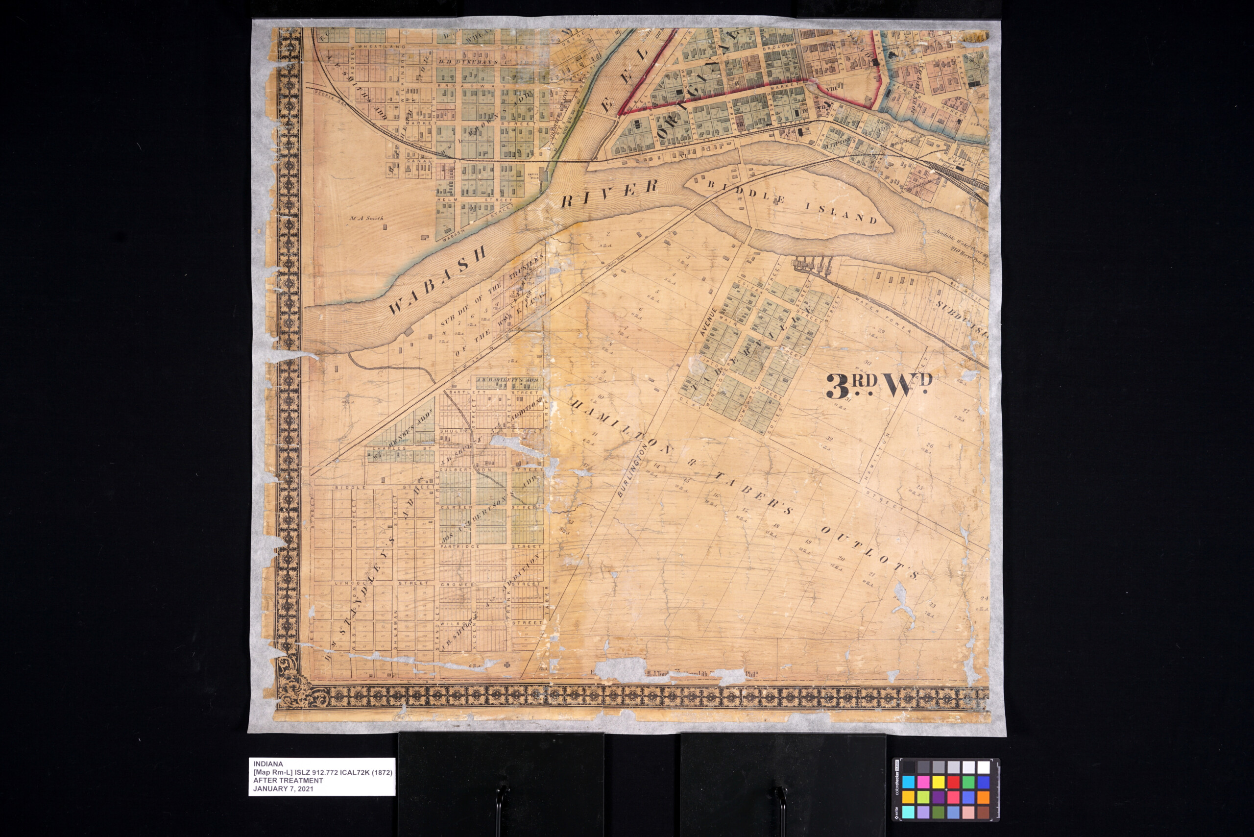
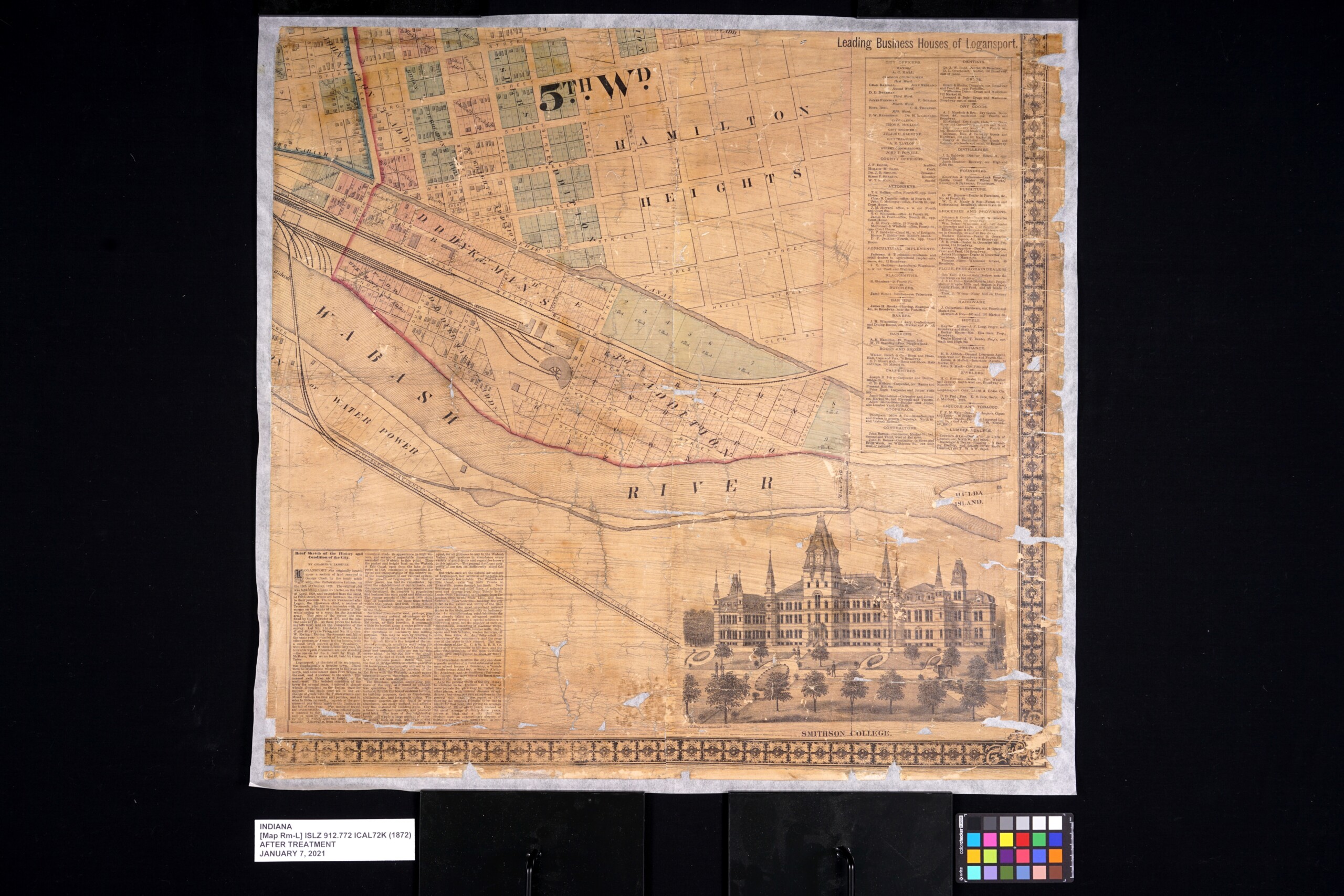
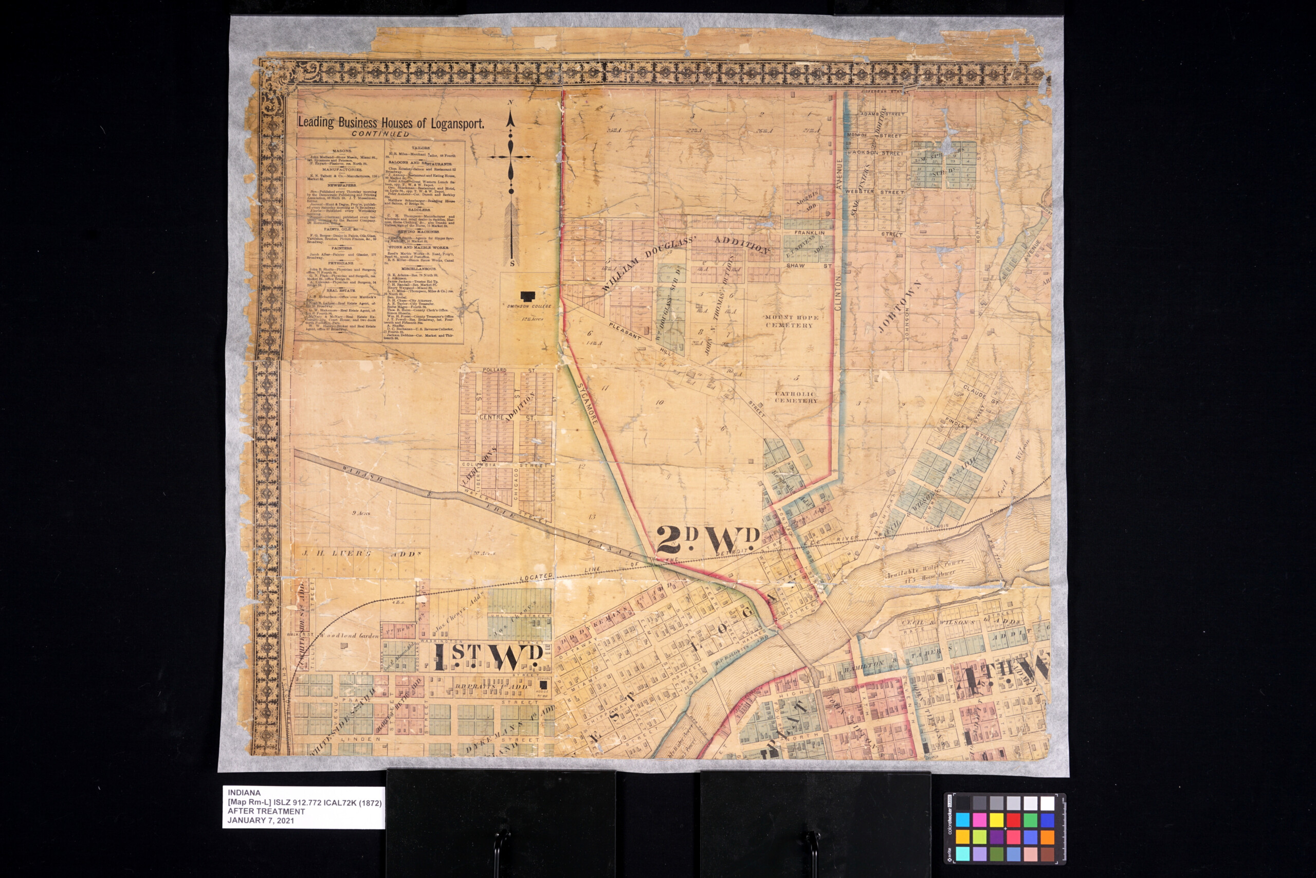
1872 Map of Logansport, Indiana
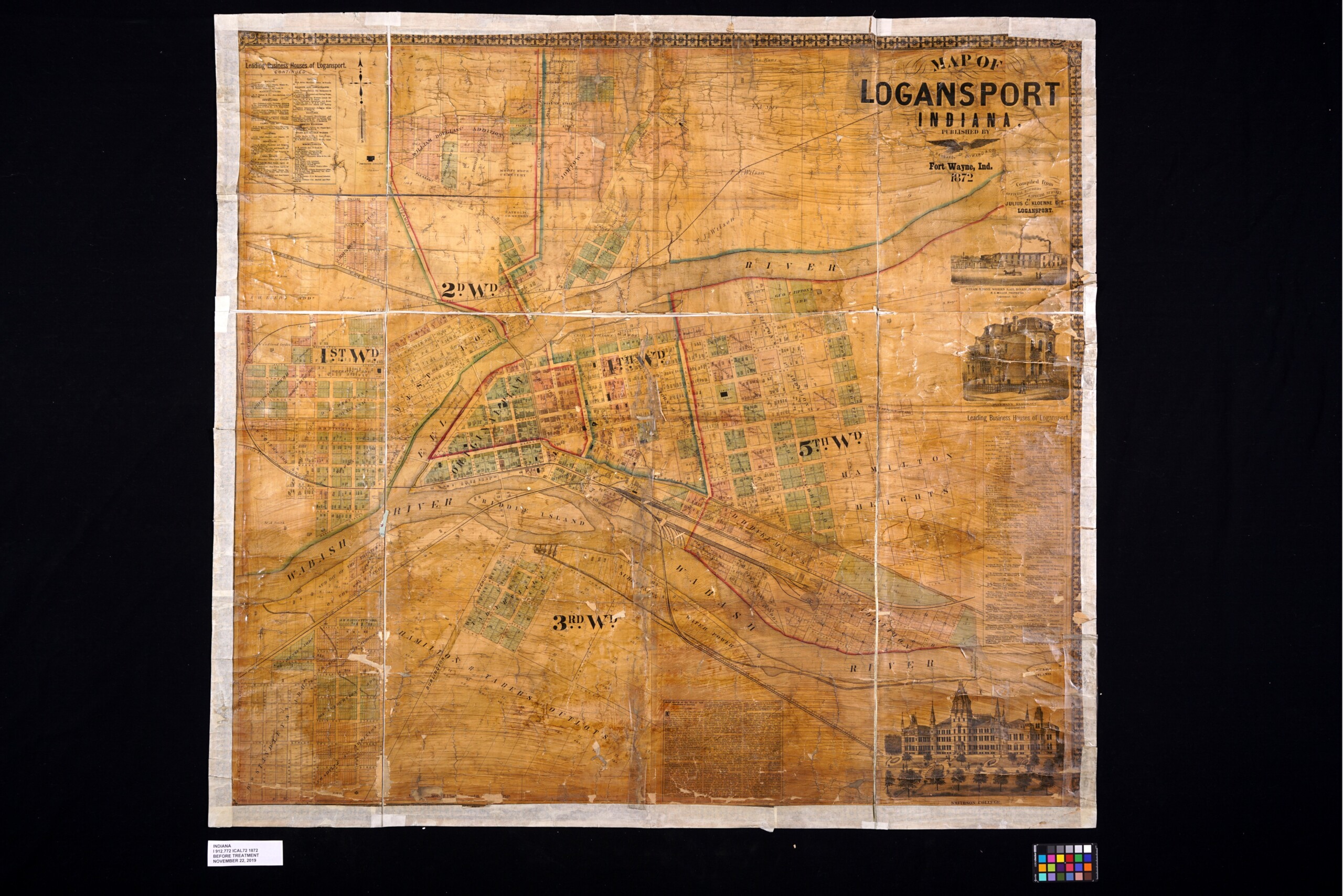
Logansport is another Indiana city with a strong railroad tie. This 1872 map of Logansport shows many rail lines crossing through the city. This map also shows many of Indiana’s internal improvements of the era, Wabash and Erie Canal, and the unlabeled Michigan Road (Burlington Road). Another great data set on this map is the list of “Leading Business Houses of Logansport.” Something of a boomtown, Logansport’s population tripled between 1860 and 1870, going from 3,000 to almost 9,000 people. The map and the text make a wonderful snapshot of what appears to be a bustling town in 1872. Compiled from records of Julius C. Kloenne, city engineer, the subdivisions and out lots are represented in detail, showing names of additions and large landholders edging the town. Kloenne would make his own map of the city in 1876. As neat as the map is, little to be found about the publisher Barnard, Hayward and Company. In contrast, the engravers H.J. Toudy and Company, out of Philadelphia, made a fine business specializing in maps, atlases and birds-eye views until a fire in 1878 destroyed their business.

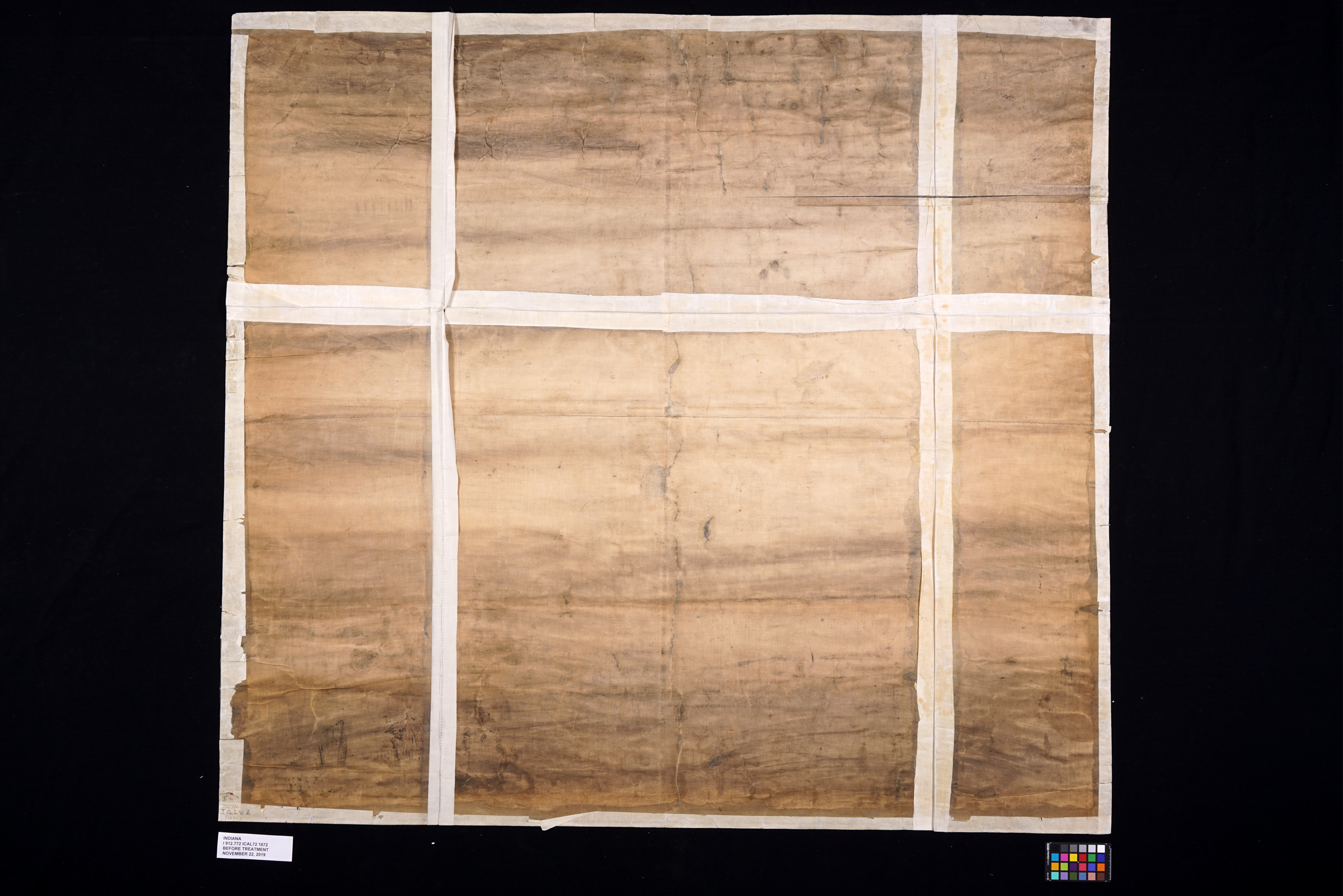
When this map was first assessed it showed a lot of problems. It was in extremely poor condition suffering from years of heavy use and prior attempted repairs. The entire map had been cut into smaller sections, in what my assume was an attempt to make the map more easily stored. Like the Jefferson map, this map was also adhered to its original fabric and varnished. Significant amounts of clear packing tape was also applied to large areas of the front, and paper had been glued to all four edges.

As with the Jefferson map, the goal for the Logansport map was to repair it for stability, safe handling and digitizing. This would mean removing all the varnish, all the tape and glued on paper, washing the map to remove discoloration, putting the sections back in their correct placement and re-lining the map onto a new sheet of Japanese tissue.

Before treatment of the front of the map.

Before treatment of the back of the map.

Conservation intern Lily Duncan removing tape from the front of the map on a tacking iron.

All of the tape removed.

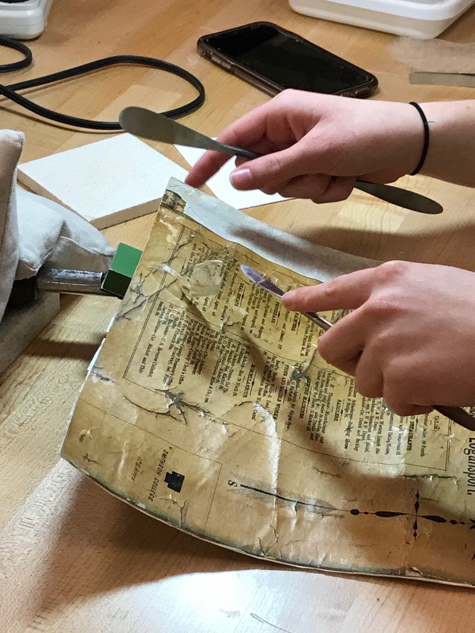
Conservation intern Lily Duncan removing varnish from the map sections on a suction table.

Conservation intern Lily Duncan washing and cleaning sections of the map.

Conservation intern Lily Duncan removing the backing fabric.

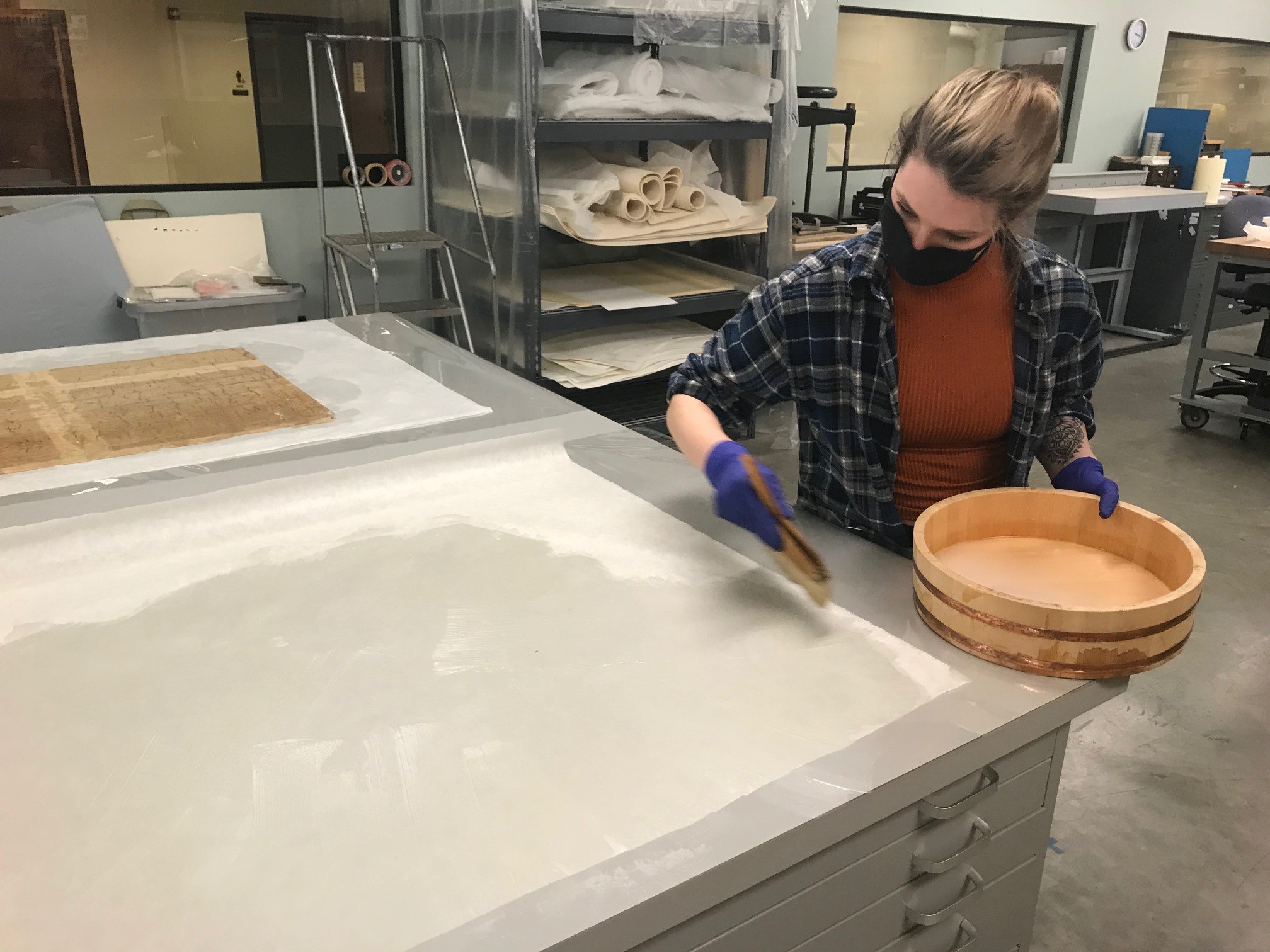
Conservation intern Lily Duncan pasting out Japanese tissue for relining.

Treated section next to the untreated sections.

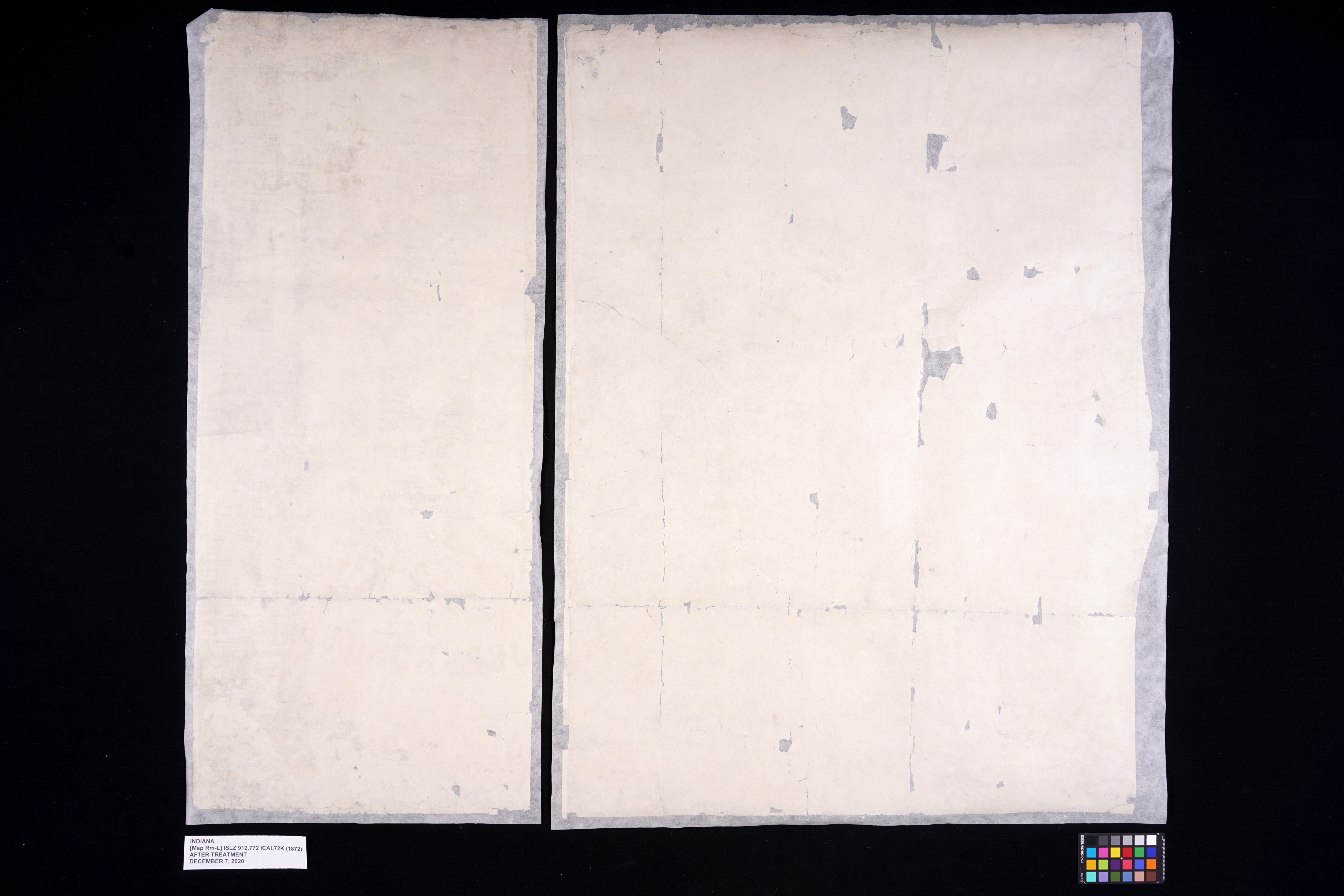
After treatment images of the front of the map.

After treatment images of the front of the map.

After treatment images of the front of the map.

After treatment images of the front of the map.

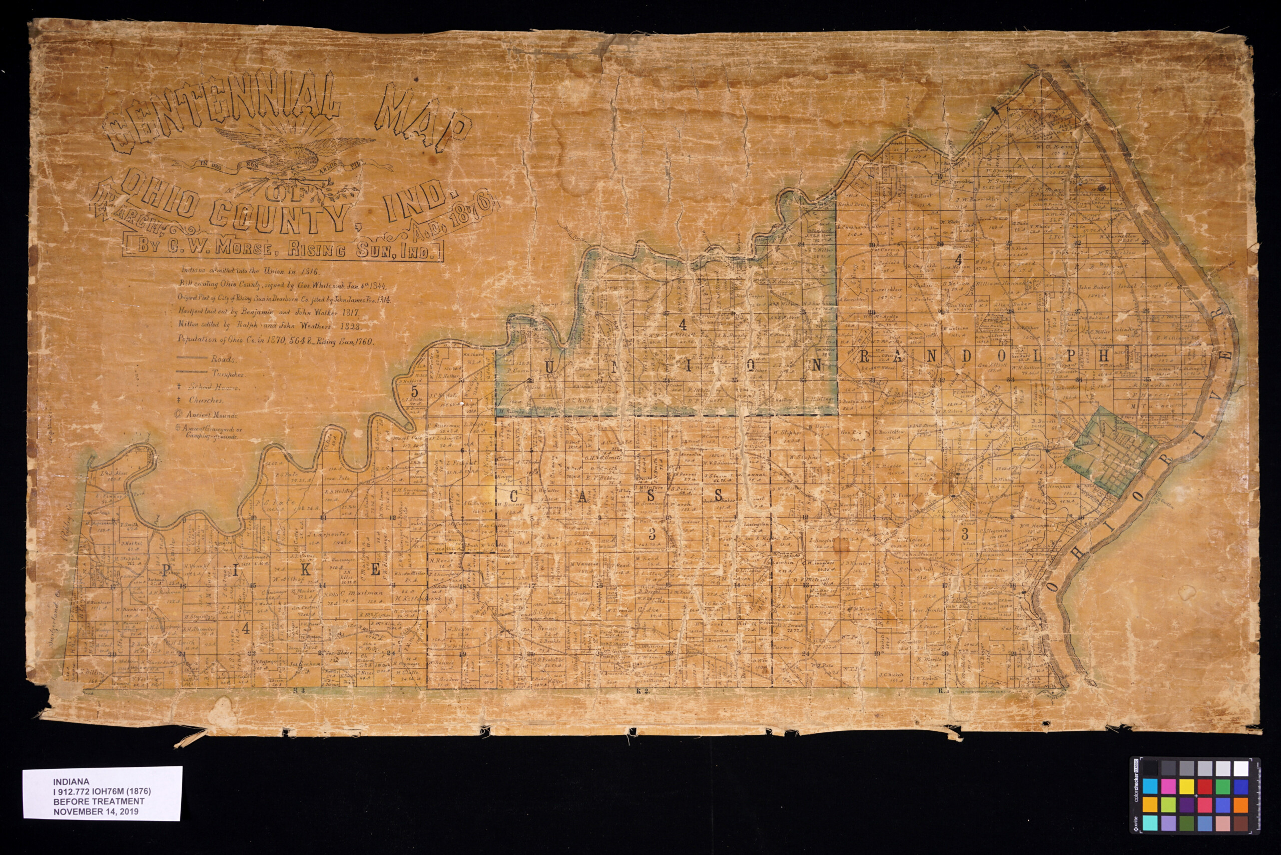
1876 Ohio County Centennial Map
Small in size, but rich in details, this map of Ohio County, Ind. was published to celebrate America’s centennial in 1876. The Ohio County Historical Society notes there were perhaps only 250 made. Surviving copies are quite rare. Ohio County was established just 30 years before this map was made. Notable are references to Native American sites at the time in Ohio County. George W. Morse, the mapmaker, is noted in the Ohio County history books as being present at the archeological digs in the area. He also delivered a historical address at the major Centennial Celebration held in Rising Sun the summer of 1876. The Centennial Independence Day was observed with cannons, bells and a parade. And this map!

This map was in an extremely fragile state. It had suffered lots of losses due to years of use. Like the other two maps it had also been varnished. The map had also suffered extensive water damage at some point resulting in staining throughout the entire sheet. Like the Jefferson map and Logansport map it was also adhered to its original fabric which had become very dirty and frayed.

As with the Jefferson and Logansport maps, the goal for this map was to repair it for stability, safe handling and digitizing. All of the varnish was removed, the map was washed and then re-lined onto a new sheet of Japanese tissue.

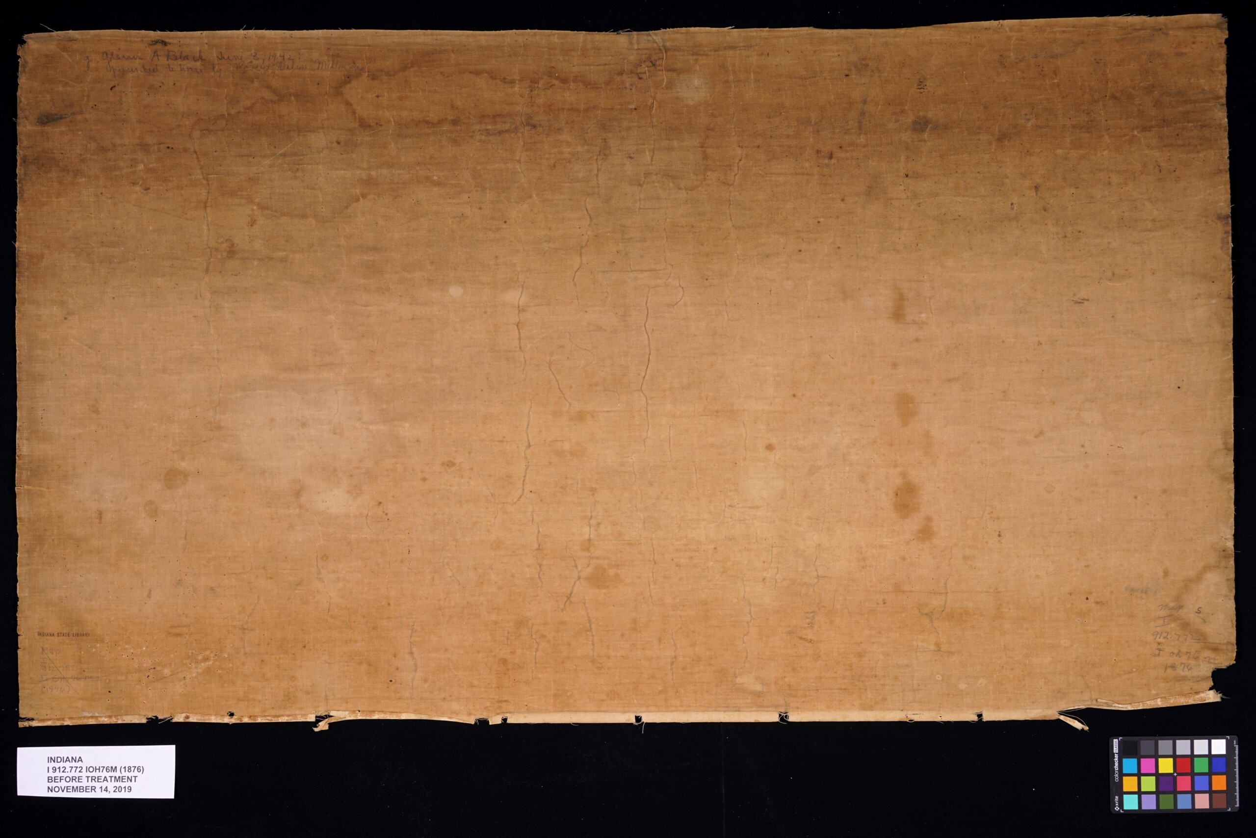
Before treatment of front of the map.

Before treatment of back of the map.

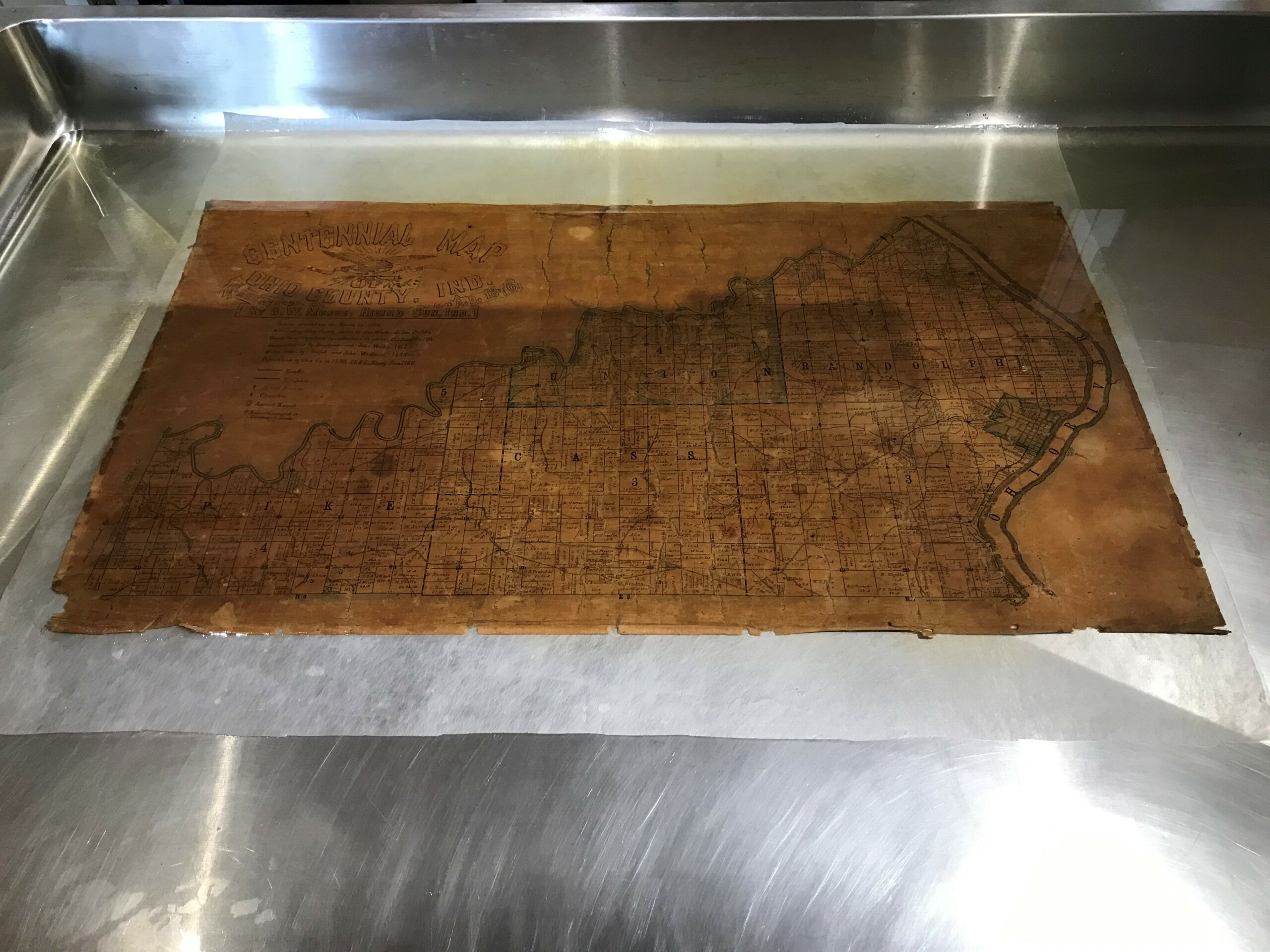
The map being washed.

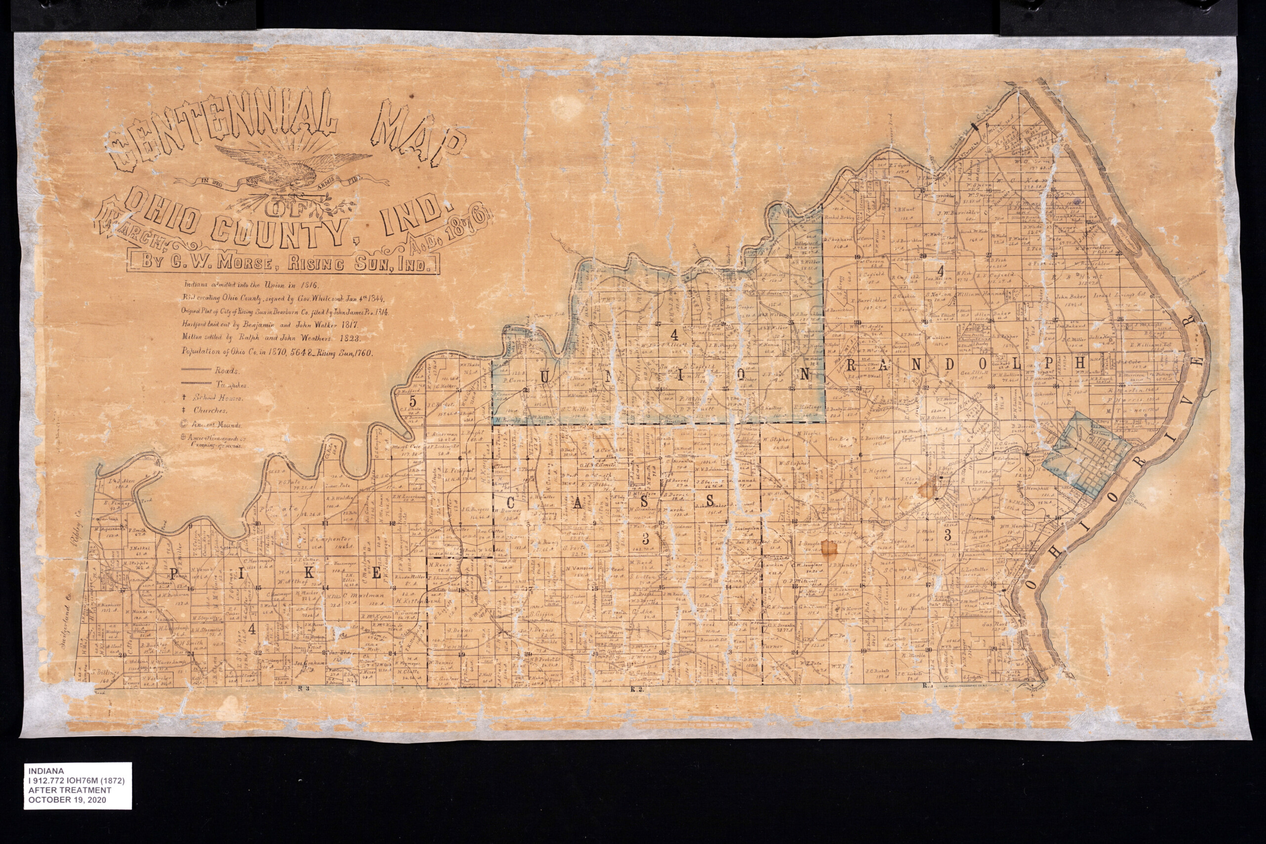
After treatment of the front of the map.

After treatment of the back of the map.

This blog post was written by Conservator Seth Irwin and Monique Howell, Indiana Collection supervisor, both of the Indiana State Library.
Conservation of an 1852 map of Madison, Indiana

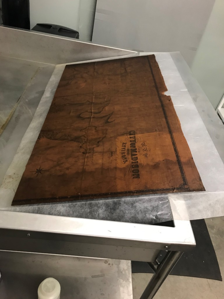
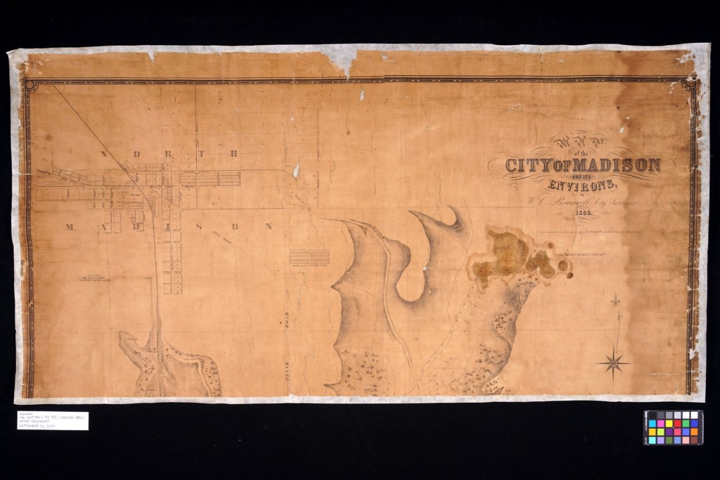
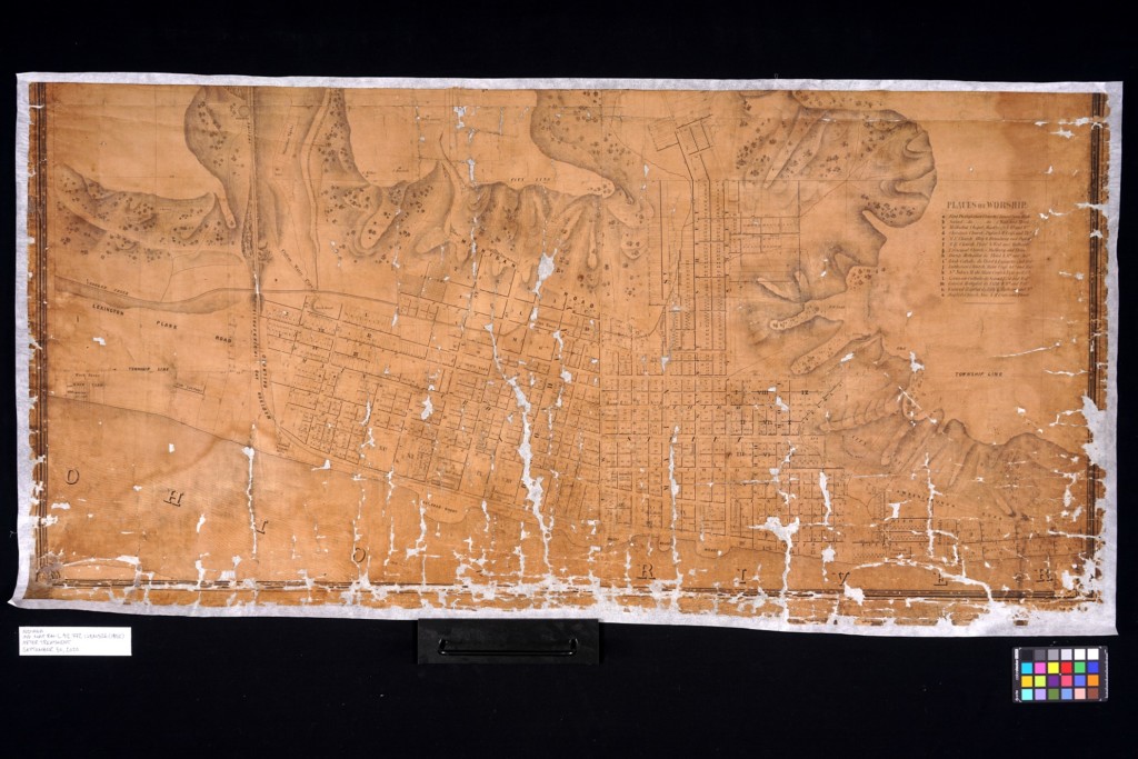
This 1852 map of the city of Madison is the earliest map of the old river city held in the Indiana State Library’s collections. The detail is brilliant, done by the careful hand of Hoosier pioneer William C. Bramwell. It seems clear that this map is the original map used for the 1854 published map of the city, which is held in Madison. Bramwell seems to have an interesting biography, although little is known about the details of his life. Credits to his name include state legislator, surveyor, preacher, inventor and spinning wheel maker. Whatever his true calling, it is clear his attention to detail and craftsmanship has left us a beautifully rich and detailed map of one of Indiana’s oldest cities.

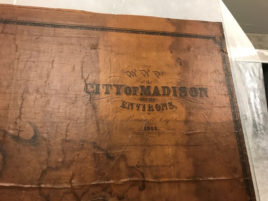
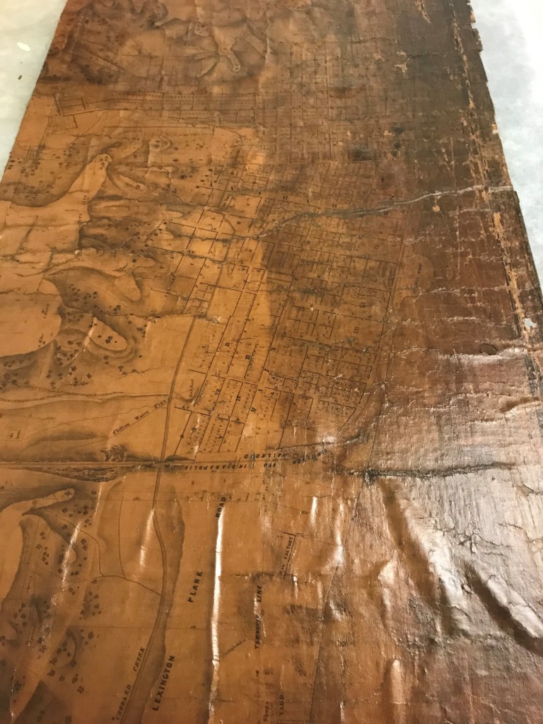
It is not known when the Indiana State Library acquired this map, or its history before it arrived at the library. When it was found in the collection it was in an extremely deteriorated and fragile state. The map was still adhered to its original fabric backing, which had become very dirty and deteriorated. As with many maps from this period, the front had been varnished, which resulted in even more deterioration. The front of the map had also become so dirty and discolored that most of the map could not be read. Many pieces of the map had broken off and become lost, and it was difficult to determine the difference between the paper areas and the cloth. It was in such poor condition, that even unrolling it would result in pieces falling off. Finally, as with many maps from this period, there was evidence of water damage as well in the form of staining.

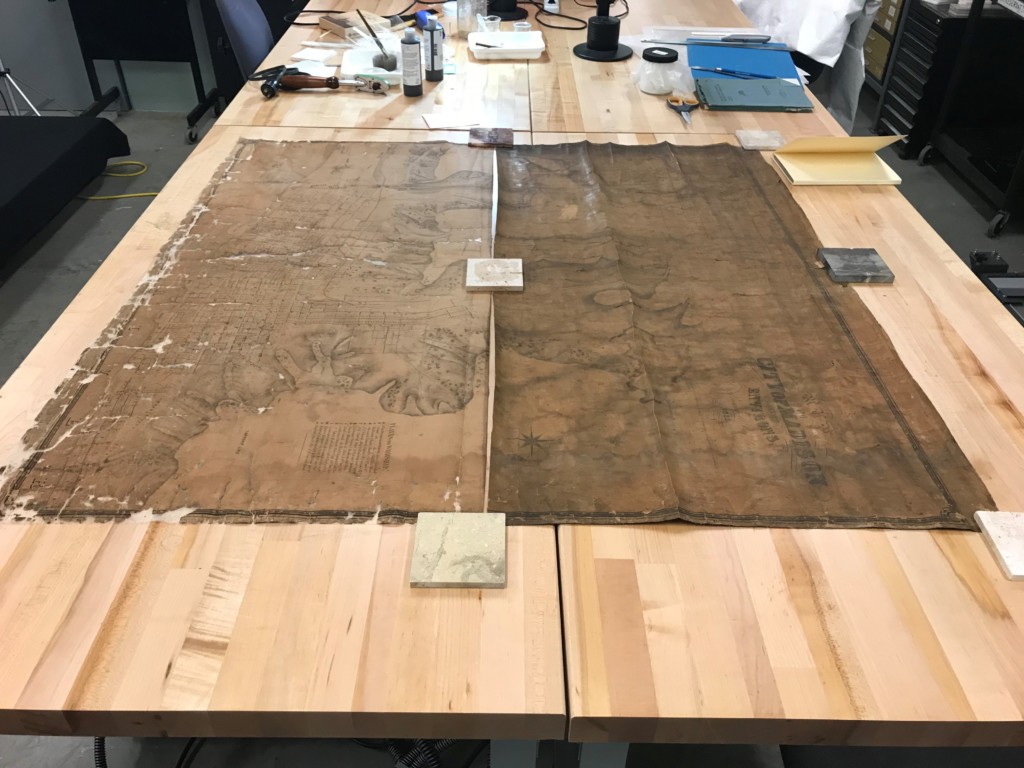
The goals for this project were simple. In its current state, the map was unusable. It was so dirty that it could not be read, and it was so fragile that even unrolling it would result in more pieces falling off. The goals of this project were to clean the map as much as possible to remove the old varnish, the dirt and the staining and then line the map onto a single sheet of Japanese paper to allow for it to be stable enough to handle. While the goals were simple, the execution would prove to be complicated by the enormous quantity of loose pieces that would come loose once the original fabric was removed. In order to preserve the information in the map, all the loose pieces would need to stay in their correct spots throughout the entire treatment. Finally, the map would be encapsulated in a custom polyester film sleeve to allow for more protection. The below pictures outline the conservation process.

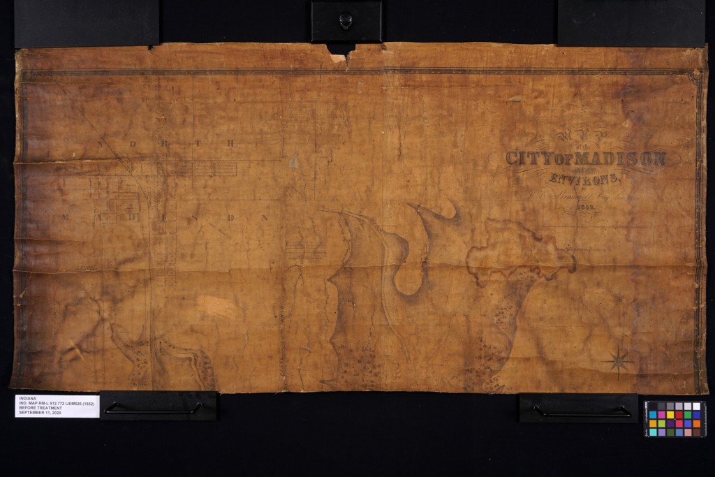
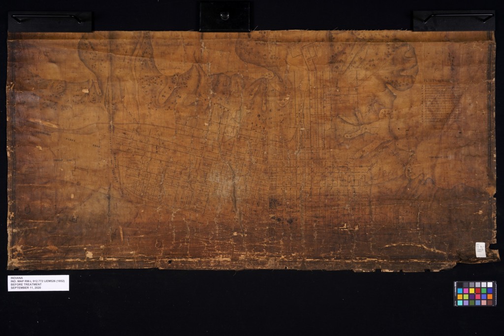
Before treatment of top section of City of Madison and Environs by H.G. Bramwell, city surveyor, 1852.

Before treatment of bottom section of City of Madison and Environs by H.G. Bramwell, city surveyor, 1852.

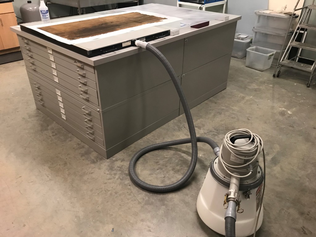
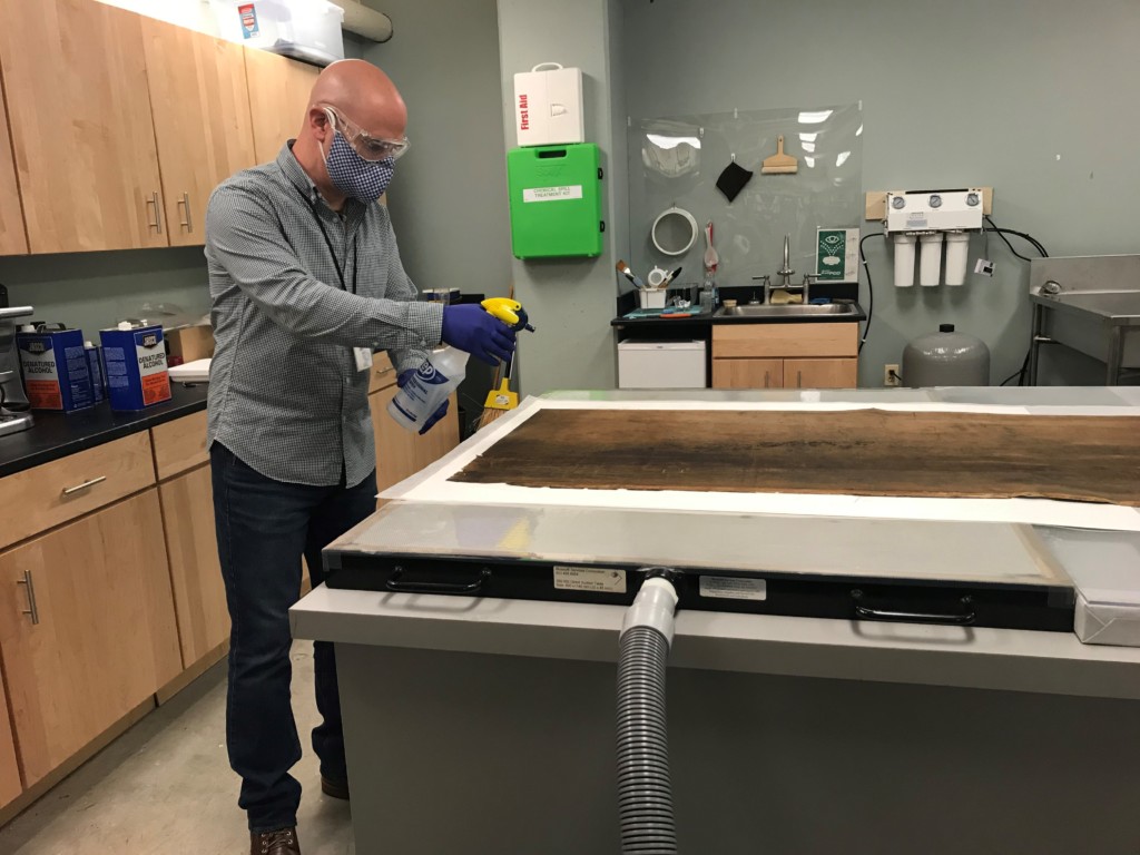
In order to remove the varnish, the map was placed faced down on blotter paper a high-power suction table and sprayed with ethanol.

The ethanol would penetrate through the fabric and paper, solubilizing the varnish, and pull it into the blotter below.

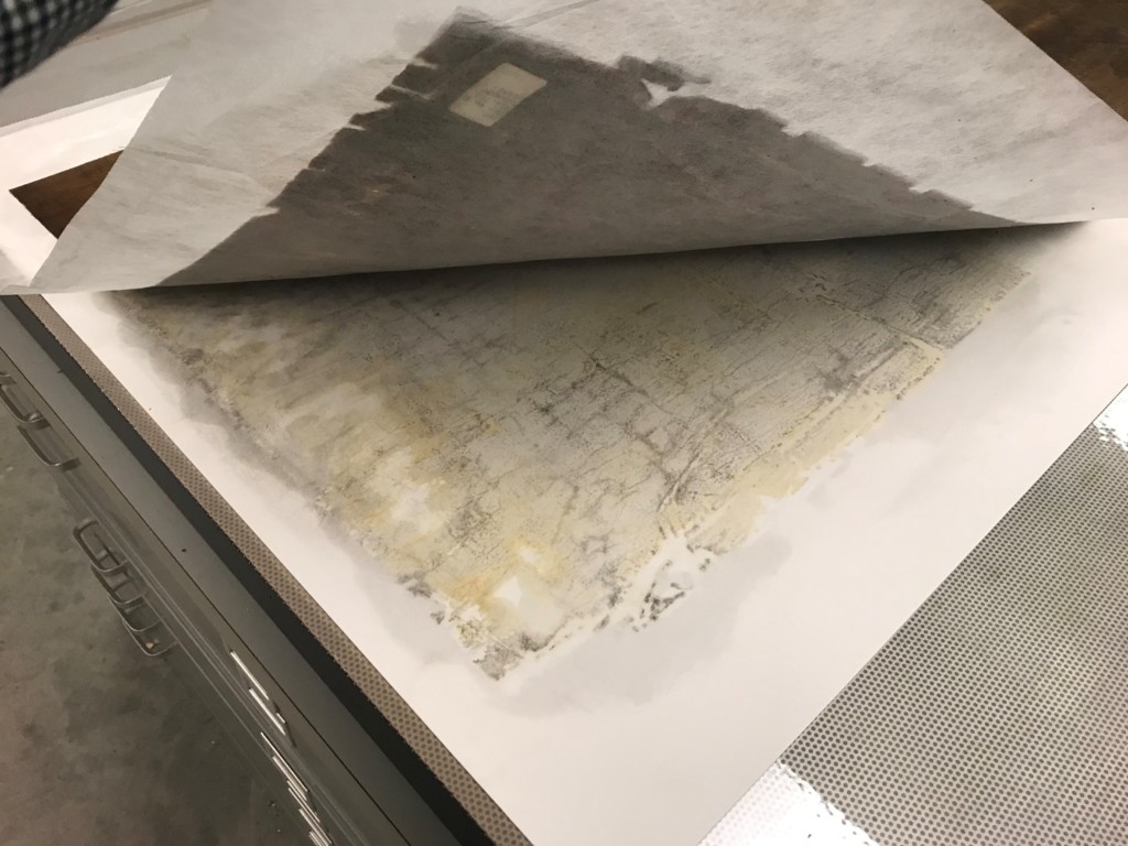
This process was repeated until all the varnish was removed. The map was routinely lifted and checked during this process.

The blotter shows all the varnish removed from the map.

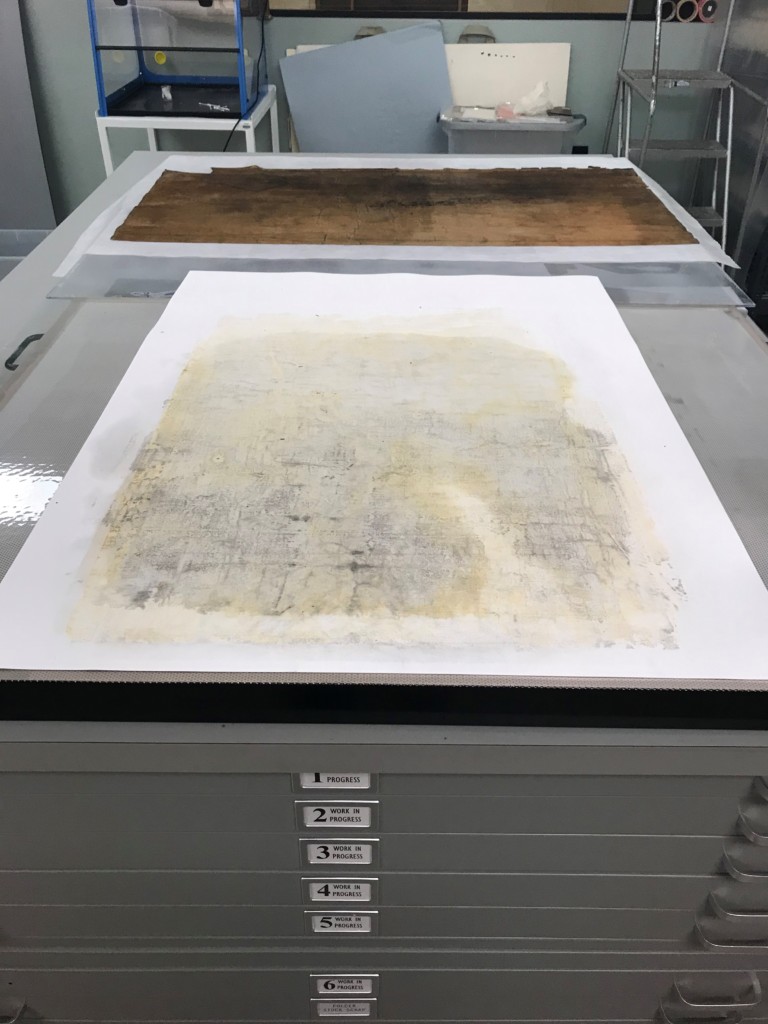
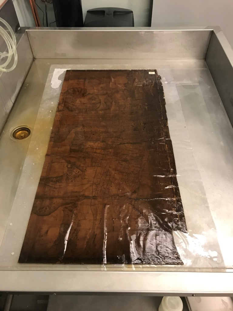
The map sections were washed in modified hot water on a rigid sheet of plexiglass for support.

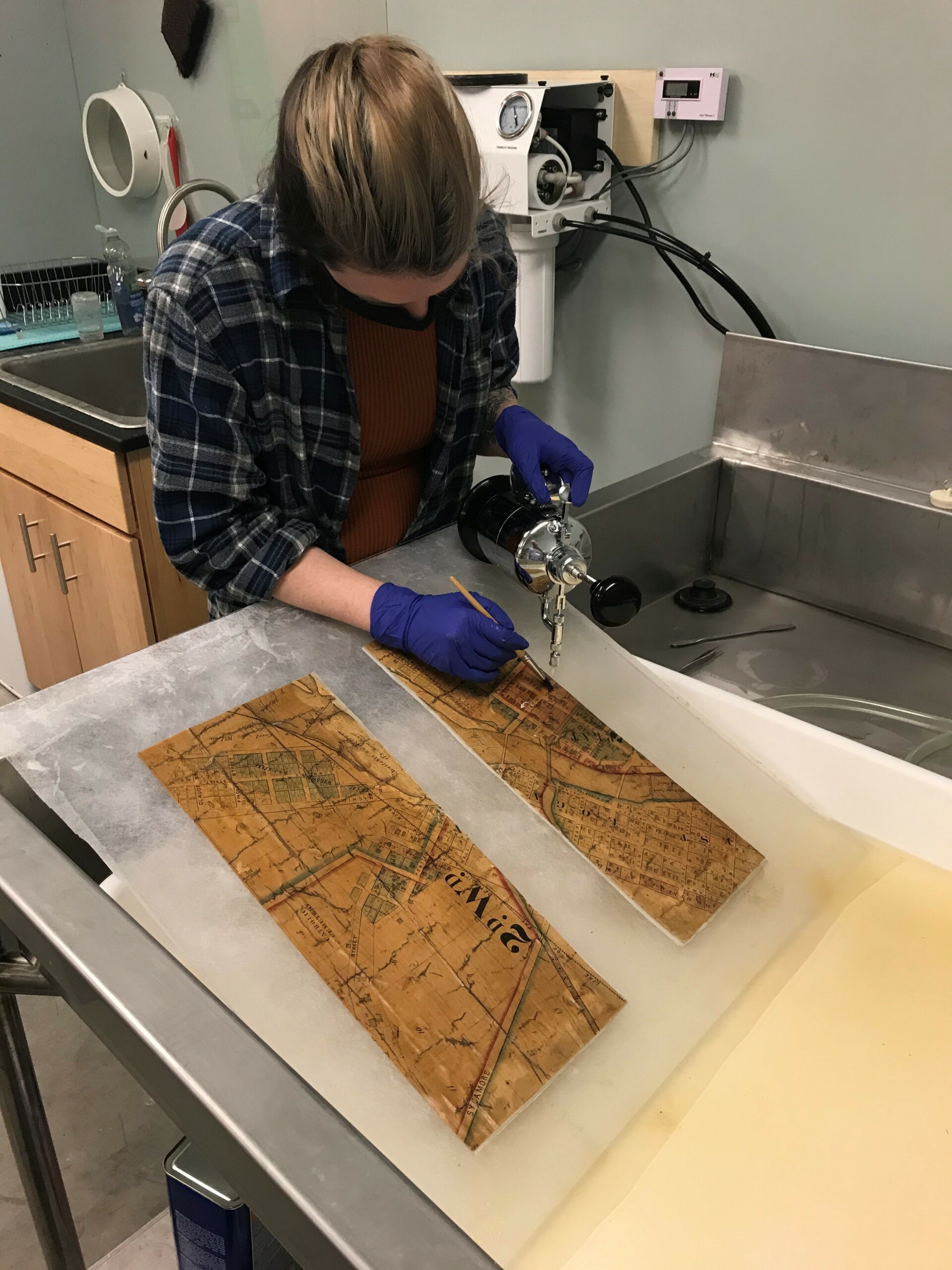
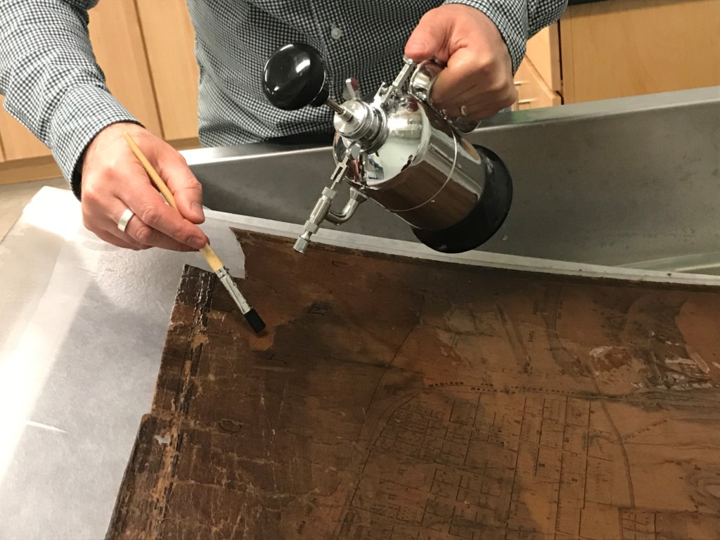
The map was carefully lifted on the plexiglass support and tilted. Using a small brush and a Japanese mister, the entire surface of the maps was cleaned to remove all remaining varnish and dirt. Careful attention was paid to make sure all the loose pieces of the map stayed in their correct spots throughout the entire process.

This image shows the progress of the cleaning of both sections.

This image shows the progress of the cleaning of both sections.

This image shows the progress of the cleaning of both sections.

After the map sections were cleaned, the map was placed face down on polyester film and the original fabric was carefully removed making sure none of the loose pieces moved.

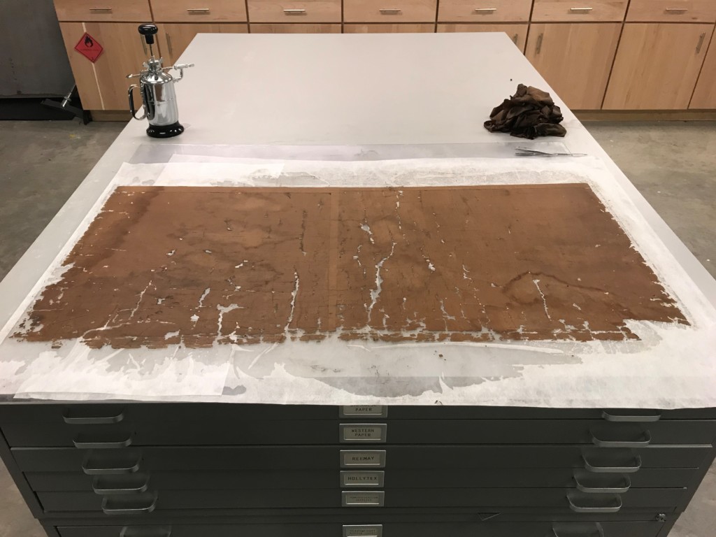
This image shows the map after the fabric was removed and the thousands of small pieces of the map that are now loose.

This image shows the map after the fabric was removed and the thousands of small pieces of the map that are now loose.

The map was lined onto a large sheet of Japanese paper with wheat starch paste and dried between wool felt blankets.

The map was lined onto a large sheet of Japanese paper with wheat starch paste and dried between wool felt blankets.

The map was lined onto a large sheet of Japanese paper with wheat starch paste and dried between wool felt blankets.

The top and bottom section of the map next to each other. At this point, the bottom section has already been treated and the top section had not yet been treated.

After treatment of top section of City of Madison and Environs by H.G. Bramwell, city surveyor, 1852.

After treatment of bottom section of City of Madison and Environs by H.G. Bramwell, city surveyor, 1852.

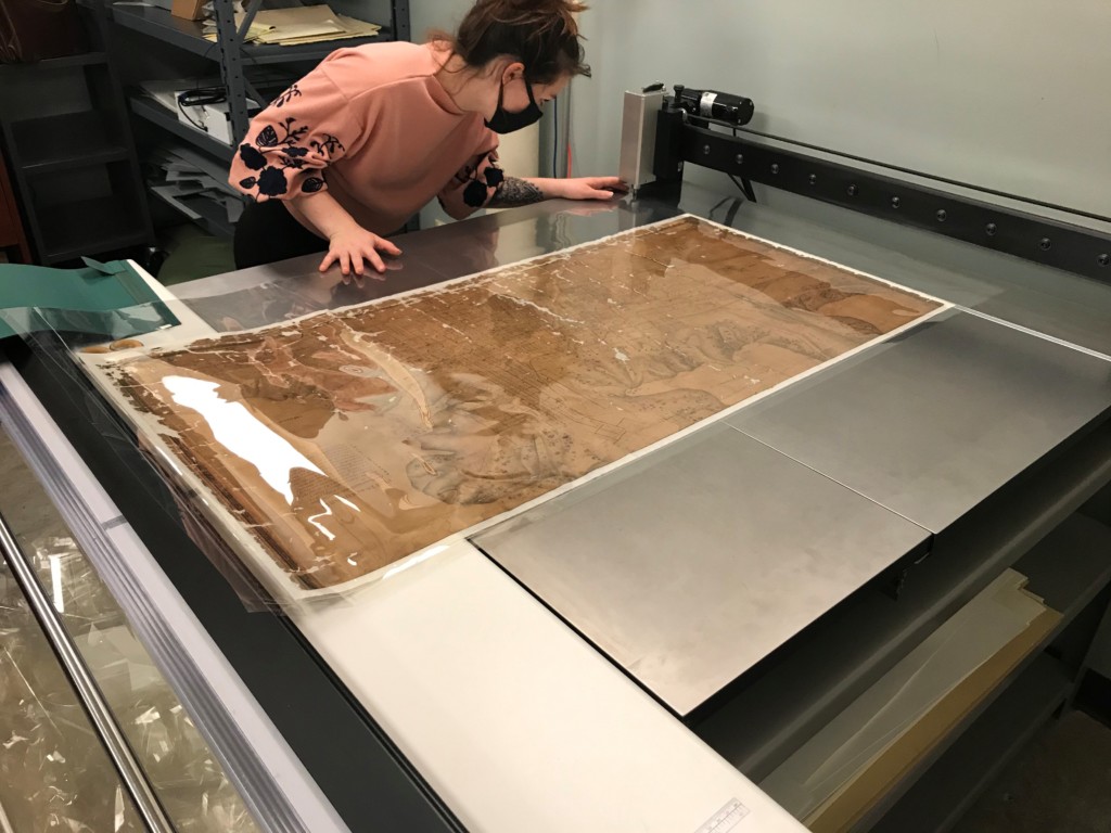
Conservation intern Lily Duncan encapsulating the map in a polyester film sleeve with an ultrasonic polyester welder.

Click here to read more about the conservation efforts of the Indiana State Library.
This blog post was written by Seth Irwin, conservator, and Monique Howell, Indiana Collection supervisor, both of the Indiana State Library.

Treating a rare French newspaper featuring the Statue of Liberty

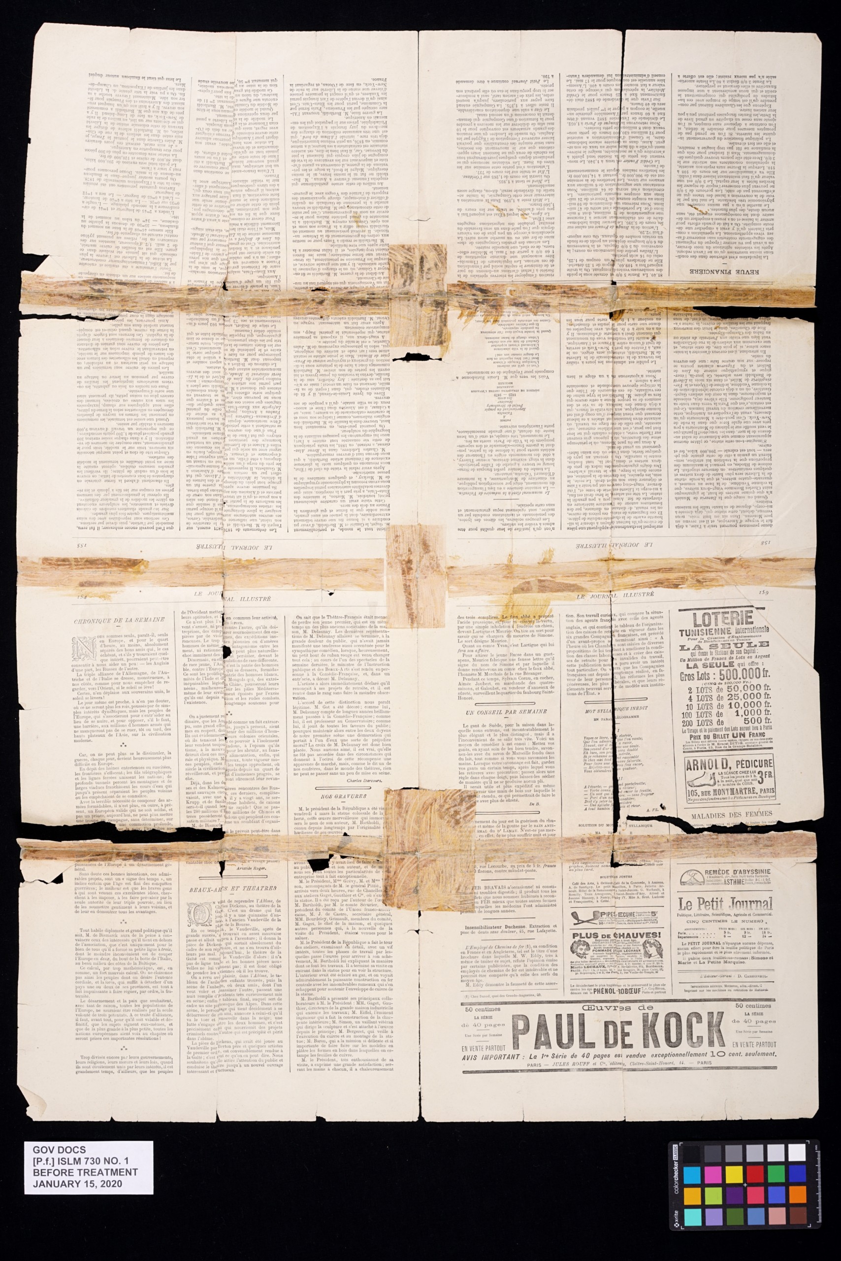
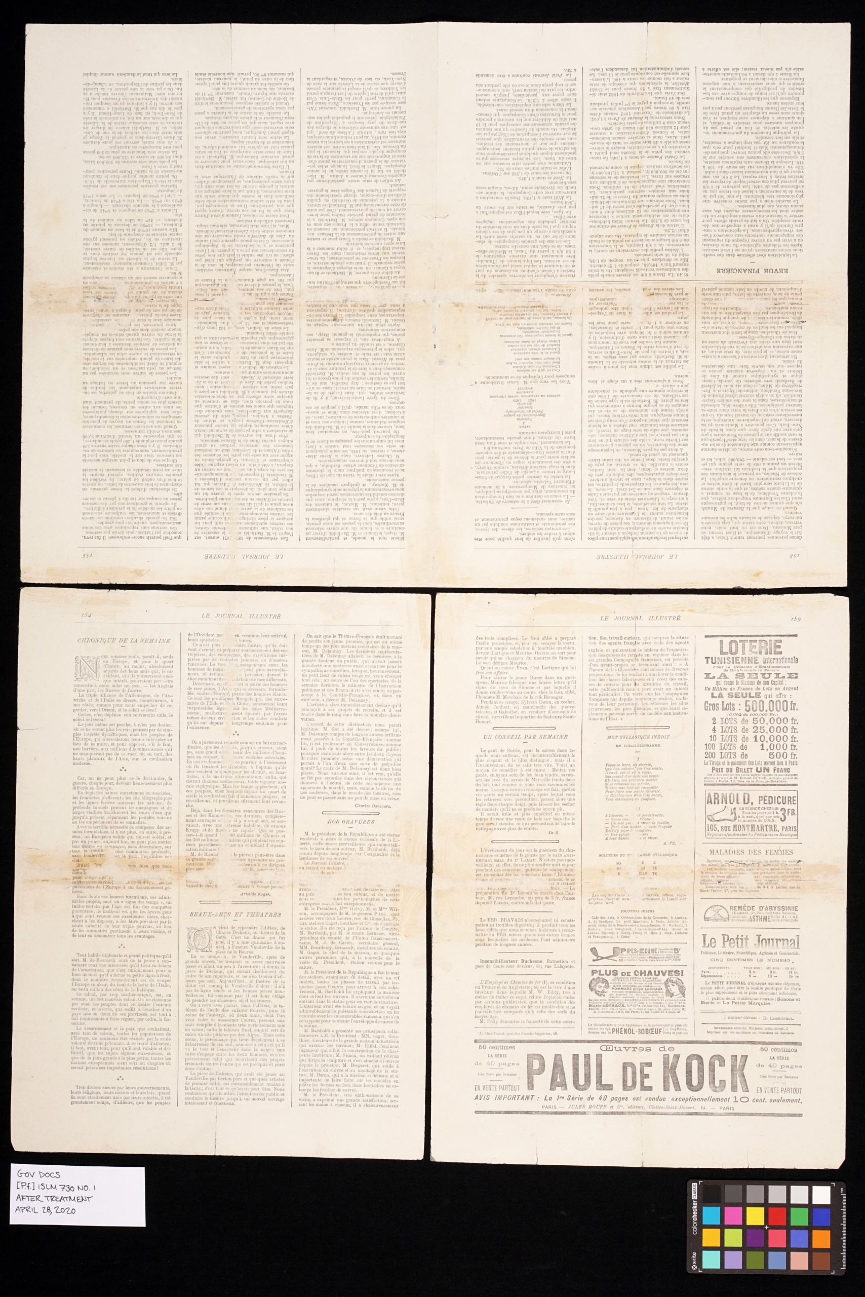
In late 2019, a rare newspaper was discovered in the Indiana State Library’s General Pamphlet Collection by Rayjeana Duty, Circulation Support supervisor. The newspaper showed a single sheet from the Le Journal Illustré from May 13, 1883. What made this particular issue of this newspaper unique and special is that it contained articles and illustrations showing the construction of the Statue of Liberty, before it was given to the United States in June of 1885. The images in the newspaper showed not only the Statue of Liberty being built, but also showed various images of the internal structure of the Statue of Liberty.

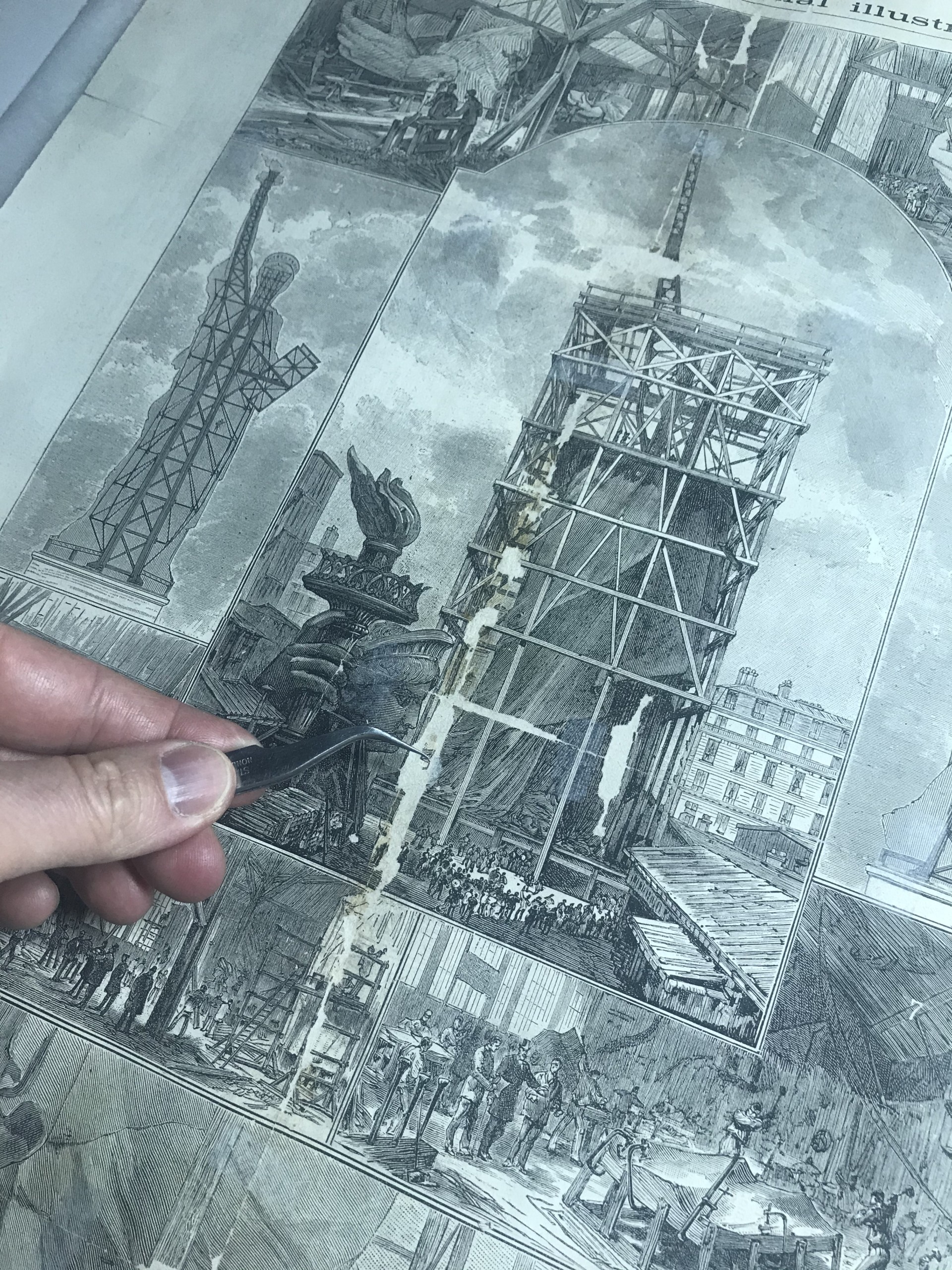
Upon realizing how unique and rare the newspaper was – and also realizing the poor condition it was in – it was brought to the conservation lab for assessment and conservation treatment. The newspaper was in extremely poor condition. Most of the sheet had been torn along the original folds, and repaired at some point with rubber cement and a thin acidic paper. This caused extremely bad staining throughout the sheet, obscuring both the images and the text. The paper was also extremely brittle and the damage was so severe that the newspaper needed to be handled on a rigid board to prevent pieces from falling off and getting lost. After thorough testing and examination, a plan was put together for a way to remove all of the staining and repair all of the remaining damage.

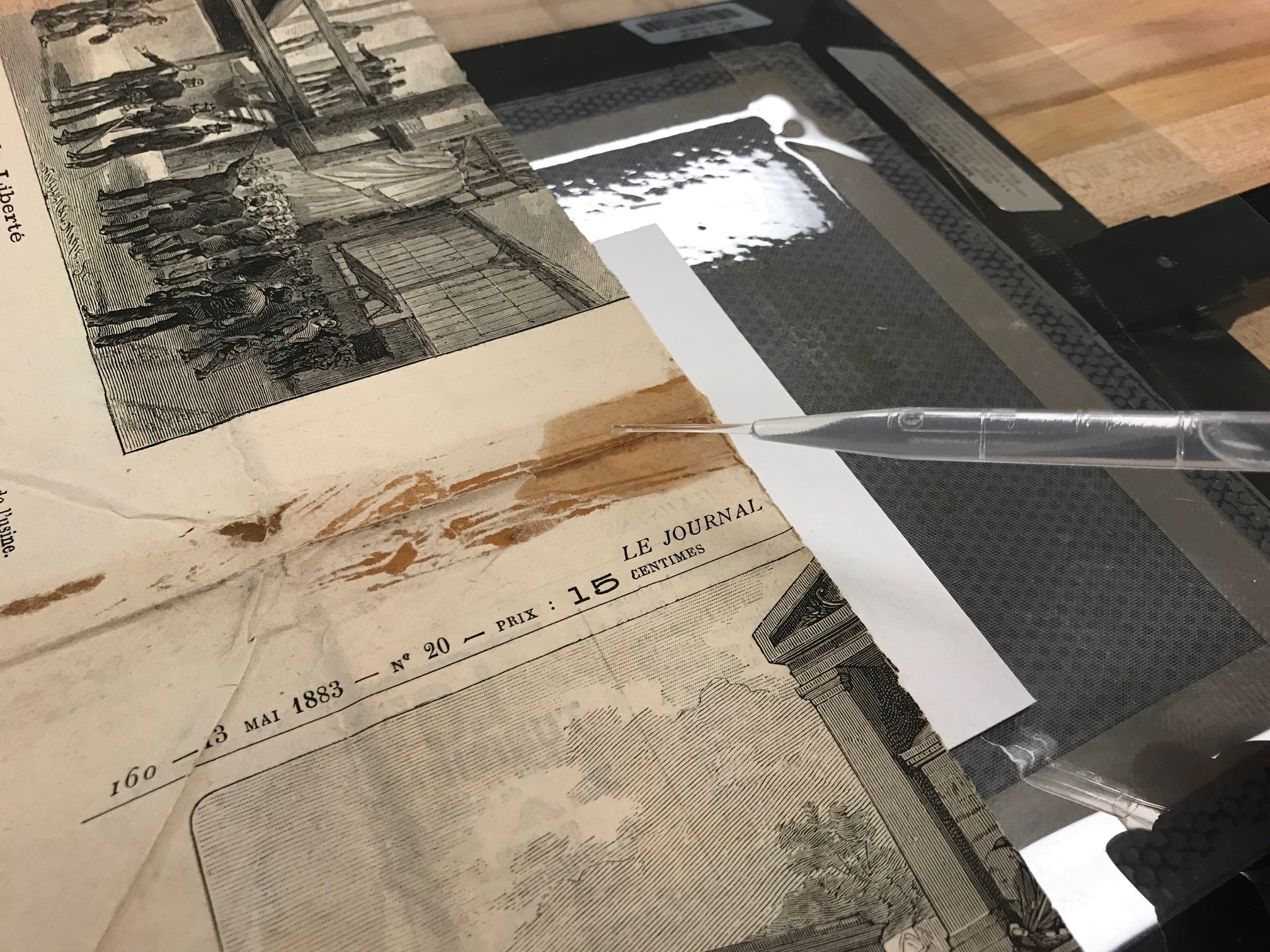
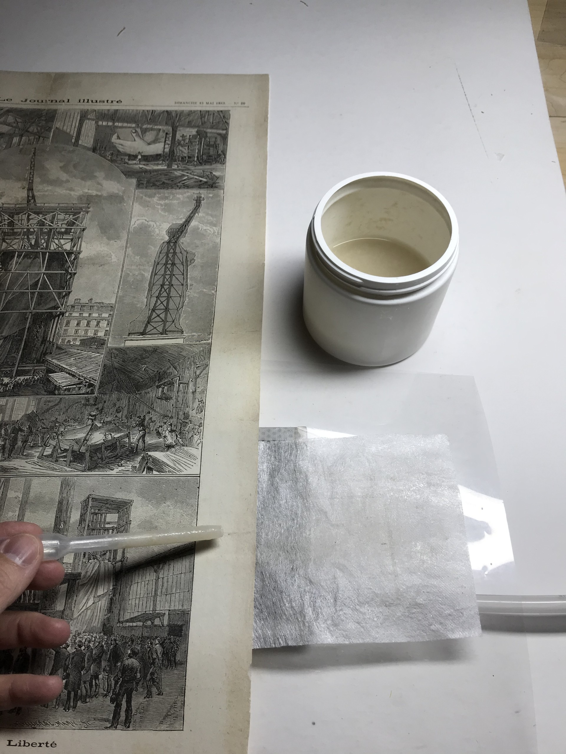
The first step was to remove all of the old repair paper and rubber cement staining. This was carefully done by applying a solvent to the stained areas on a powerful vacuum table.  The solvent would solubilize the old rubber cement and move it into sacrificial blotter paper underneath. Slowly, this cleared out the staining and allow the removal of the old acidic repair paper without damaging the newspaper.

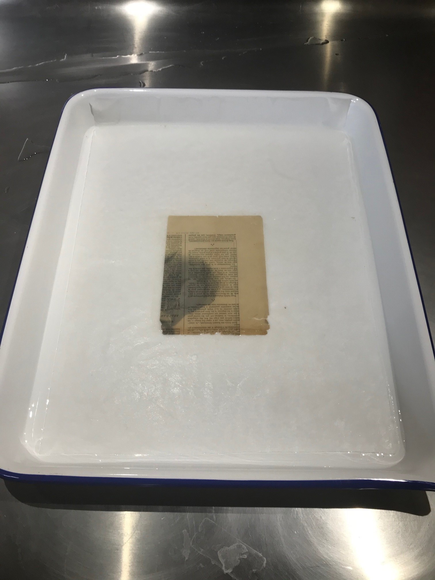
Once all of the staining and repair paper was removed, all of the tears opened up again.  This was sort of like taking an old bandage off a wound. Since the repair paper was the only thing holding all of the pieces together, once the repair paper was removed all of the pieces came apart. This was the point where it was possible to determine how much of the sheet was missing, and how many holes there were. Due to the brittleness of the paper and the staining, each of the pieces were individually washed in specially modified water to de-acidify the paper. This removed much of the brittleness and resulted in the paper being stronger. Much of the yellowing of the paper also went away.

Once all of the pieces were washed, the reassembly process began. All of the missing areas were filled with re-pulped paper on a suction table and the sheet was lined with a very thin Japanese tissue with wheat starch paste. This tissue was thin enough to still allow for the text on the opposing side to be read.

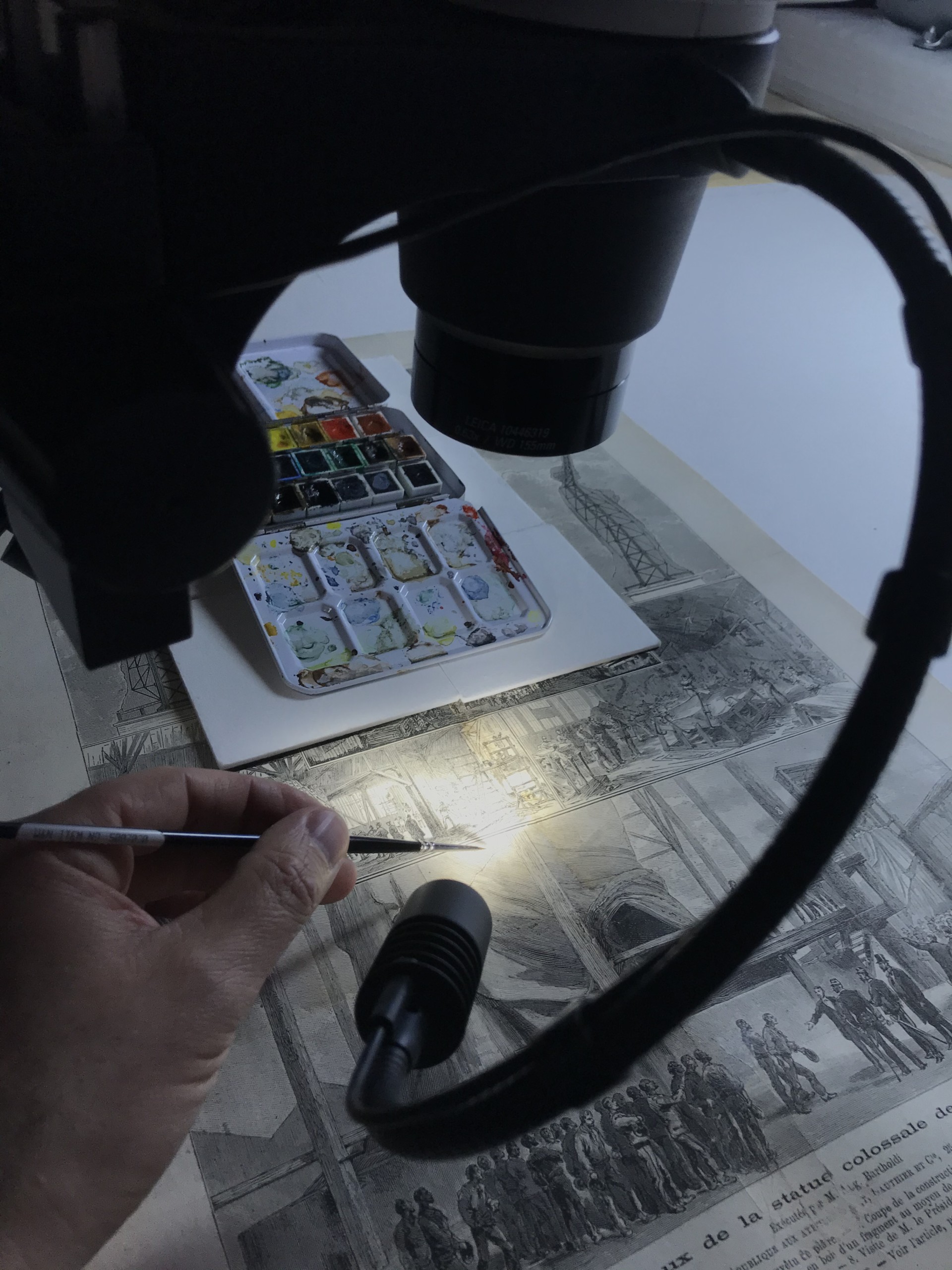
Working under a microscope, the loose pieces were carefully put back into in their correct spots.

Finally, the newly-filled in areas were carefully in-painted under a microscope to blend in with the surrounding image.

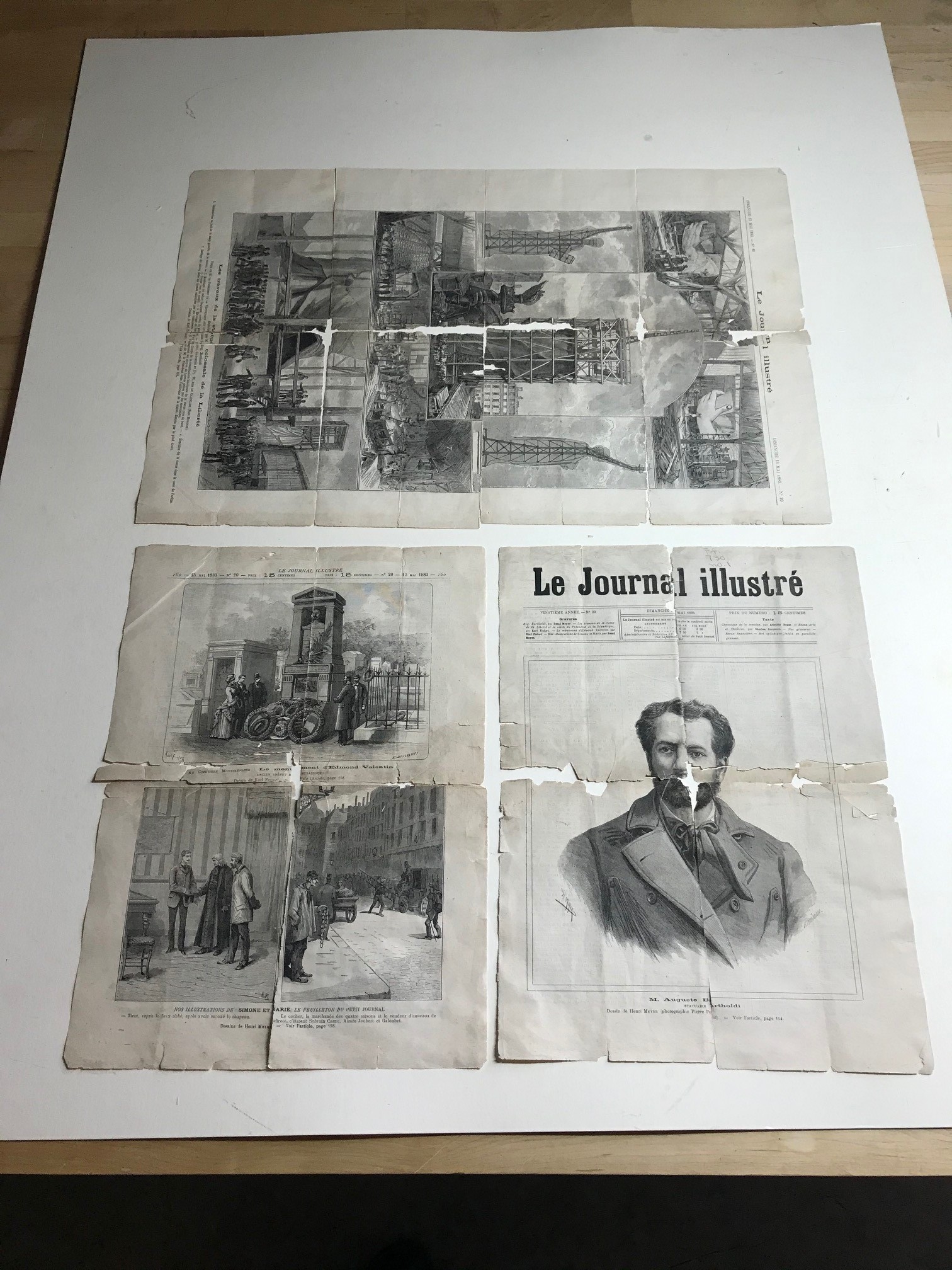
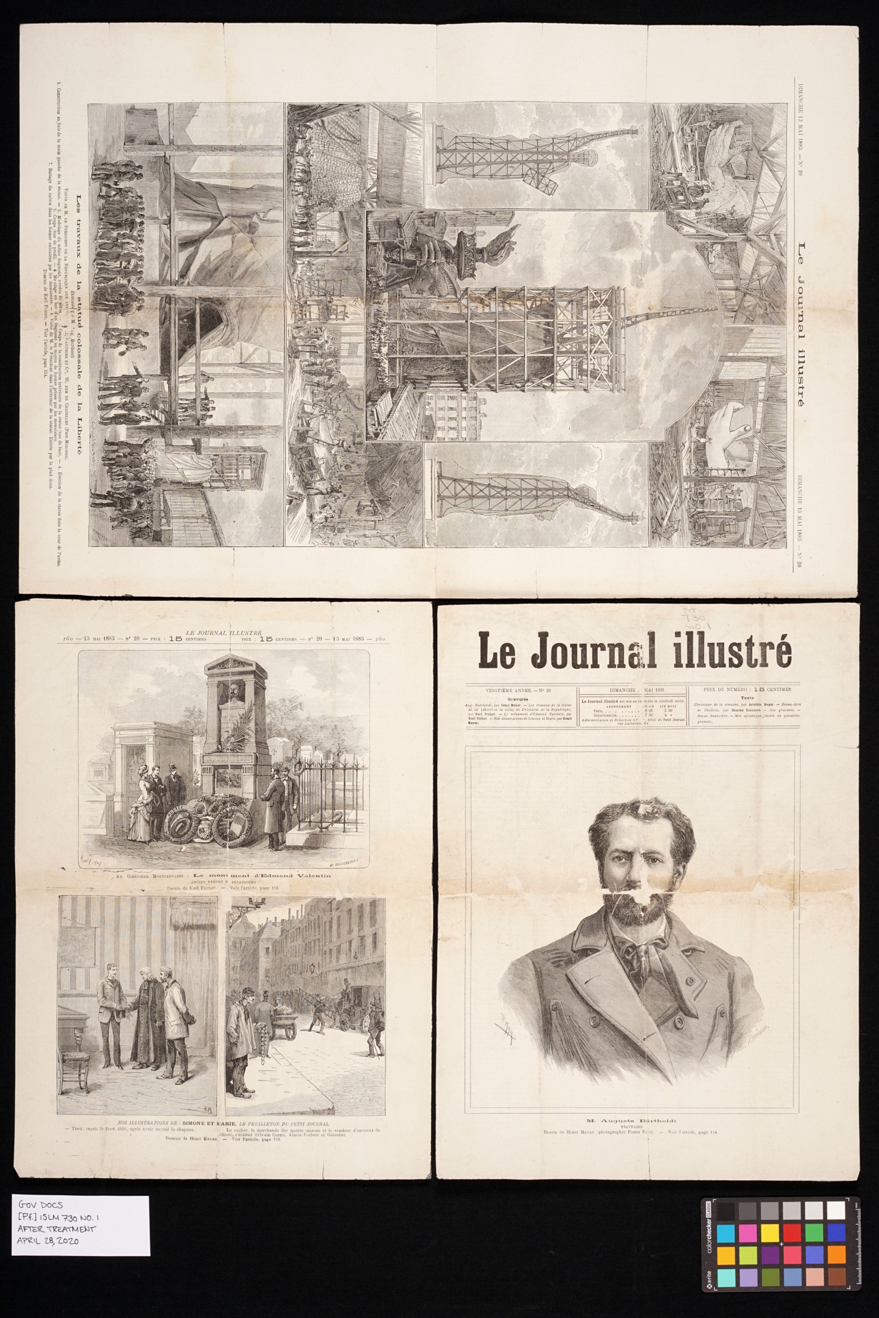
The final result is a newspaper that is better preserved and free of damage. This will allow for better viewing of both the images and the text. Click on the photos below for a larger view.

Translation of the bottom of the page featuring the Statue of Liberty:

The creation of the colossal statue of liberty
Executed by M. Aug. Bartoldi
Visit from M. President to the manufacture Gauthier and Cie, 25 rue de Chazelle (Parc Monceau)

1.       Fabrication in wood of the left hand of the statue.
2.       Modeling the same body fragment, covered in plaster.
3.       Scheme of the interior structure of the statue, facing forward.
4.       Building the statue in the courtyard of the manufacture.
5.       Section of the statue, seen from the side
6.       Modeling in wood of a part, molds built by the woodworkers.
7.       Beating of the copper on the molds built by the woodworkers
8.       Visit of M. President inside the statue. Entry through the right foot.

Drawings by Karl Fichot. See article p. 154.

Learn more about the Indiana State Library’s Martha E. Wright Conservation Lab here.

Translation courtesy of Sophie Barbisan, assistant paper conservator at the St. Louis Art Museum.

This blog post was written by Seth Irwin, conservator, Indiana State Library.

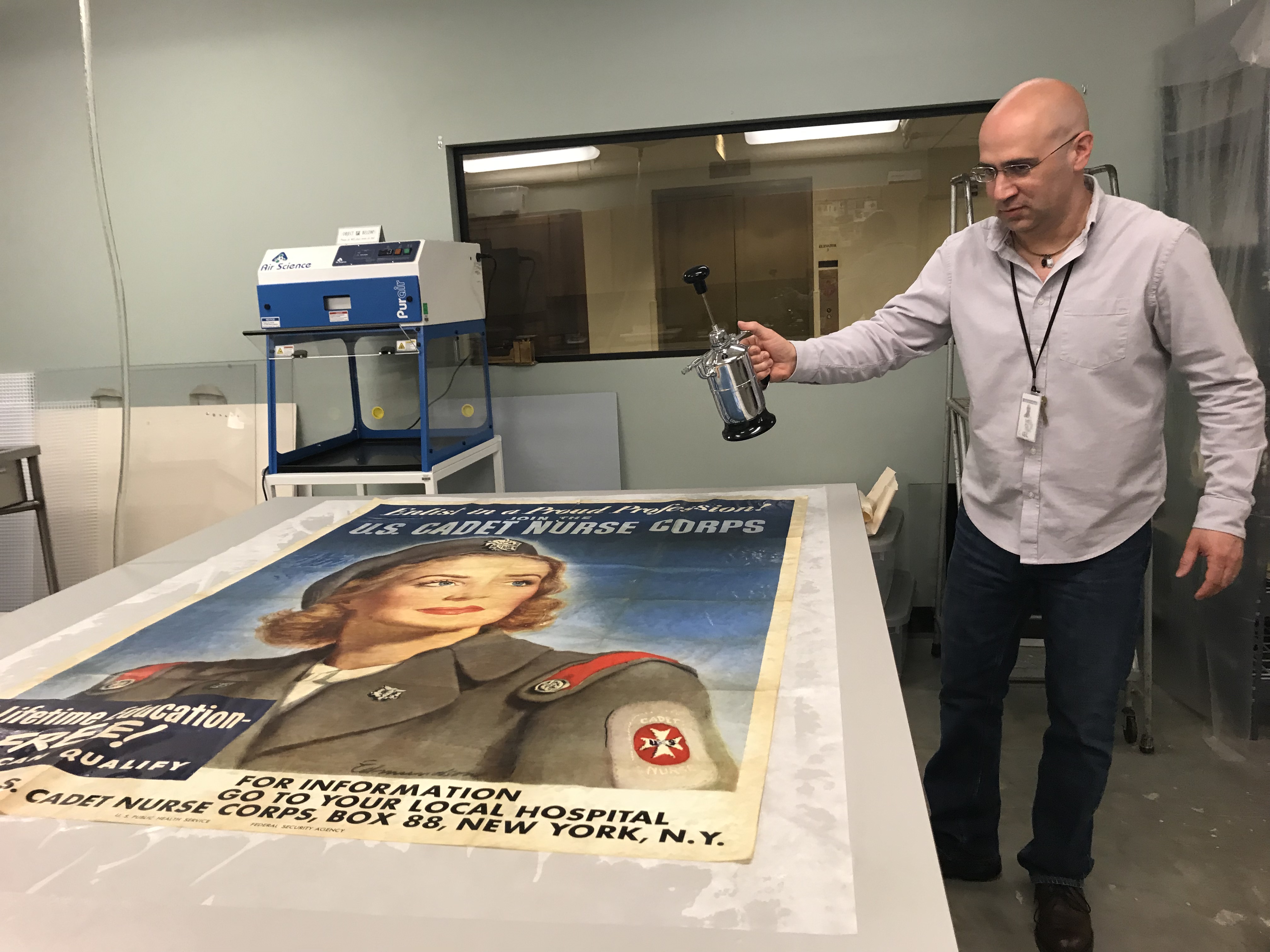
Treatment of a water-damaged 1943 U.S. Cadet Nursing Corps poster

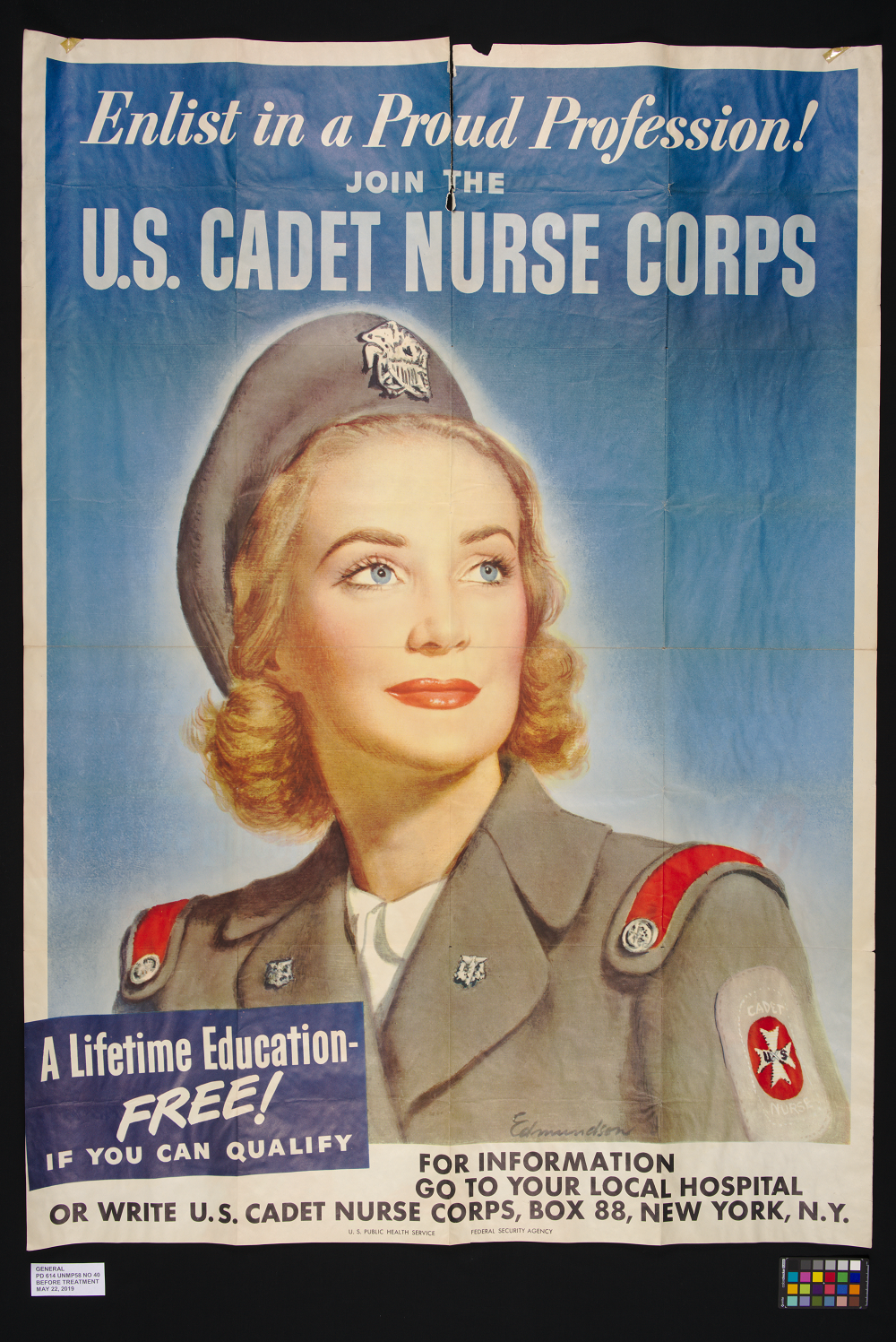
As a follow-up to a recent post regarding material from the Indiana State Library’s Government Documents Division, this post will summarize the repair of a 1943 U.S. Cadet Nursing Corps poster that was damaged during an air handler water leak on April 15, 2019.

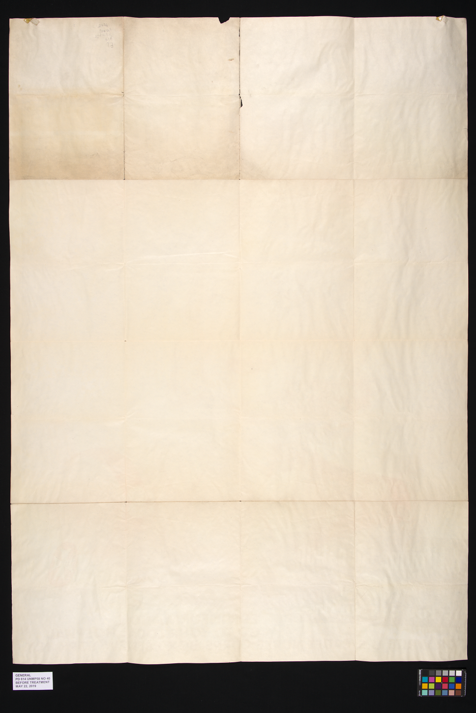
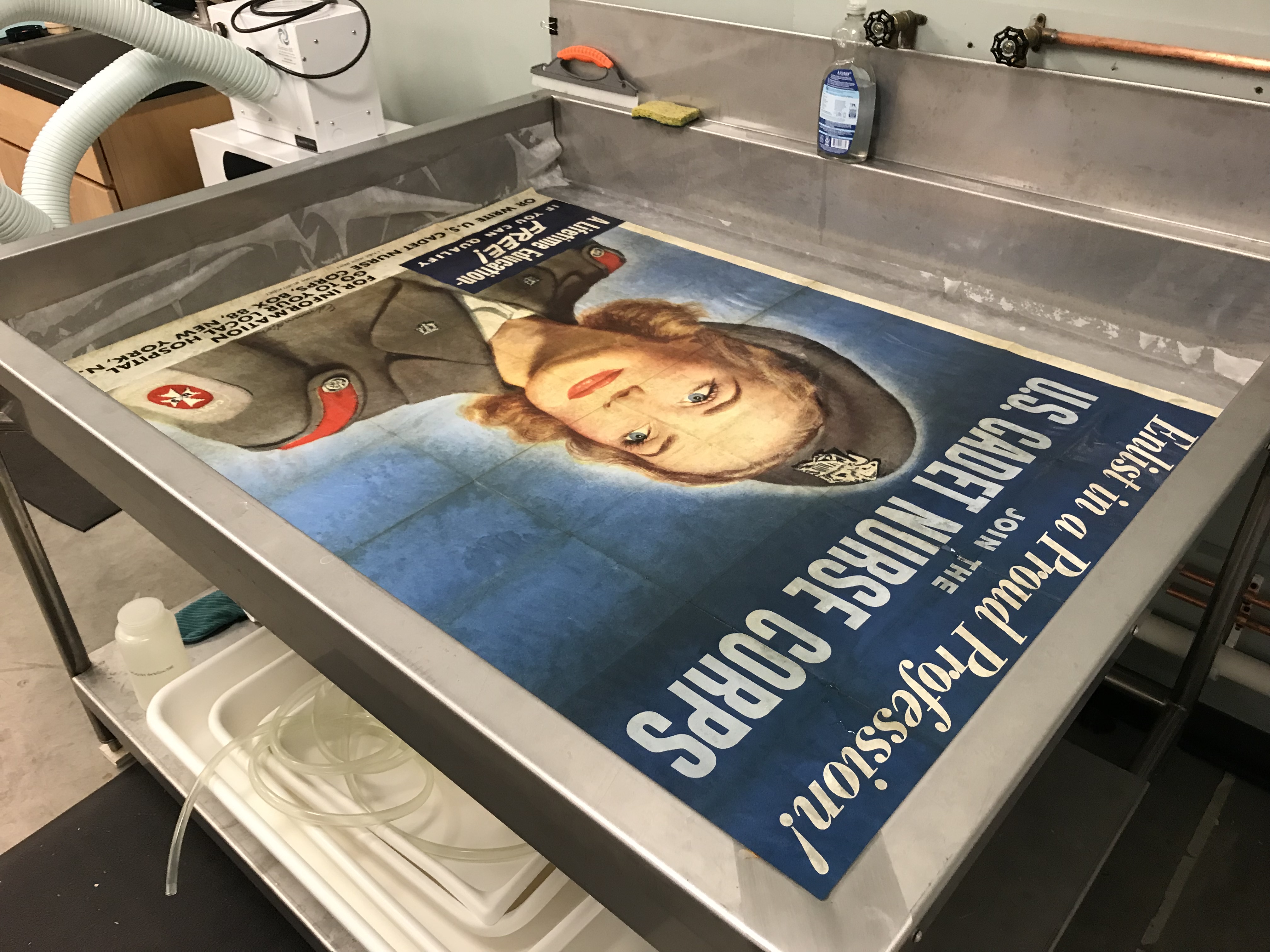
The poster is a 1943 lithographic poster for the U.S. Cadet Nurse Corps, drawn by artist Carolyn Edmundson. On that morning, a leak was discovered in the public documents room in the library. By the time it was discovered, the water had caused damage to a variety of pieces that had been left on a table under the leak spot. One of these pieces was the nursing poster. It was apparent, that while the poster had suffered water damage, there was also damage to the poster that predated the leak. The poster suffered from severe creasing, tears and areas of loss. A small amount of old pressure sensitive cellophane tape was found on the back and the paper was very dirty and brittle. Staining had occurred from the water damage. Additionally, the paper was cockled.

The treatment of the poster began with documentation. Both sides of the poster were photographed, and a report was written documenting its condition and proposing treatment options to address the damage. The first step was to dry clean both sides of the poster to remove the dirt and grime. The cellophane was then removed with the use of a hot air pencil.

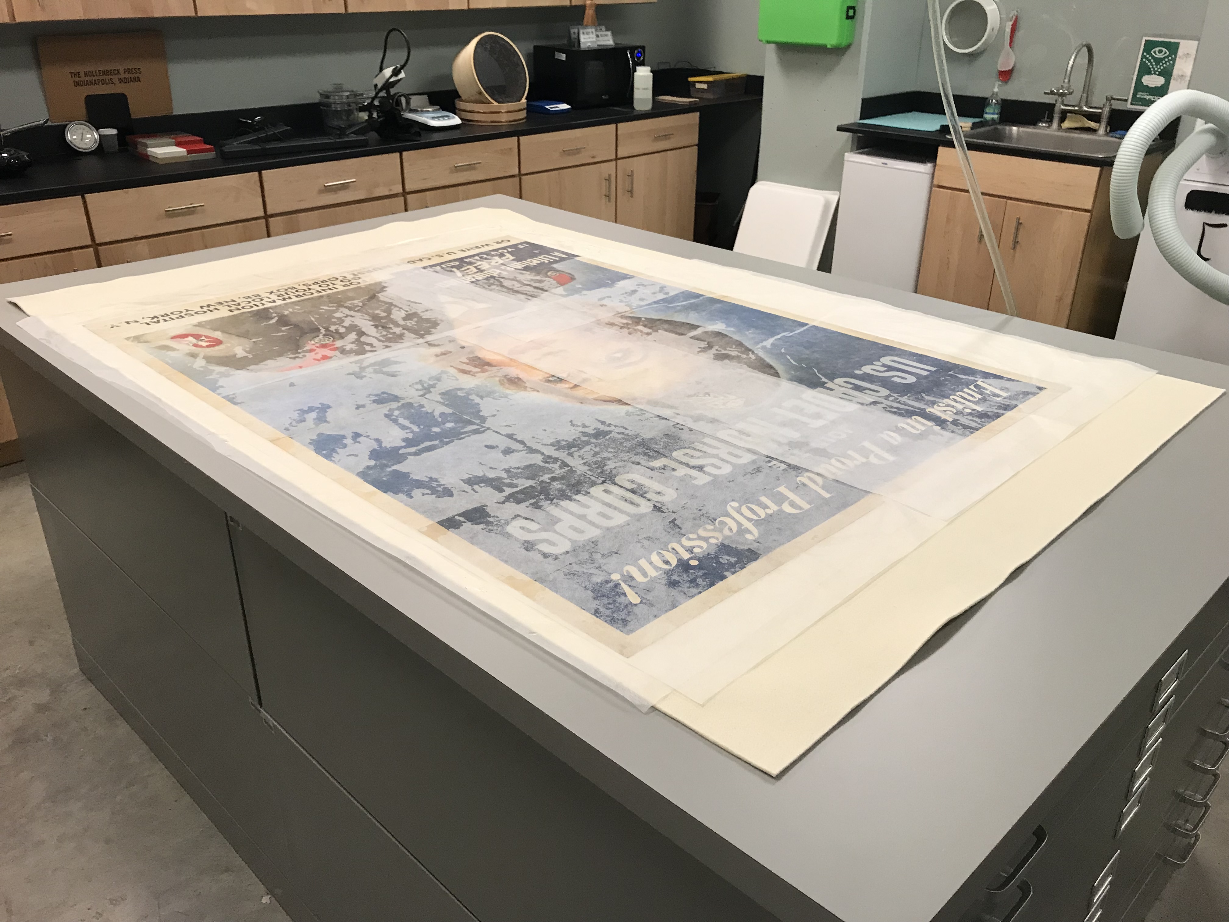
The entire poster was washed in alkalized water and dried between wool felt blankets.

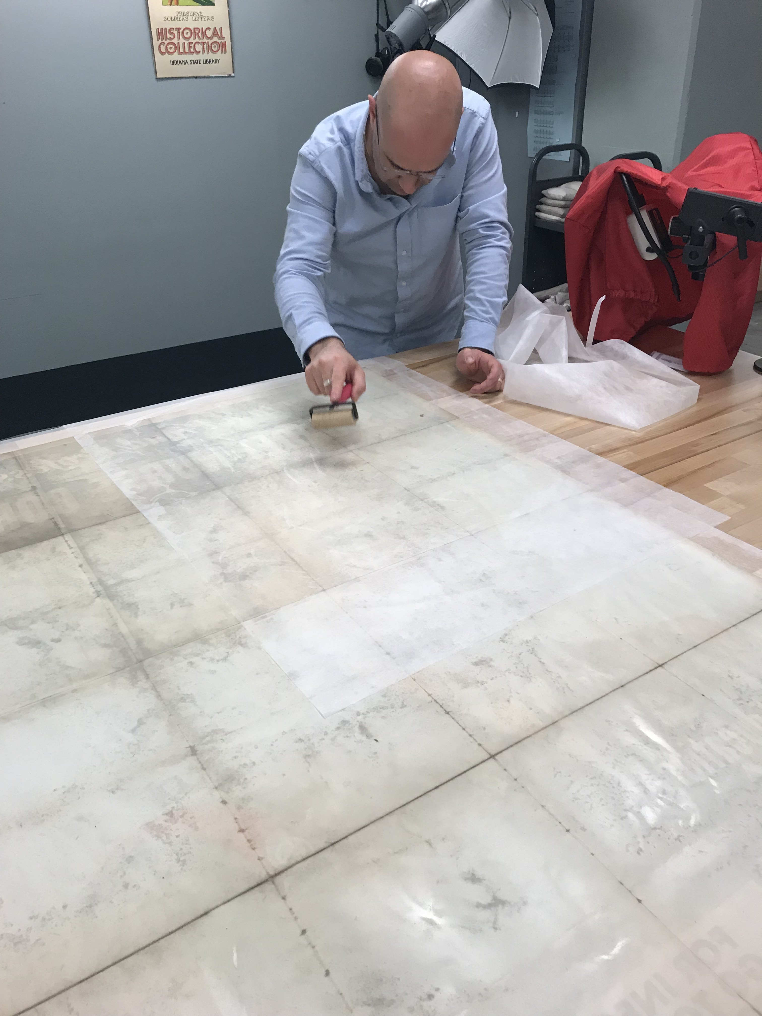
The area of loss was filled with re-pulped paper and the entire poster was lined onto a sheet of Japanese tissue with wheat starch paste.

The poster was photographed again and a final report was written documenting the treatment.

The poster is now safely back in the flat file cabinet with the library’s other broadsides.

This blog post was written by Seth Irwin, conservator, Indiana State Library.

Maps of Jennings and Ripley County, by William W. Borden (c. 1875): Part 1

This will be part one of a two-part feature on this collection item. Please be sure to check back in the near future for part two from Chris Marshall, who will give more information about the map book’s creator and the historical importance of its contents.

Rescuing a Book of Hand-drawn Maps from Repairs Gone Wrong

When Indiana Division Librarian Chris Marshall recently brought me a book of hand-drawn maps for consultation, it was a bittersweet experience. This little volume created by William W. Borden in 1875 contains notes, maps, and delightful remnants of pressed plants, evidence of which only remains in the impressions and acidic discoloration in the paper. Chris had selected the volume for digitization due to a patron request, but it needed some conservation treatment beforehand.


Suffering from loose pages, pages stuck together, taped hinges, and a fragile leather cover completely encased in stiff library book cloth with what was likely an overzealous coating of paste, this little book had received so much well-meaning but poorly executed repair work that it could barely open. A little pocket at the back also held three additional maps, each broken at their fold-lines in four sections. After some discussion with our Genealogy Division Supervising Librarian, Stephanie Asberry, a treatment plan for how best to restore access to this volume was agreed upon.

Here was the plan:

  1. Separate text block from binding safely
  2. Remove tape
  3. Separate all pages adhered together if possible
  4. Mend all loose pages back into sections
  5. Re-sew text block in a way that allows a relaxed, flat opening
  6. Mend the three additional maps back into one piece
  7. Send all to Chris Marshall for digitizing
  8. See if the original leather binding can be rescued from the book cloth
  9. Rebind either in original binding or new case, storing old binding with the book

As you can see, we are currently up to step eight:

Stuck pages have been safely separated. The title page seen in the first before image was a later, modern addition that Borden would not have intended to be there. We decided to separate the page and use the information for cataloging only.

Pages have been mended back together and the text block sewn back together for a comfortable, flat opening.

The pages can now relax flat.

Loose page from the before images above has been mended back in.

Lovely acidic discoloration left behind from a long-missing plant fragment.

While I was able to very carefully remove the book cloth from the leather binding, the leather is very stiff and brittle. Because it no longer flexes, it would not be safe to rebind back into its original binding.

When I receive the volume back from Chris from digitization, I will rebind it in a new case and create a box for the volume, the extra maps, and the original binding. At that point it will be readily available for researchers to view in person in addition to the digitized copy Chris will make available online in the near future.

Stay tuned for a part two about this map book in the near future! Also, if you’re interested in learning more about William W. Borden, the Indiana Historical Bureau had a wonderfully written feature about him in The Indiana Historian, December 1995 available here.

This blog post was written by Rebecca Shindel, Conservator, Indiana State Library.

Making it “happy” again

During a recent treatment, I was reminded by a librarian that it’s amusing to them that I describe conservation treatment work as making something “happy” again. To be perfectly honest, that is exactly how I see it. When I see something that is torn, stained, and taped within an inch of its life, it looks miserable to me. I see the potential and I can’t wait to get stuck in.

A great example of this is a recently completed treatment on one of our beautiful 1920s South Shore Line broadsides. “Steel Mills at Gary by South Shore Line,” (C. 1925) had come to my attention because it will be featured in an upcoming exhibit here at the library this summer. We have also been digitizing these broadsides and, in its current condition, it would have been very unsafe to do so.

With a large disfiguring tear down the front and several edge tears, creases and losses, this broadside just looked uncomfortable. As you can see on the back, an enterprising former employee had attempted to mend this posted with one of a conservator’s most-dreaded nemeses: tape. This mending job had also not quite lined up the tear carefully enough, causing the main disfiguring problem: bumpiness in the overall surface (or as we call it in fancy conservation terms, cockling and planar distortion). The edges definitely held promise because I could see that much of what appeared “lost” at the front had actually just been torn and folded over onto itself. With careful work, it could be made happy again!

The plan of attack was simple:

  • Surface clean the front and back carefully
  • Remove the tape from the back, ensuring all adhesive residue is removed
  • Properly align and mend tears
  • Re-encapsulate

Self-mending flap tears, where the paper has torn in a way that overlaps itself and can be mended to itself, sometimes without Japanese paper needed.

Encouraging folded edges to lay flat again with the use of localized humidification.

More of the same.

Using gentle pressure to encourage folded edges to lay flat.

After the tape and adhesive residue were painstakingly removed, I was able to realign the tears and mend it all back together using wheat starch paste and Japanese paper. Here are the results:

After treatment.

This broadside looks much happier and can now be safely exhibited, digitized, and accessed by our patrons. A very satisfying treatment, indeed!

This broadside is part of the Rare Books and Manuscripts Broadsides Collection at the Indiana State Library.
This blog post was written by Rebecca Shindel, Conservator, Indiana State Library. 
Please note that colors presented on computer screens are not precisely accurate, and may look slightly different from one screen to another.