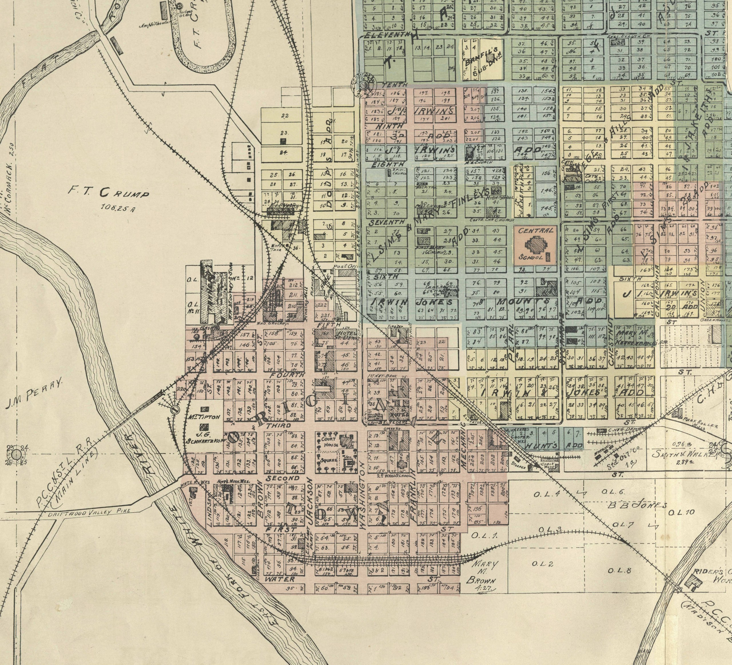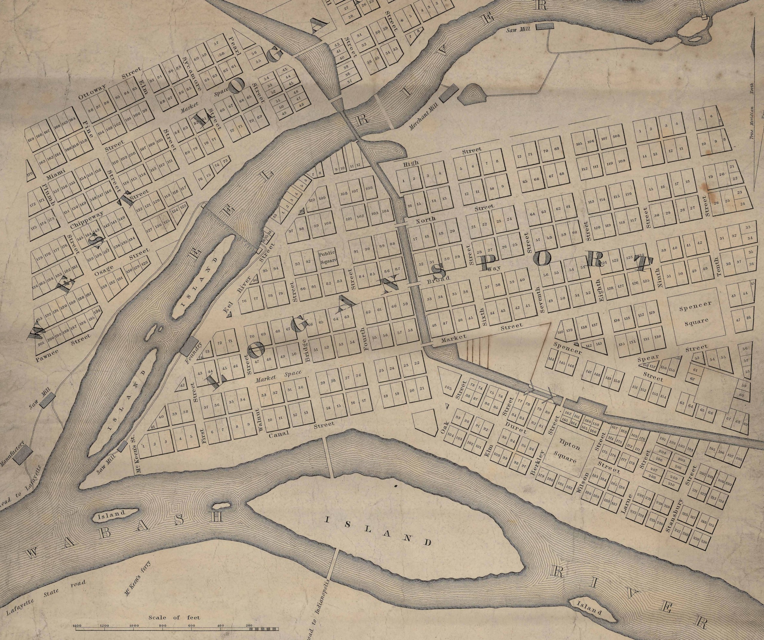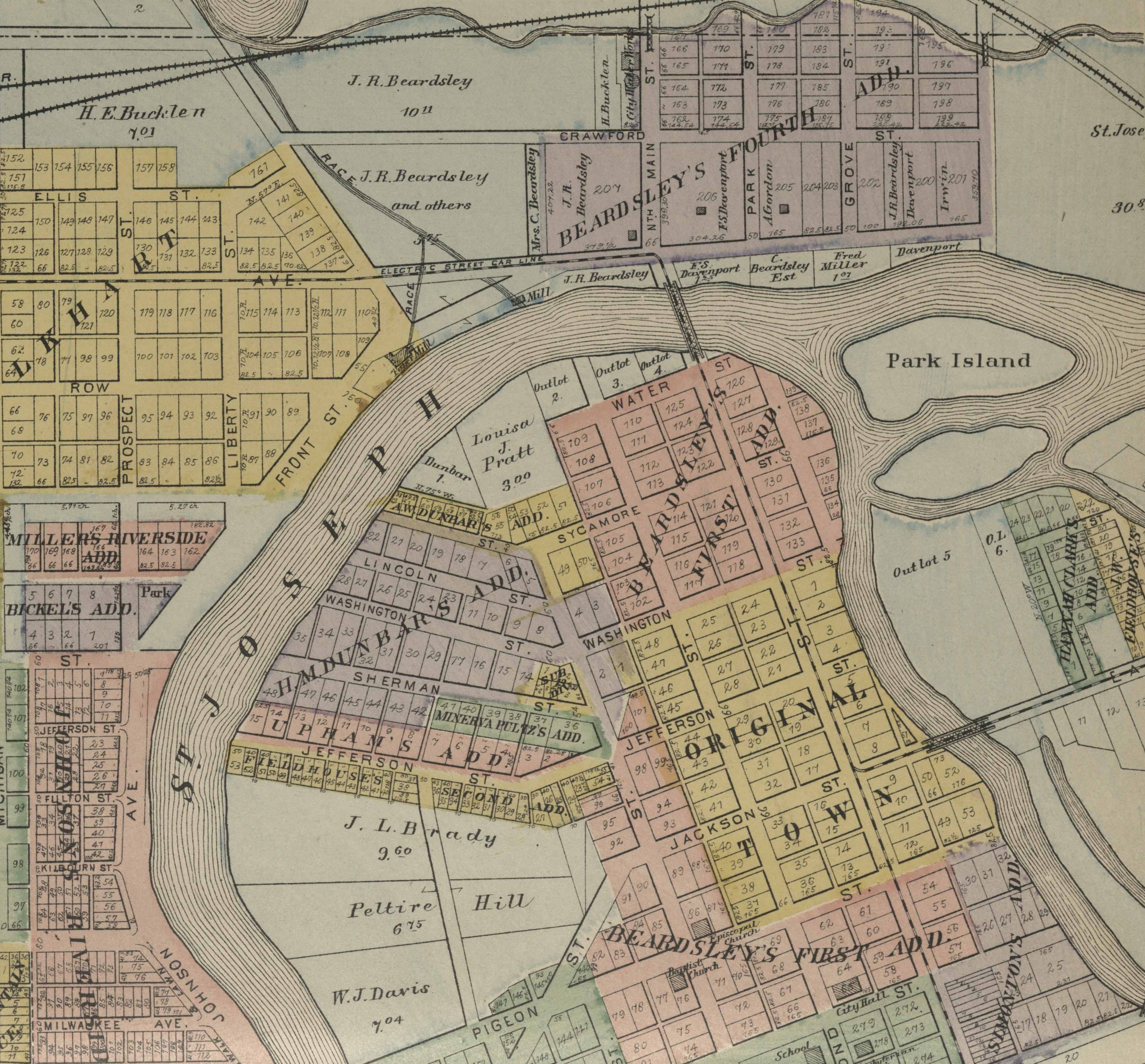
This 1852 map of the city of Madison is the earliest map of the old river city held in the Indiana State Library’s collections. The detail is brilliant, done by the careful hand of Hoosier pioneer William C. Bramwell. It seems clear that this map is the original map used for the 1854 published map of the city, which is held in Madison. Bramwell seems to have an interesting biography, although little is known about the details of his life. Credits to his name include state legislator, surveyor, preacher, inventor and spinning wheel maker. Whatever his true calling, it is clear his attention to detail and craftsmanship has left us a beautifully rich and detailed map of one of Indiana’s oldest cities.
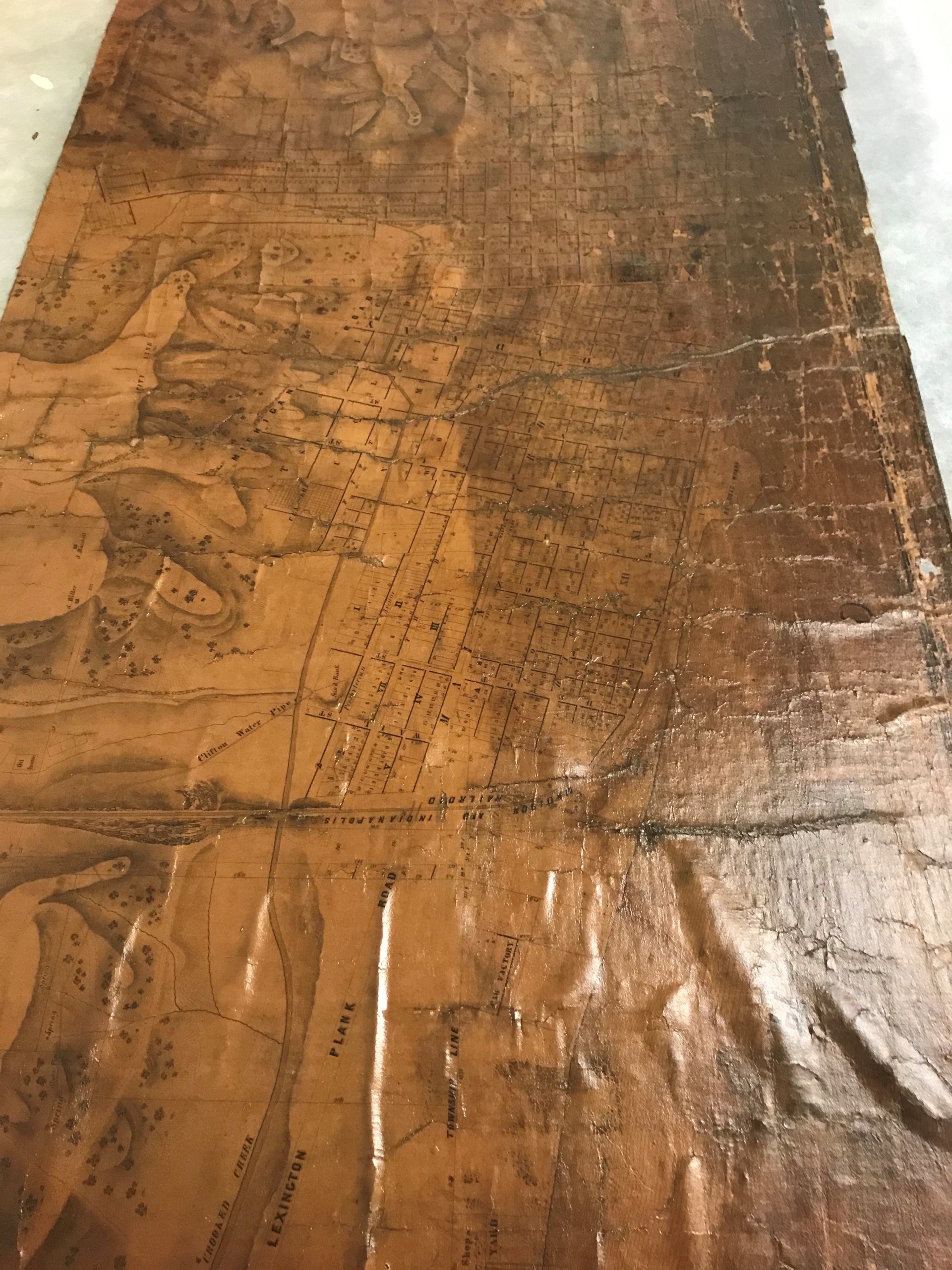
It is not known when the Indiana State Library acquired this map, or its history before it arrived at the library. When it was found in the collection it was in an extremely deteriorated and fragile state. The map was still adhered to its original fabric backing, which had become very dirty and deteriorated. As with many maps from this period, the front had been varnished, which resulted in even more deterioration. The front of the map had also become so dirty and discolored that most of the map could not be read. Many pieces of the map had broken off and become lost, and it was difficult to determine the difference between the paper areas and the cloth. It was in such poor condition, that even unrolling it would result in pieces falling off. Finally, as with many maps from this period, there was evidence of water damage as well in the form of staining.
The goals for this project were simple. In its current state, the map was unusable. It was so dirty that it could not be read, and it was so fragile that even unrolling it would result in more pieces falling off. The goals of this project were to clean the map as much as possible to remove the old varnish, the dirt and the staining and then line the map onto a single sheet of Japanese paper to allow for it to be stable enough to handle. While the goals were simple, the execution would prove to be complicated by the enormous quantity of loose pieces that would come loose once the original fabric was removed. In order to preserve the information in the map, all the loose pieces would need to stay in their correct spots throughout the entire treatment. Finally, the map would be encapsulated in a custom polyester film sleeve to allow for more protection. The below pictures outline the conservation process.

Before treatment of top section of City of Madison and Environs by H.G. Bramwell, city surveyor, 1852.
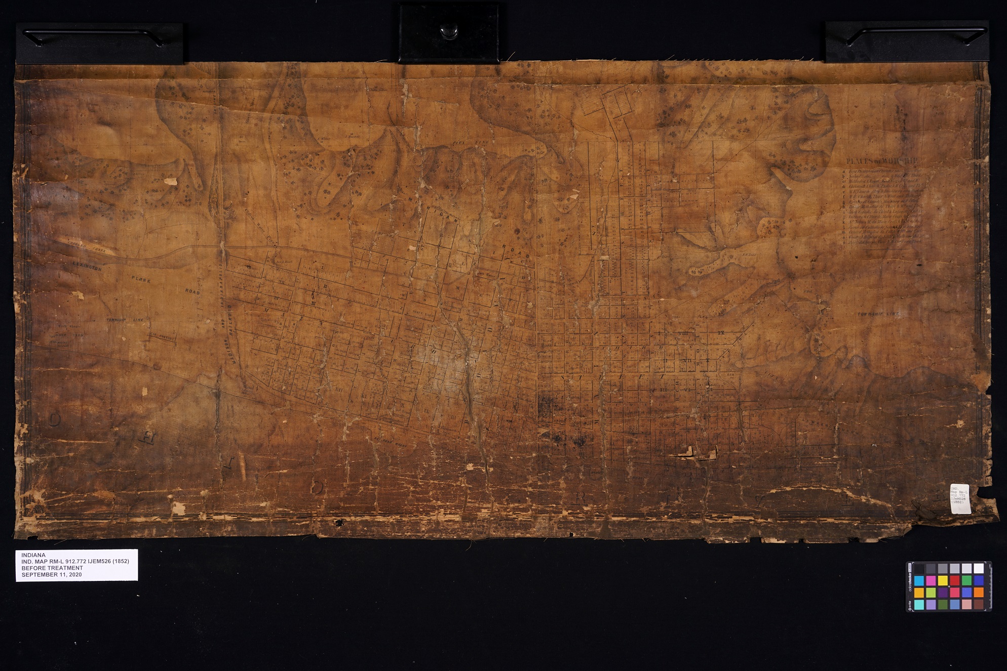
Before treatment of bottom section of City of Madison and Environs by H.G. Bramwell, city surveyor, 1852.
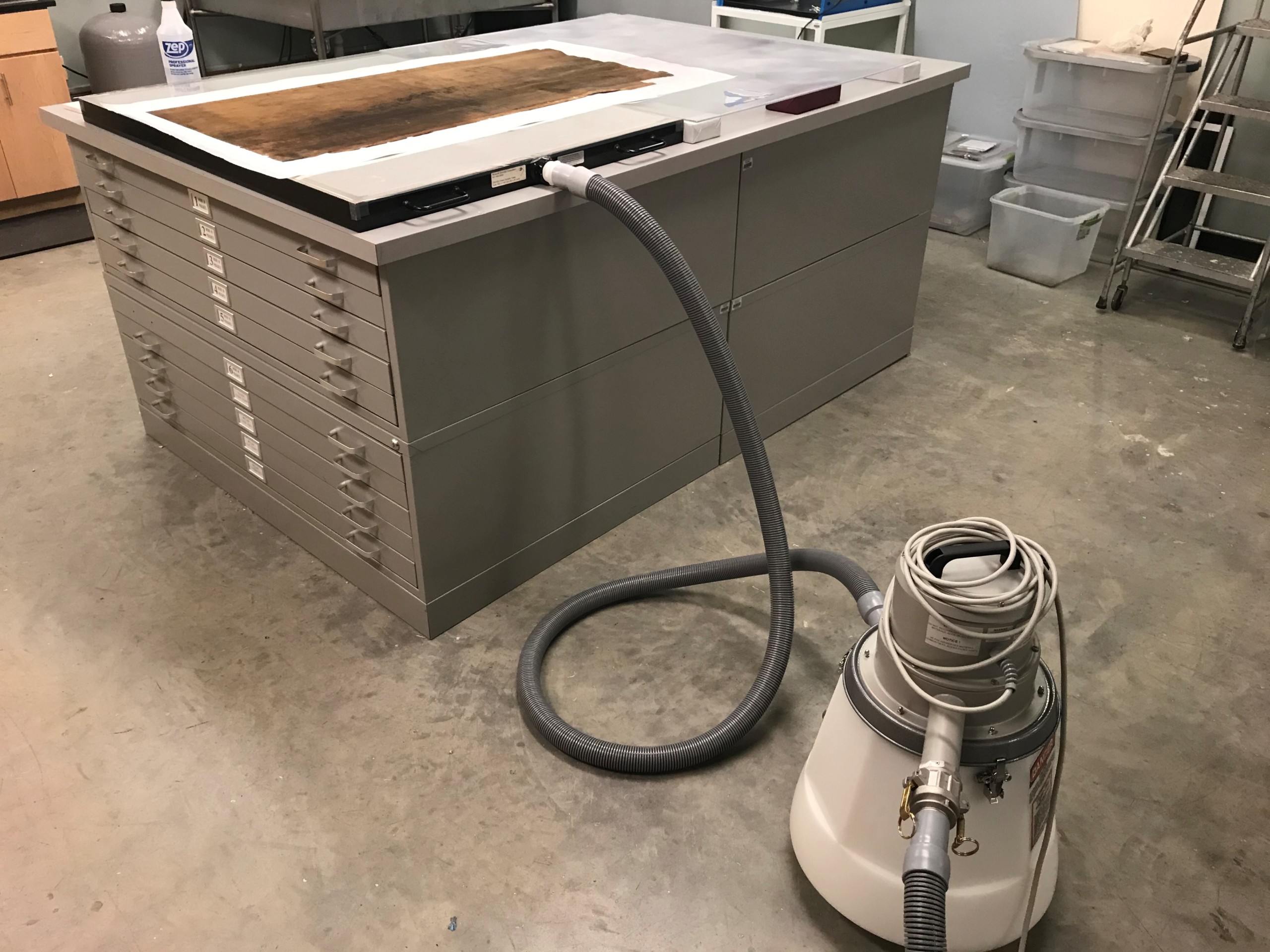
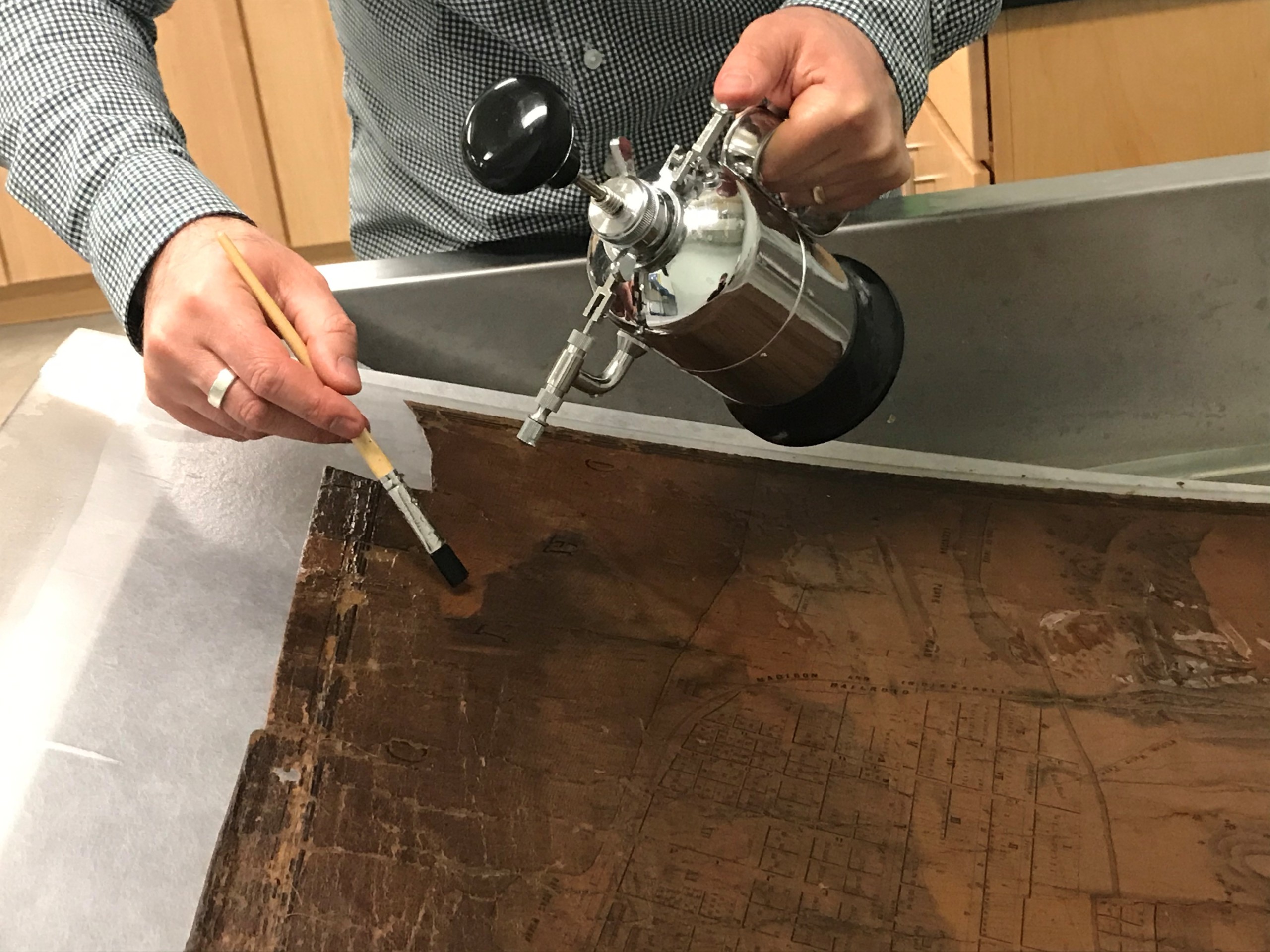
In order to remove the varnish, the map was placed faced down on blotter paper a high-power suction table and sprayed with ethanol.
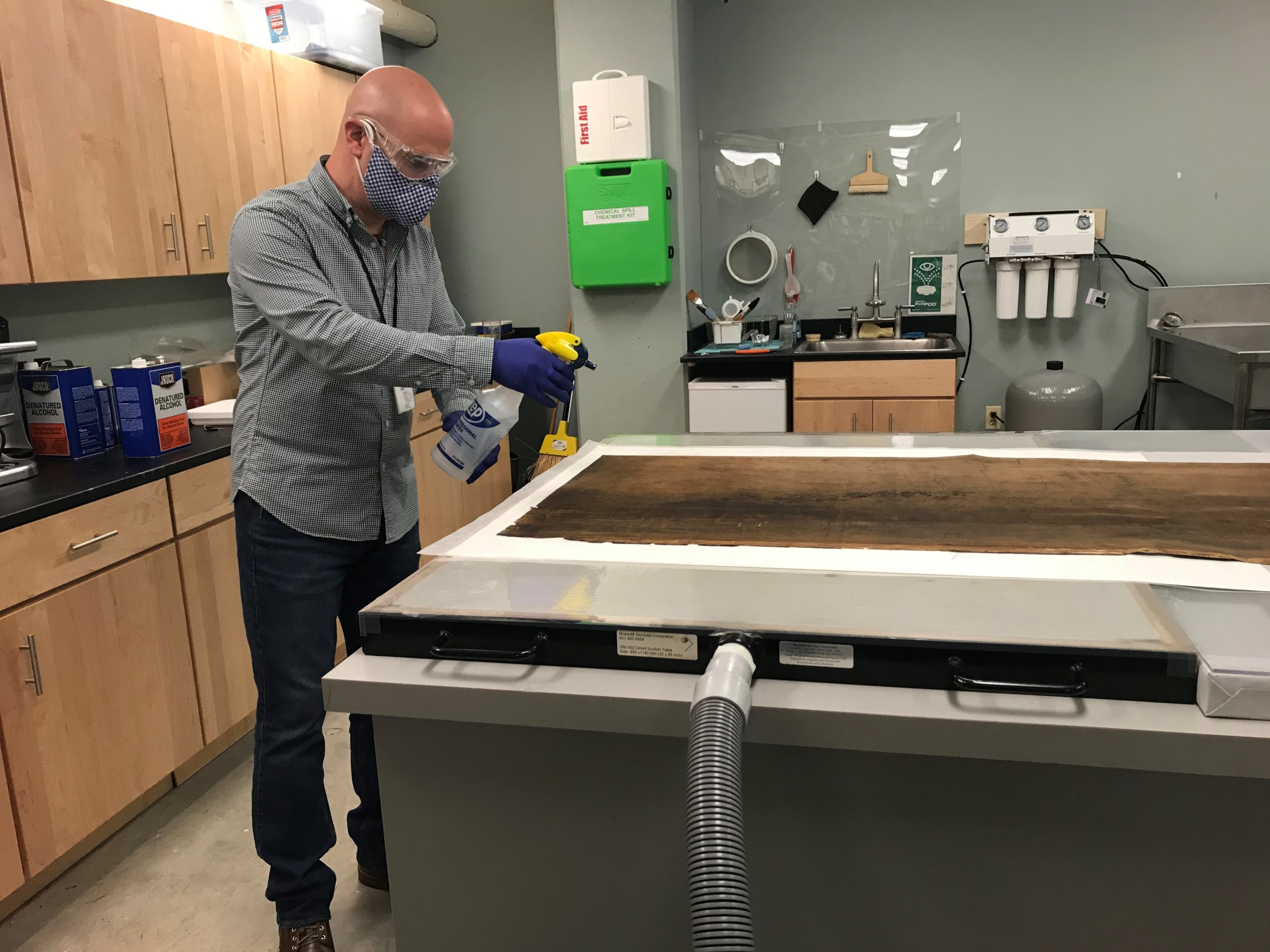
The ethanol would penetrate through the fabric and paper, solubilizing the varnish, and pull it into the blotter below.
This process was repeated until all the varnish was removed. The map was routinely lifted and checked during this process.
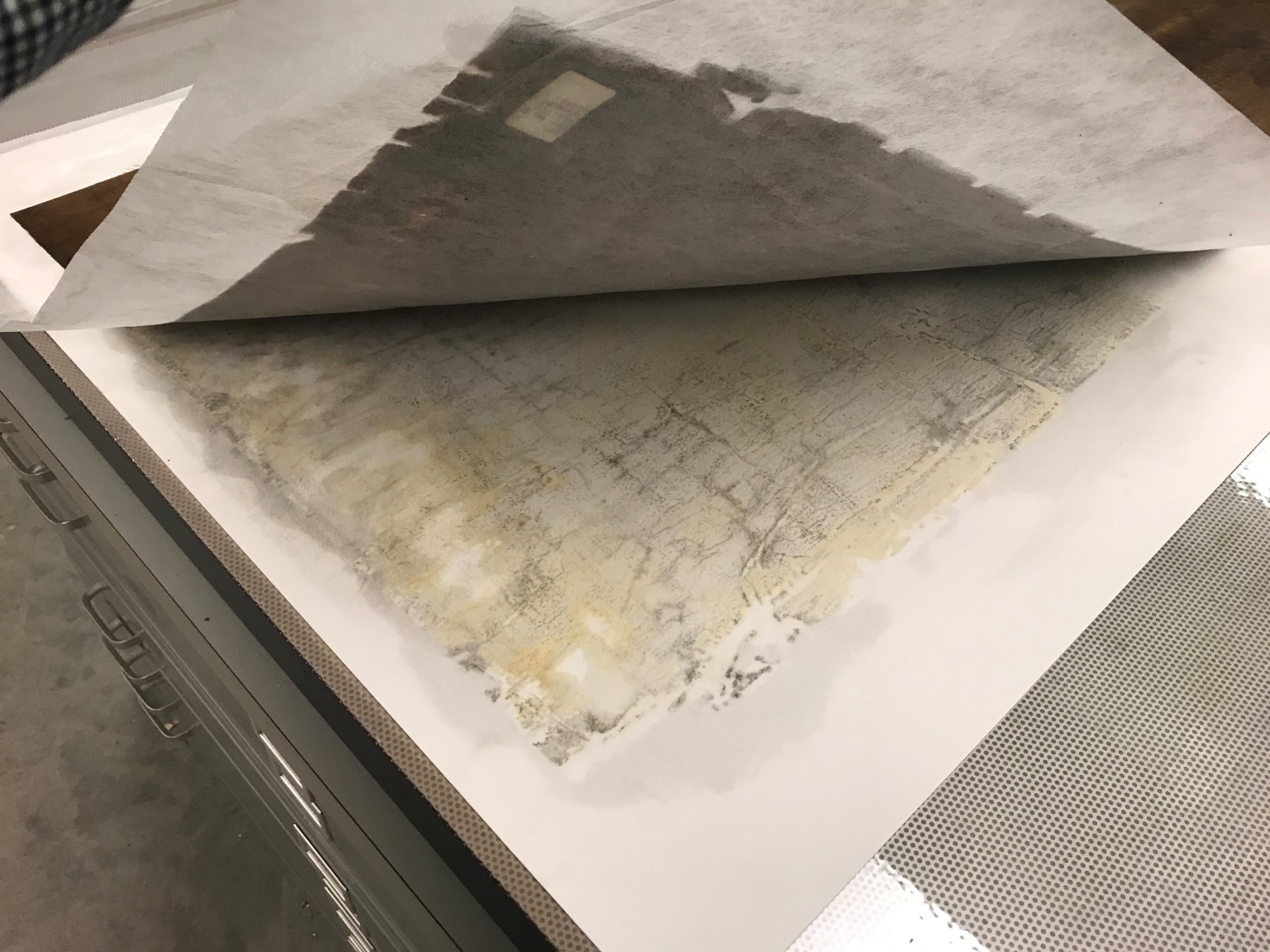
The blotter shows all the varnish removed from the map.
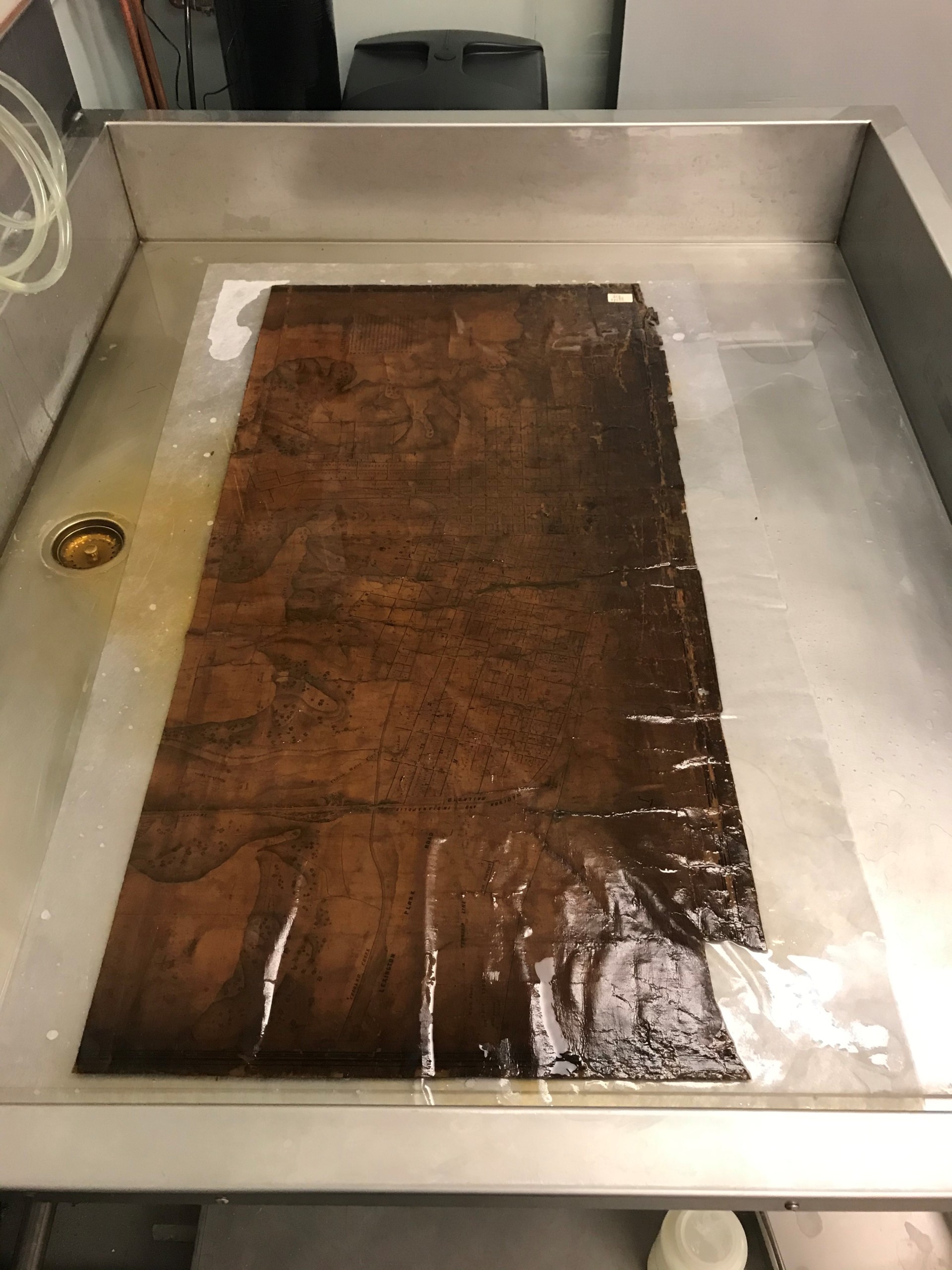
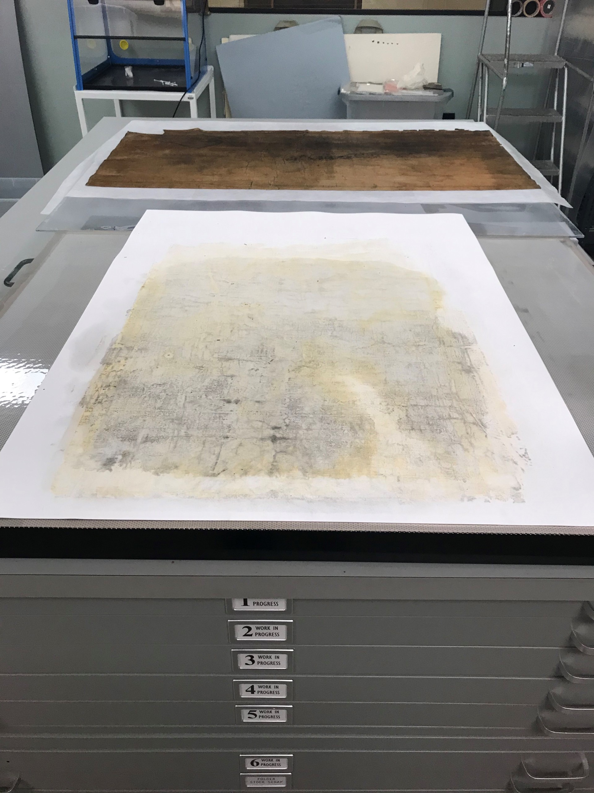
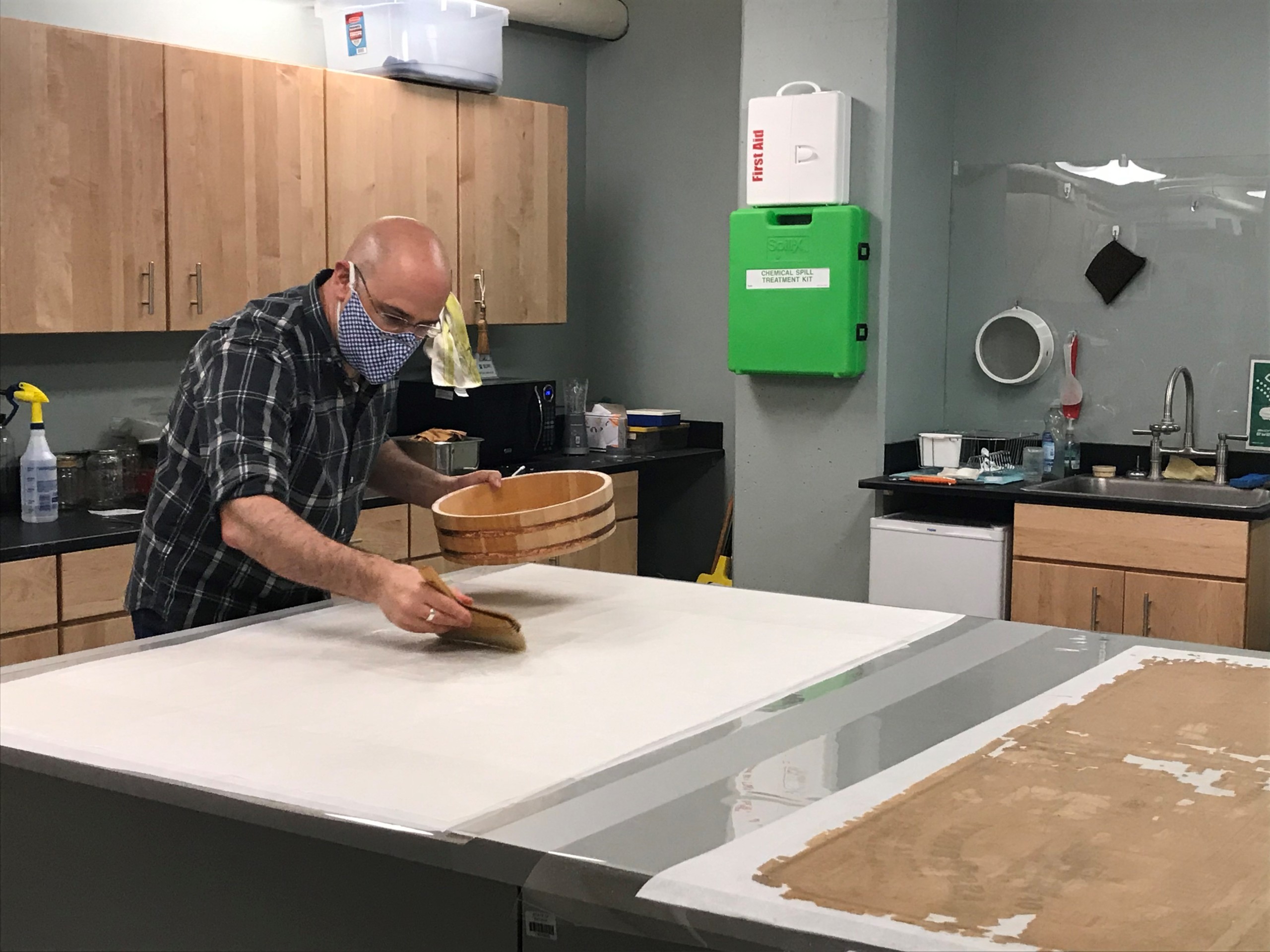
The map sections were washed in modified hot water on a rigid sheet of plexiglass for support.
The map was carefully lifted on the plexiglass support and tilted. Using a small brush and a Japanese mister, the entire surface of the maps was cleaned to remove all remaining varnish and dirt. Careful attention was paid to make sure all the loose pieces of the map stayed in their correct spots throughout the entire process.
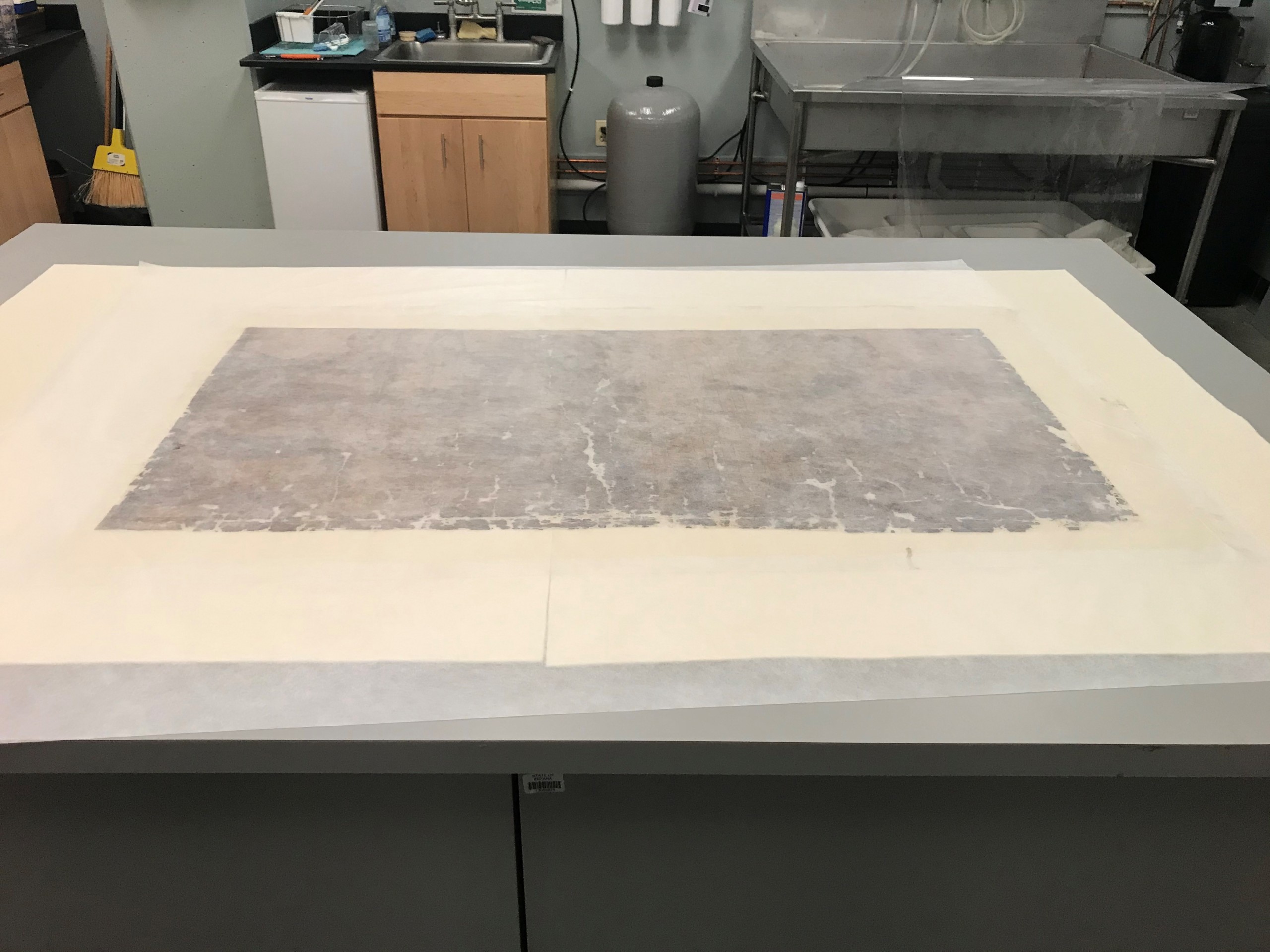
This image shows the progress of the cleaning of both sections.
This image shows the progress of the cleaning of both sections.
This image shows the progress of the cleaning of both sections.
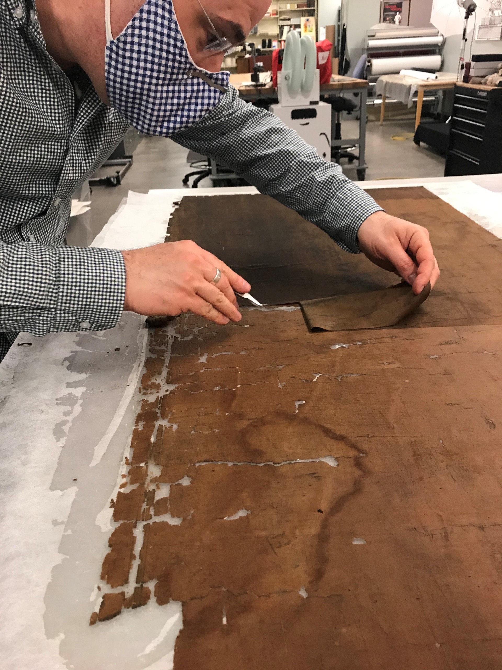
After the map sections were cleaned, the map was placed face down on polyester film and the original fabric was carefully removed making sure none of the loose pieces moved.
This image shows the map after the fabric was removed and the thousands of small pieces of the map that are now loose.
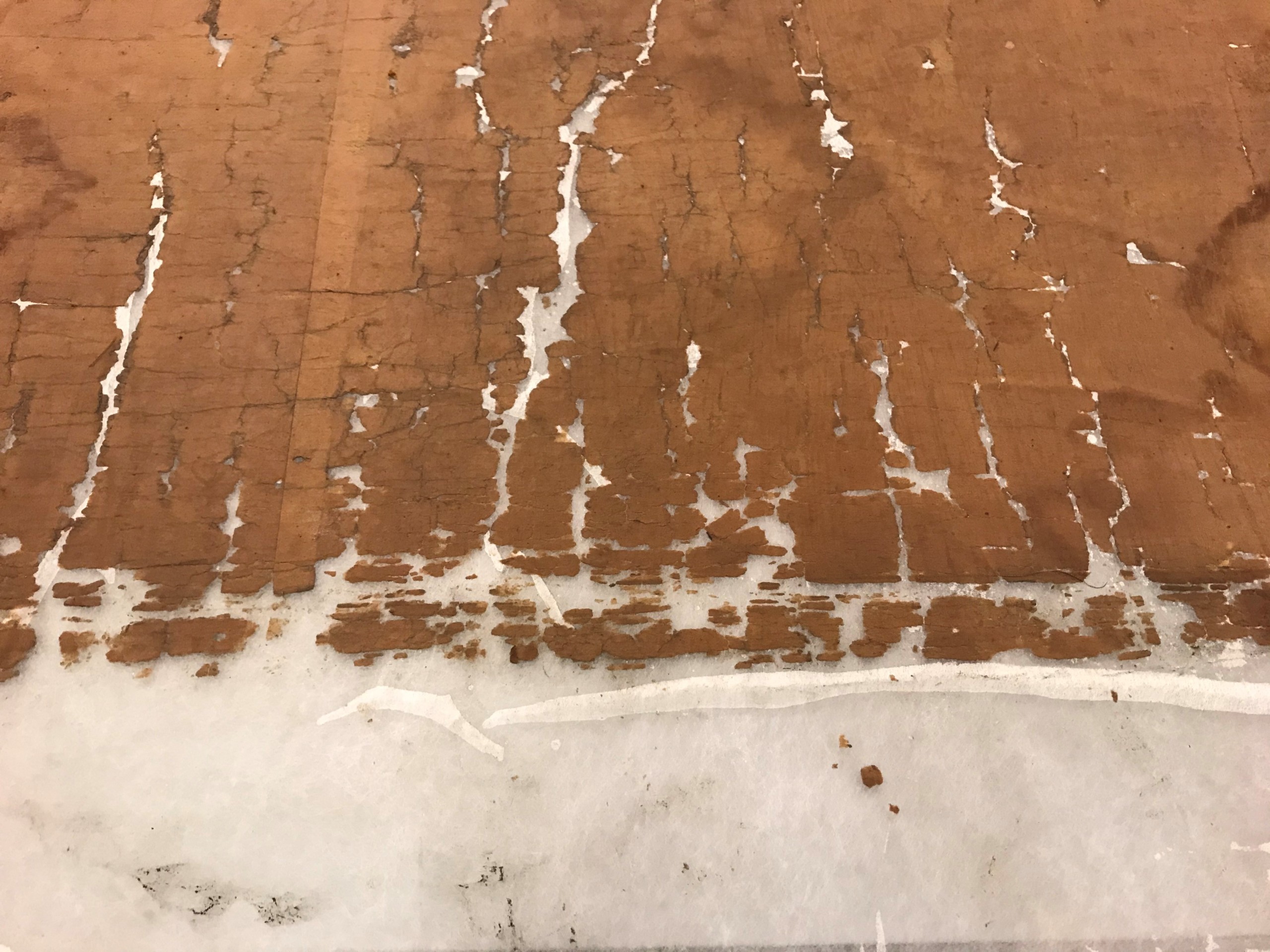
This image shows the map after the fabric was removed and the thousands of small pieces of the map that are now loose.
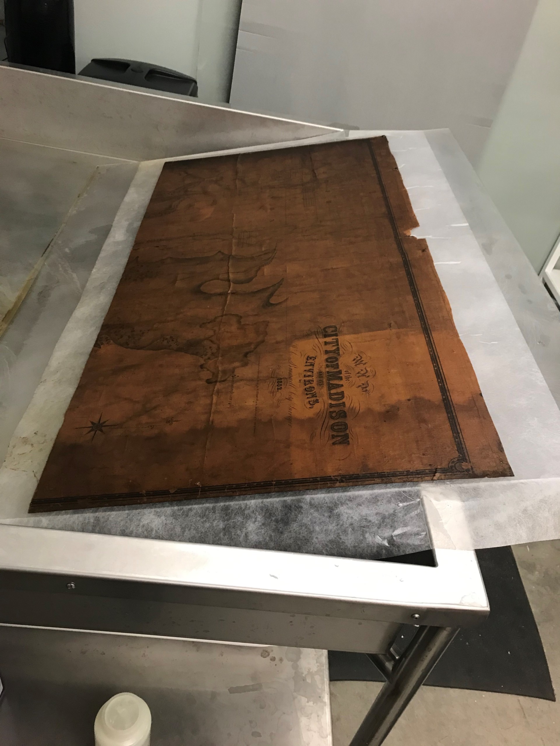
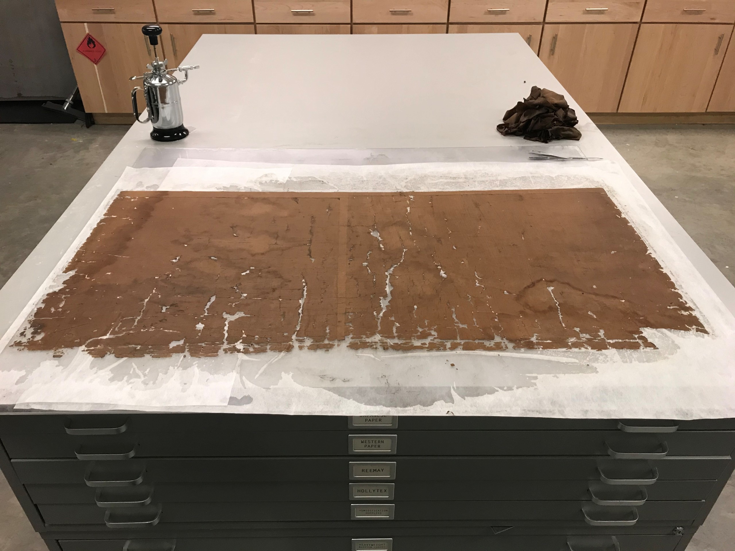
The map was lined onto a large sheet of Japanese paper with wheat starch paste and dried between wool felt blankets.
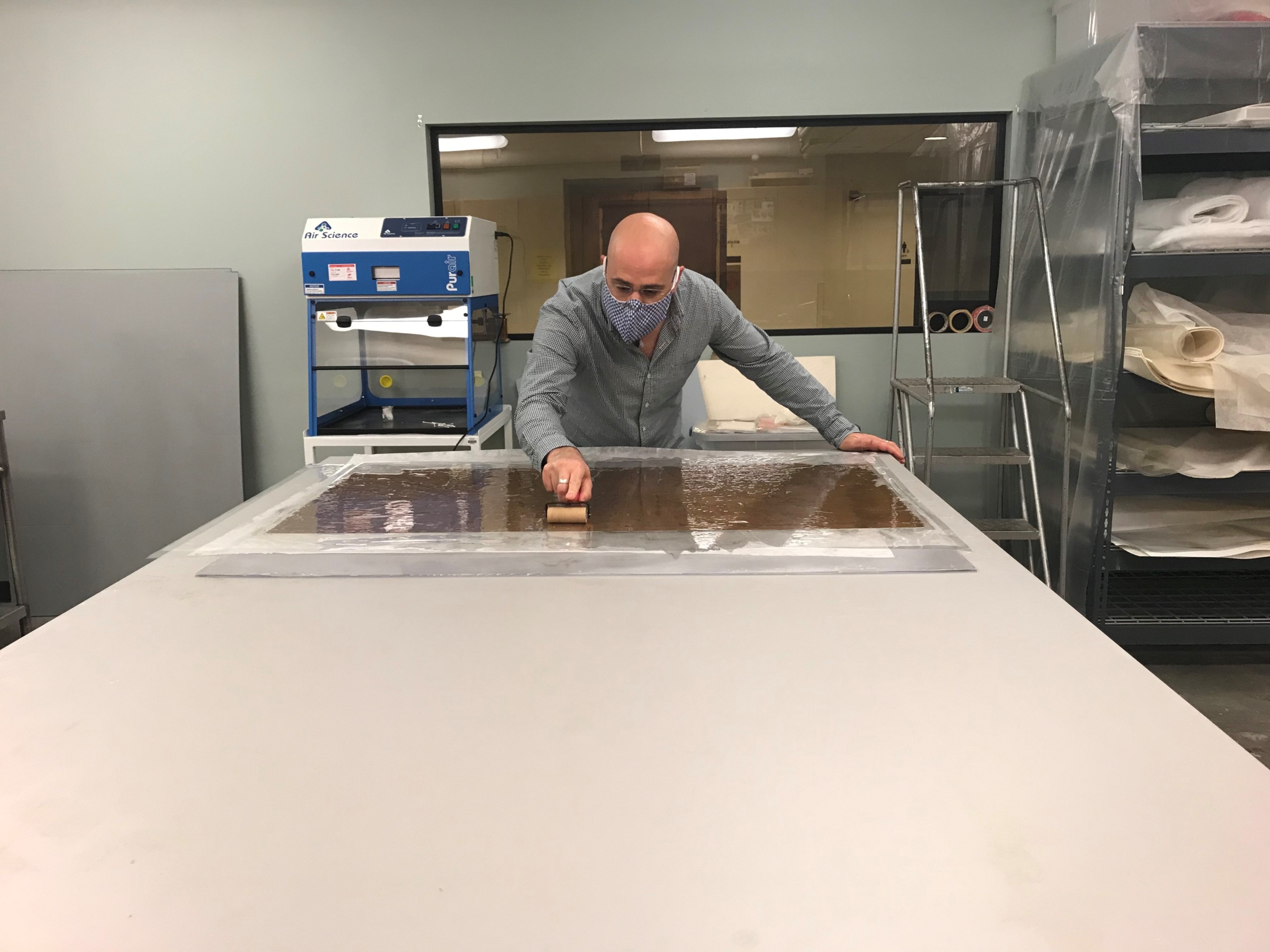
The map was lined onto a large sheet of Japanese paper with wheat starch paste and dried between wool felt blankets.
The map was lined onto a large sheet of Japanese paper with wheat starch paste and dried between wool felt blankets.
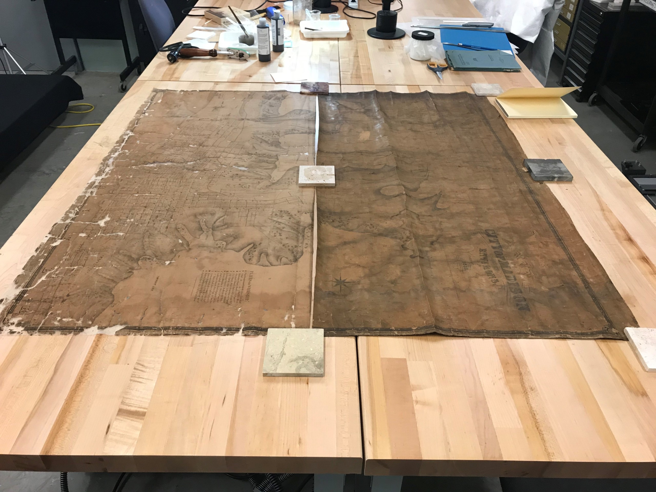
The top and bottom section of the map next to each other. At this point, the bottom section has already been treated and the top section had not yet been treated.
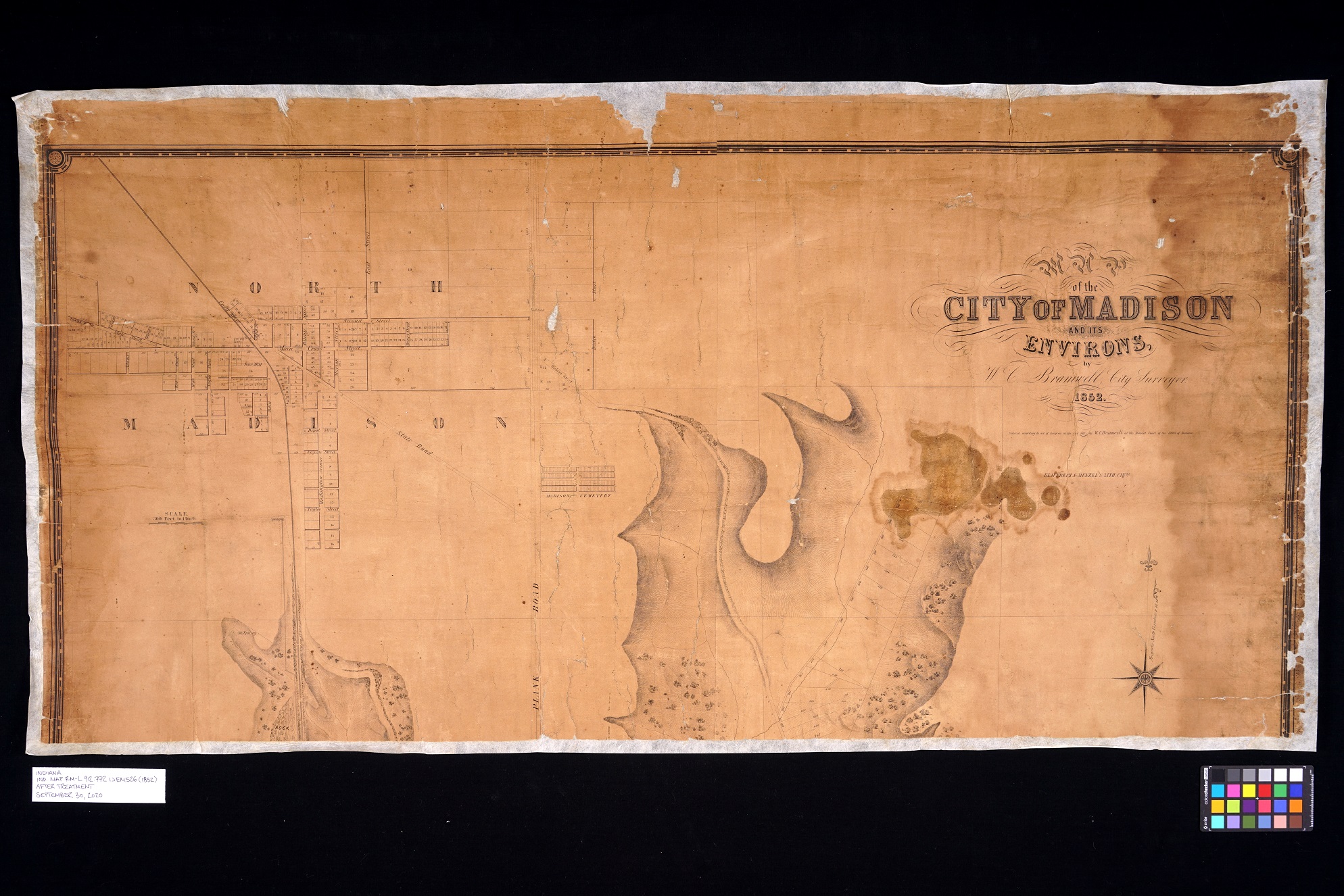
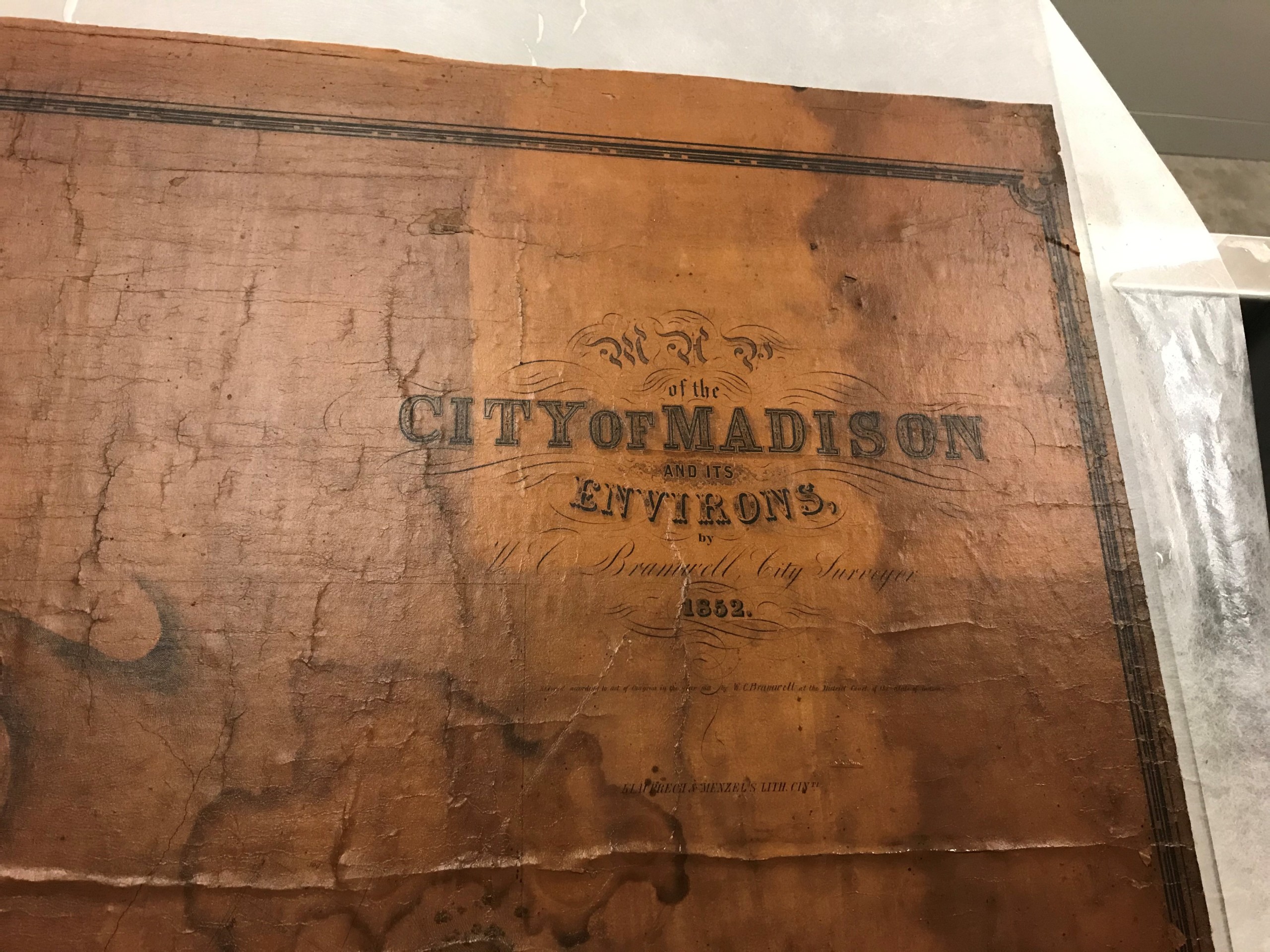
After treatment of top section of City of Madison and Environs by H.G. Bramwell, city surveyor, 1852.
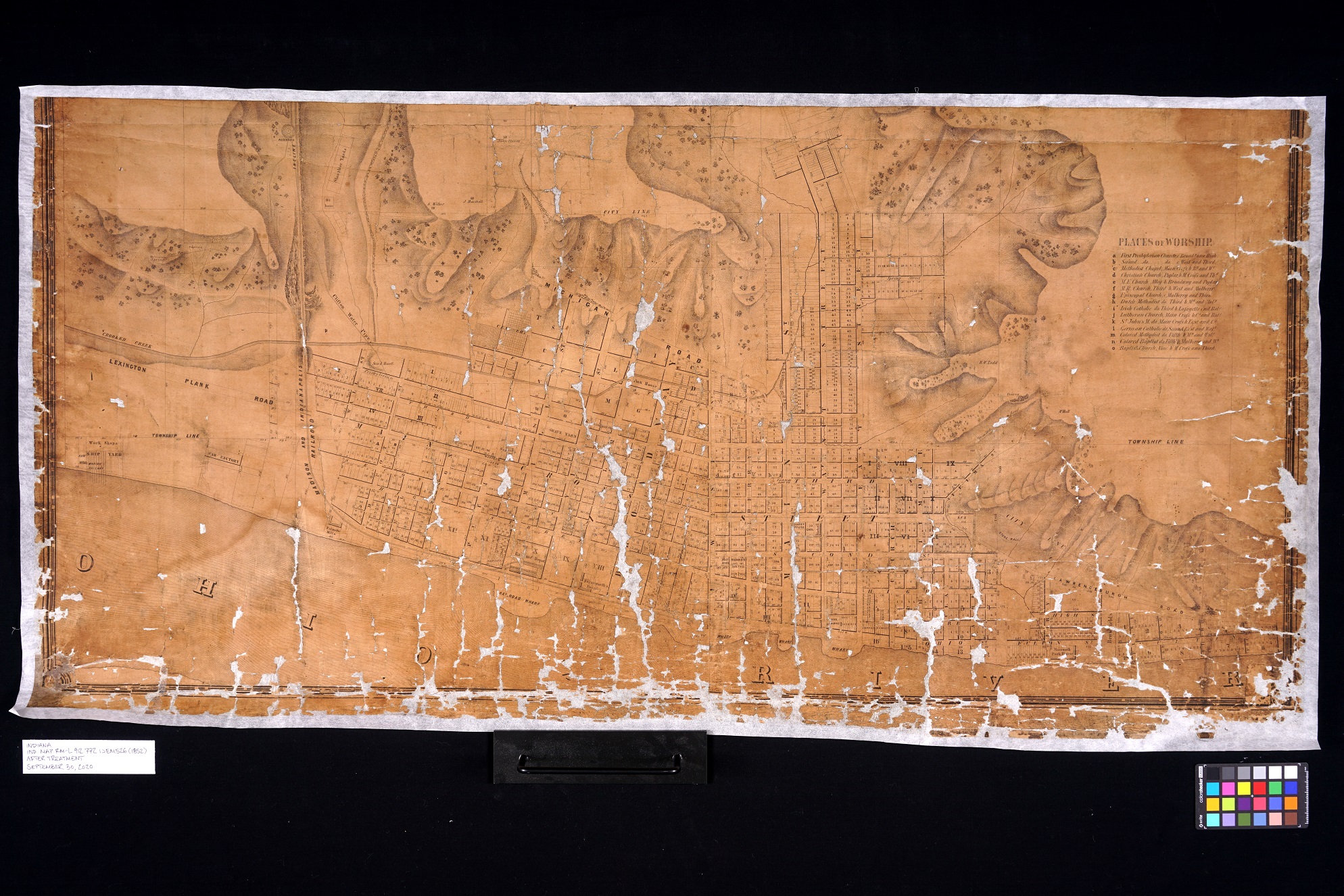
After treatment of bottom section of City of Madison and Environs by H.G. Bramwell, city surveyor, 1852.
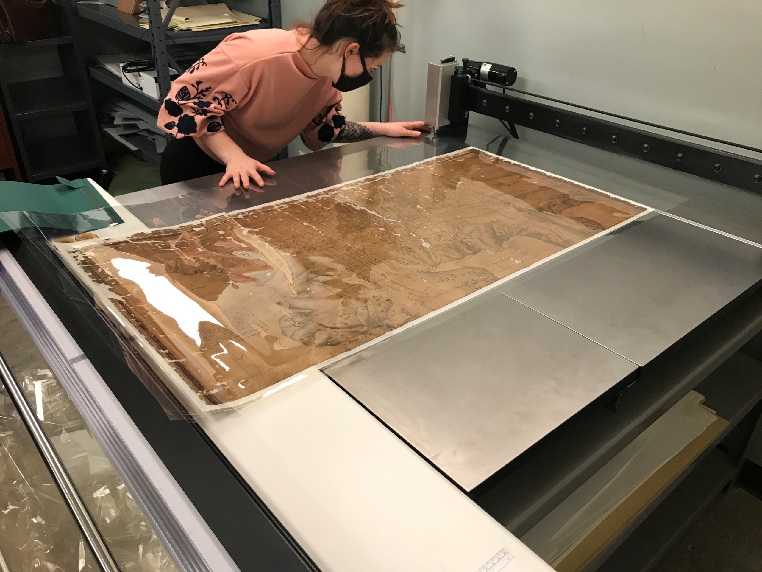
Conservation intern Lily Duncan encapsulating the map in a polyester film sleeve with an ultrasonic polyester welder.
Click here to read more about the conservation efforts of the Indiana State Library.
This blog post was written by Seth Irwin, conservator, and Monique Howell, Indiana Collection supervisor, both of the Indiana State Library.