
At the end of 2022, the Indiana State Library received the exciting news that it had received a $30,000 grant from the Nicholas Noyes Foundation to work on some of the most important and condition critical Indiana maps in the Indiana Division’s collection. The maps at issue comprised mid-19th century wall maps of Indiana cities and counties. Most of the maps were varnished and in an extremely deteriorated condition, making them completely unusable for any purpose. These maps are historically very important, often showing details such as property owners, churches, businesses and population information.
For many of the maps, the Indiana State Library has the only copy left in existence and the condition is in such a state that even the act of handling them causes pieces to fall off. The grant allowed the library to hire a project conservator, Valinda Carroll, for six months to work in the Indiana State Library Conservation Lab exclusively on some of the most vulnerable maps in the collection, stabilizing them and digitizing them for accessibility.
Being able to use the Indiana State Library’s varnished wall maps will support the work of several academic disciplines, local historians, railroad enthusiasts, students, genealogists and other researchers. We also hope to set an example for other institutions that might be holding these difficult to manage fragile, oversized historic collections. We are very excited to see the progress of the project as these important maps get completed and can be shared. The below pictures detail the process involved in repairing the maps.
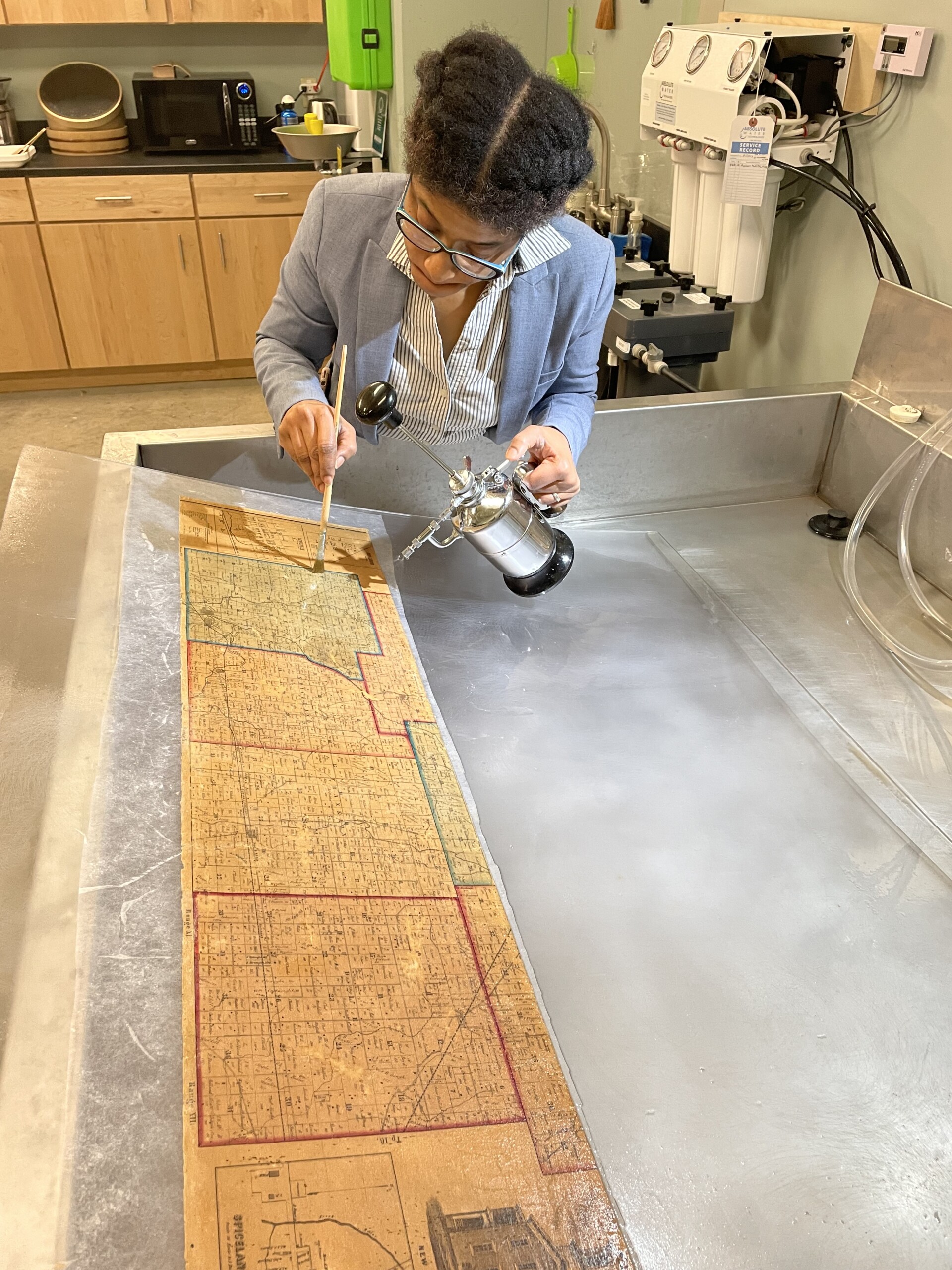
Valinda Carroll washing and cleaning a map with water.
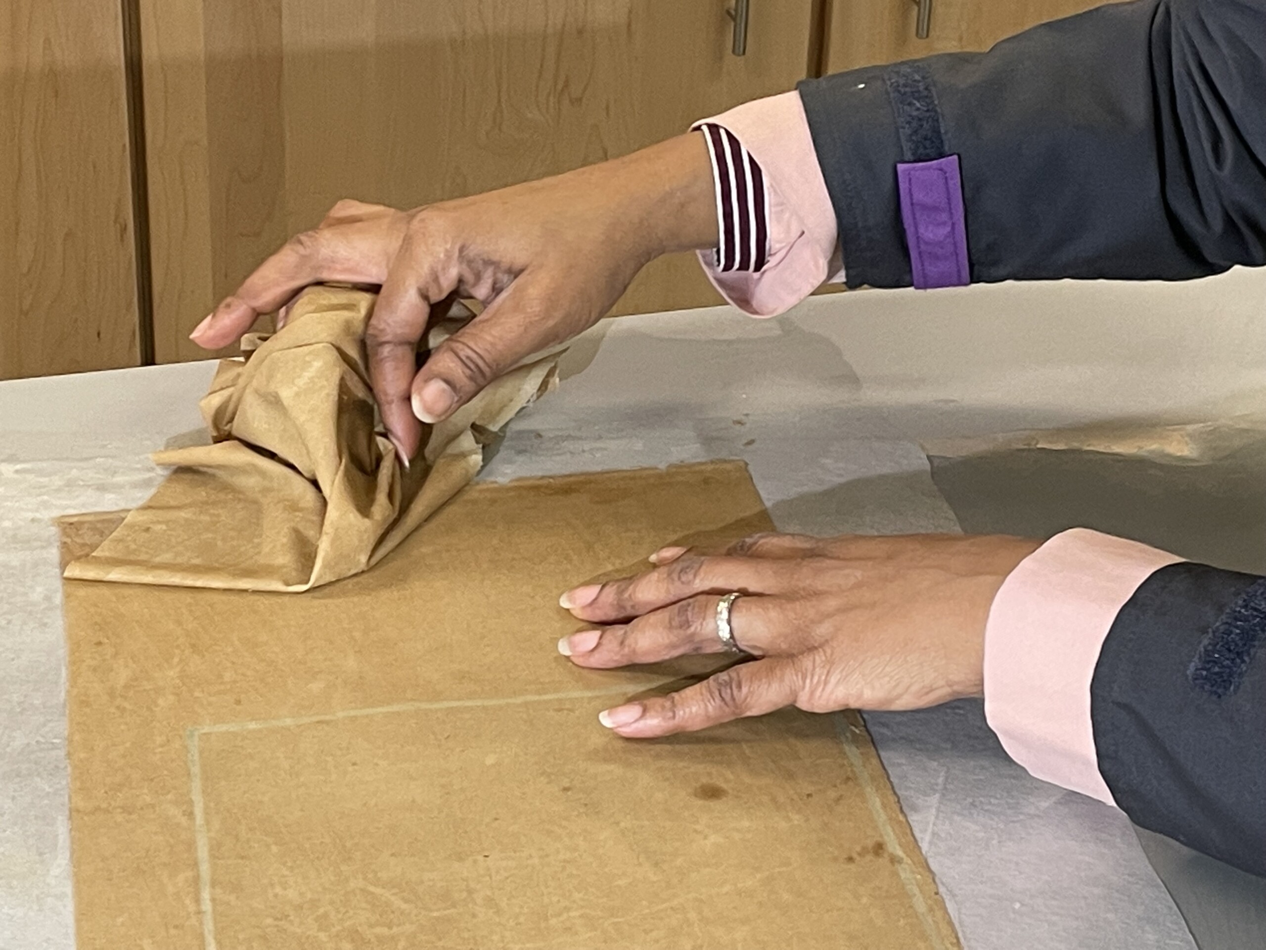
Valinda Carroll removing the deteriorated backing cloth from the back of a map.
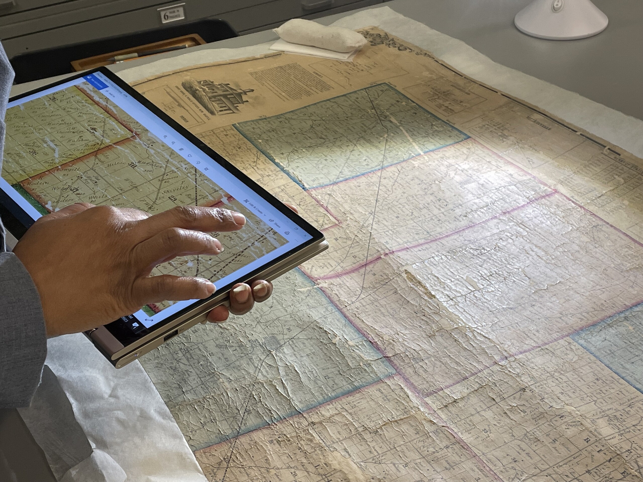
Valinda Carroll using a high resolution before treatment photograph of a map to check for locations for any remaining loose pieces.
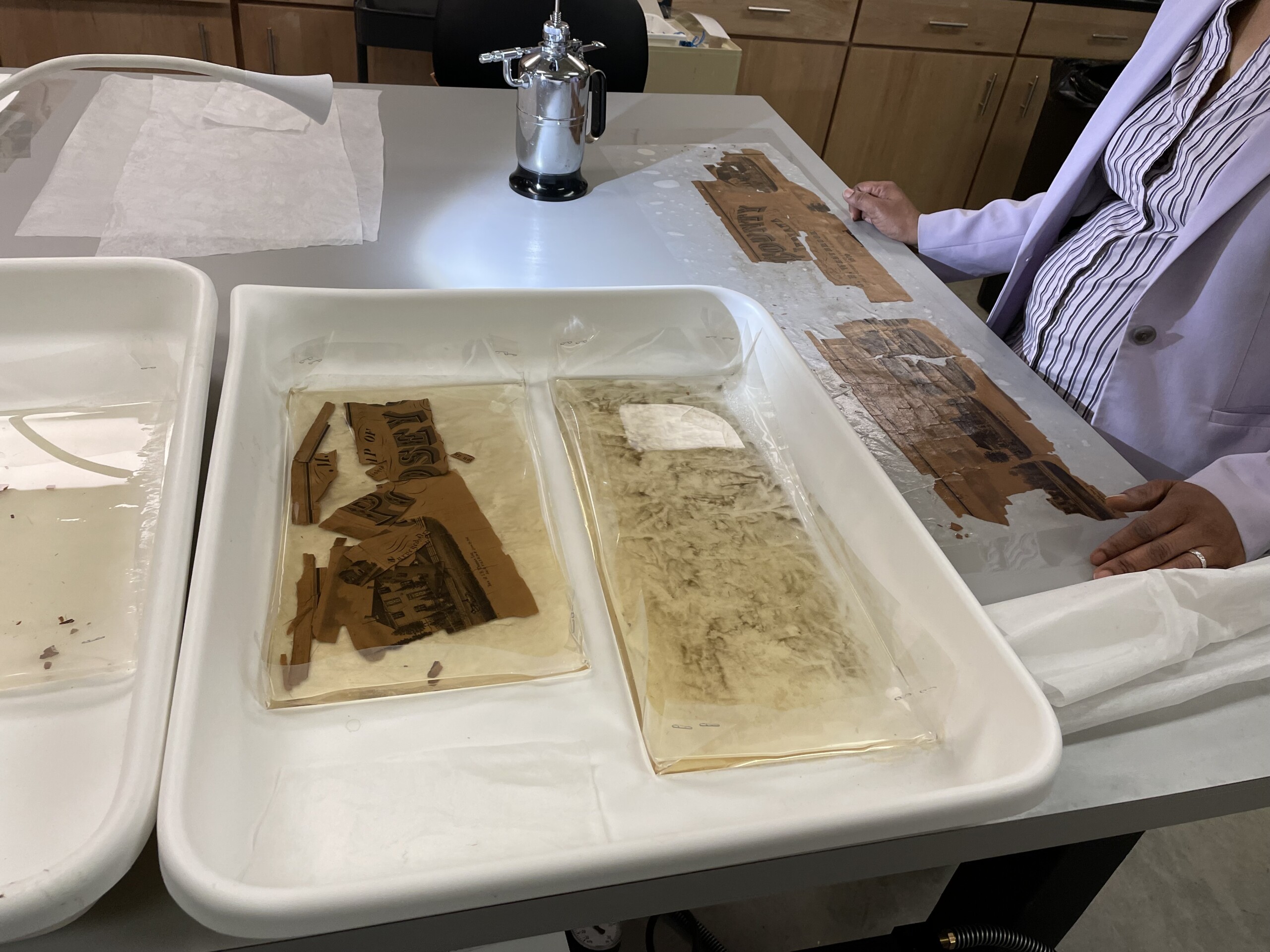
Valinda Carroll washing loose pieces of a map section in custom made trays.
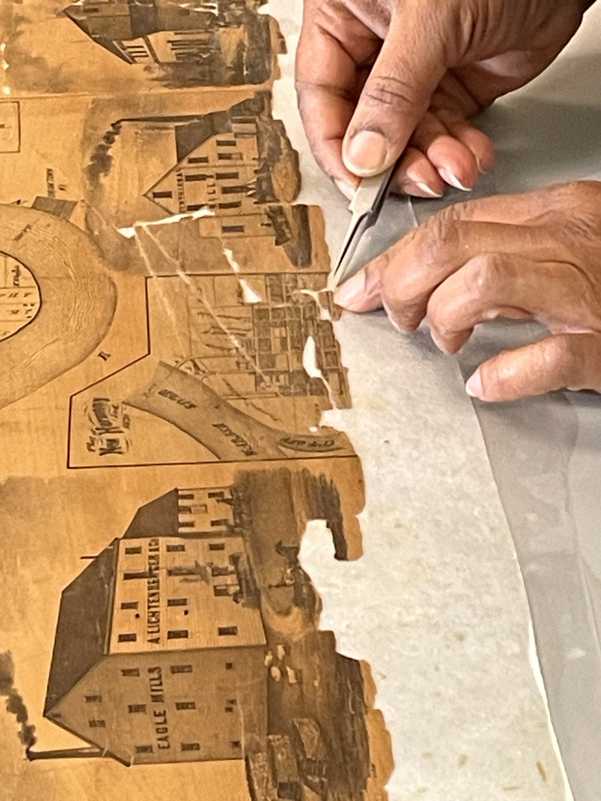
Valinda Carroll placing loose pieces of a map in their correct locations.

Before Treatment – 1855 Noble’s Map of Franklin County Indiana.
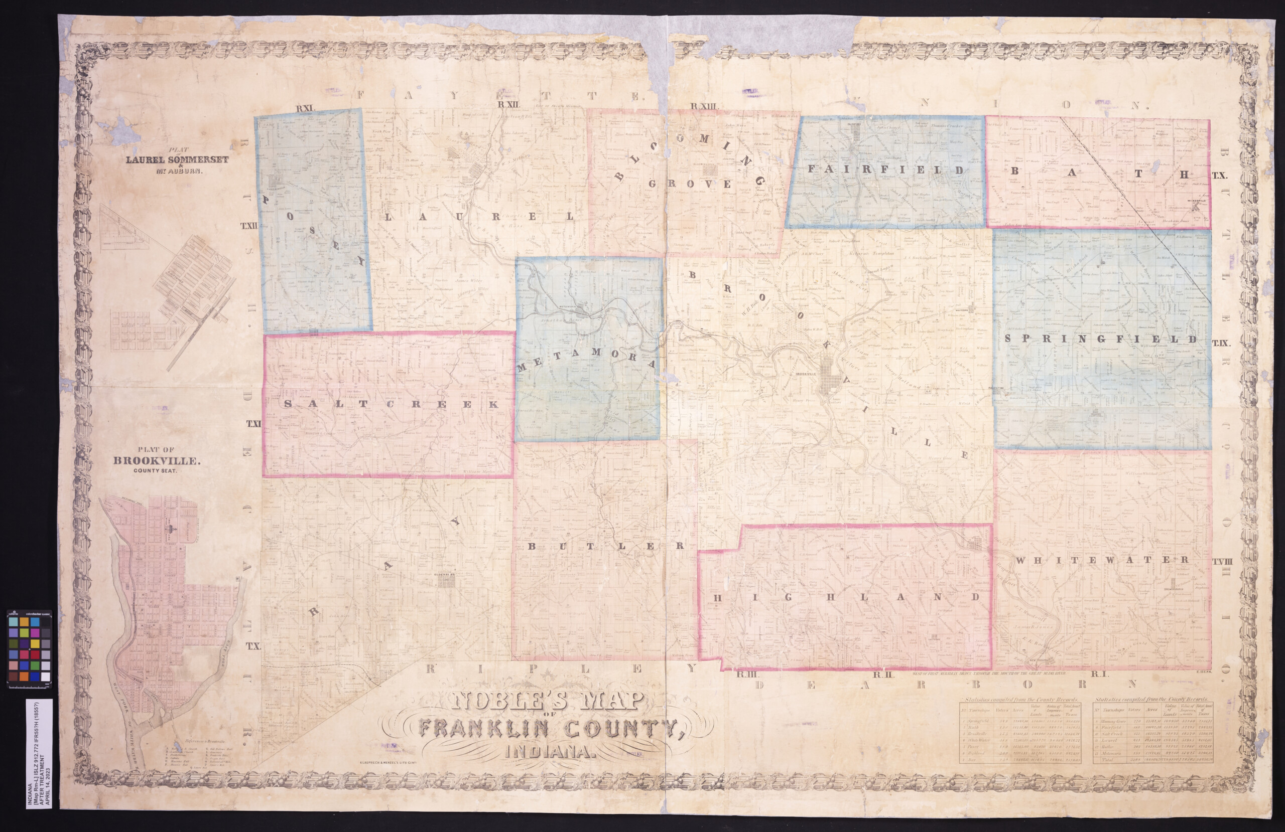
After Treatment – 1855 Noble’s Map of Franklin County Indiana.
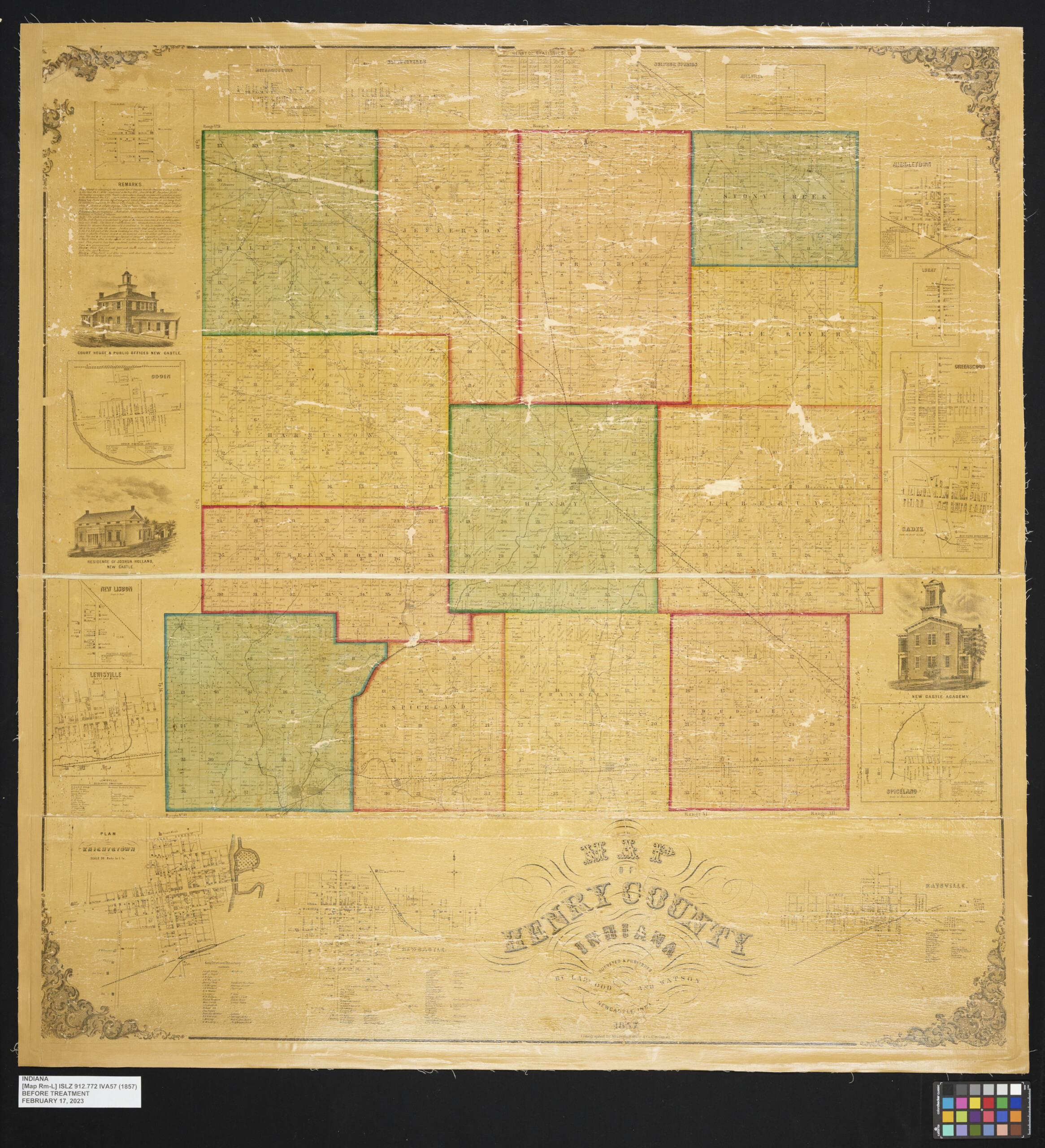
Before Treatment – 1857 Map of Henry County Indiana.

After Treatment – 1857 Map of Henry County Indiana.
This blog post was written by the Indiana State Library Conservator Seth Irwin.