Geospatial awareness in Indiana: Mapping our community past to present

Indiana has a geospatial learning community like no other. We have a supportive network of peers which rivals any other state. Why? Because we value our community and we keep learning more to contribute to the value of our work. The teaching and learning of digital mapping continues as a result of this positive cycle. Our Indiana Geographical Information Council (IGIC) conference occurs annually each May. It is attended by geospatial professionals, new and seasoned geographic information system (GIS) and data users, educators and students from Indiana and the surrounding states. This year marked the fourth conference competition for GIS students and early professionals, held by the IGIC Emerging Professional Group. Geography and GIS courses and degree programs are offered by Indiana colleges and through organizations like The Polis Center. People who are looking to learn GIS fundamentals can attend the Indiana Geospatial Training Academy (IN-GTA). GIS practitioners in this state come from a wide array of backgrounds and a number of them have gained their GISPs, an additional certification level for GIS professionals. There are also many geospatial courses and tools that can be found online at no cost. New learners are welcome!

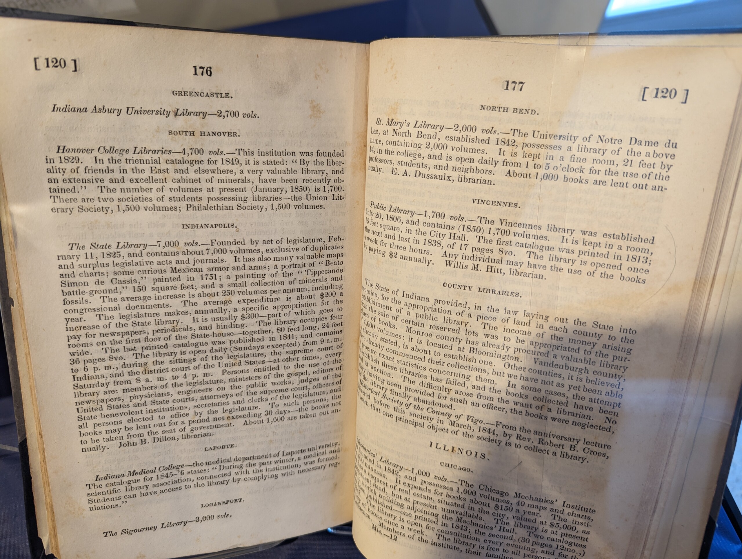
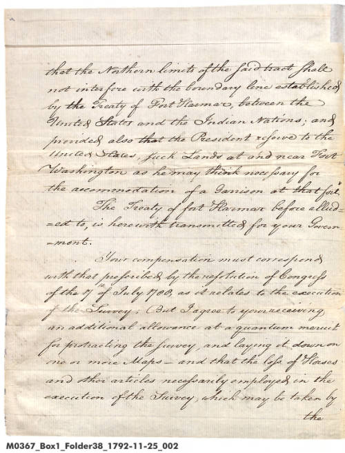
Decorative logo.Indiana’s geospatial history goes back to the mapping of Indiana geology and the first state geologist of Indiana, David Dale Owen (son of New Harmony founder Robert Owen), whose early geologic reports (the state’s first) precede our Indiana Geological and Water Survey (IGWS). Read more in A StoryMap: Landmarks in Indiana Geology – A Timeline. Indiana geography history harkens back to the first land surveying done in the U.S., early USGS maps and Purdue University’s early 20th century soil surveys. Today, the public can view map collections, both digital and in print, held by the Indiana State Library and by Indiana University, going back to the days of the Vincennes territory.

GIS is being used in Indiana to create new digital maps every day to answer questions and solve problems statewide. Historical paper maps remain accessible at libraries, as they can be used to discover paths to the past to verify land ownership, view location details and track geographic patterns over time. Not everything has been digitized, so call upon librarians for support!

Preview the print map collections and find digitized maps using the Indiana State Library Map Collection websites and the State Data Center Maps webpage. To view historical maps in print, you can visit the State Library weekdays from 8 a.m.-4:30 p.m. and every second Saturday of the month from 10 a.m.-4 p.m.

View a subject guide from Indiana University Bloomington about their map collection, the largest in the state, as well as GIS tools here.

If you aren’t involved yet in exploring geospatial tools, this is your chance to discover how these resources can help illuminate parts of your own research and continue to tell your stories. You do not need to have a degree or know much about the technical side of GIS to benefit from it. Check out the Library of Congress collection of story maps to see the kinds of resources being produced today on all topics.

The Indiana Management Performance Hub (MPH), holds a free conference, Data Day, each spring in downtown Indianapolis at Indiana Government Center South. Many state agencies incorporate GIS and use geospatial data in their projects and demonstrate these during the conference. Visit the Data Day 2026 website to view highlights from this year’s sessions as well as session materials from previous years.

The Indiana Geographic Information Office (IGIO) holds a free conference, GIS Day, each year in the fall during national Geography Awareness Week, also at IGC-South. This year’s upcoming conference is Wednesday, Nov. 18. You can contact outreach staff for the office here. For more details about the IGIO, visit A StoryMap: 5-Year GIO Strategic Plan For the Indiana Geographic Information Office. The IGIO is also responsible for IndianaMap, the public portal to geospatial data. Here, you can use the viewer to select features and add map layers yourself from the Data Catalog.

At the IU-Indianapolis Department of Geography, you’ll find GENI, the Geography Educators’ Network of Indiana, which is especially geared towards K-12 and university-level outreach. Explore the website for lesson plans, educational resources, and opportunities for starting and supporting a career in geospatial arts and sciences.

Saturday, June 20, is the grand re-opening of the Indiana Geological and Water Survey Learning Lab, an experiential learning experience for all ages. Learning Lab open hours at the new location will begin on Tuesday, June 16.

Coming up Sunday, Sept. 20, in partnership with the Indianapolis Public Library, attend a GIS Basics program at Central Library, “Mapping Indianapolis: The Science of Somewhere.” Visit here for more information, to register and for a reading list curated by Montoya Barker, Special Collections librarian.

The wonders of mapping are here at your fingertips. There are so many ways to get involved in using maps to learn about the world around us. You can start at your library!

This blog post was written by Katie Springer, reference librarian and director of the Indiana State Data Center. For more information, contact the Reference and Government Services Division at 317-232-3678, or submit an Ask-A-Librarian request.

Analog skills in a digital-centric world

A sentence using roman numerals and cursive that reads "In the year 2026, some skills are fading form use."

If you can easily read the opening sentence as “In the year 2026, some skills are fading from use,” then you were likely born before the digital era. What older generations once understood instantly now requires analog skills that today’s digital environment rarely demands. Among these skills are writing and reading cursive handwriting, deciphering Roman numerals, telling time on an analog clock and navigating by using paper maps.

There are concerns that today’s students don’t know how to read or write cursive handwriting, as schools devote less time to teaching it. In Indiana, the current handwriting standard for third grade only requires that students learn to “write legibly in print or cursive, leaving space between letters in a word, words, in a sentence, and words and the edges of the paper.” Without regular practice, future historians and genealogists may struggle to read handwritten documents. Will they depend entirely on artificial intelligence to convert handwriting into machine‑readable text?

Transcript of above correspondence. "TranscriptIndianapolis Jan 7 64 Sir The bearer Saml. [Samuel] Matthews has enlisted and been mustered as a private in a white company of Greensburgh[sic] Decatur Co. by Capt. Swain. His being a man of color has subjected him to persecution & he was obliged to leave camp. He desires to be transferred to the colored battallion & of course[?] it would be best for him to have it done at once. Respy.[Respectfully], William P. Fishback Commandant Adj. [Adjutant] Gen. [General] Noble Indianapolis"

Transcription of the above correspondence.

Some online tools such as Transkribus are already using AI for handwritten text recognition and continue to improve the accuracy of results. When the 1950 U.S. Census population schedules were released in April 2022, the U.S. National Archives indexed them quickly using Artificial Intelligence/Machine Learning (AI/ML) and Optical Character Recognition (OCR) technology. A 2025 blog post from ISL’s Genealogy Division reported that breakthrough AI technology has transformed how genealogy records are indexed and discovered on FamilySearch.org.

Recognizing Roman numerals is another increasingly uncommon skill. No one wants to make the mistake of misreading “World War II” as “World War Eleven.” Roman numerals remain relevant and appear on monuments, movie copyright statements, Super Bowls, generational suffixes (II, III, IV), Popes, royalty and in book chapters and multi-volume works. The U.S. Government Publishing Office Style Manual (2017) has a section explaining Roman numerals (see below).

Chart of Roman numerals. Indiana’s second-grade mathematics standard requires students to learn to “tell and write time to the nearest five minutes from analog clocks, using a.m. and p.m.” Since many classical clock faces have Roman numerals, that is an opportunity to learn both skills together.

The Indiana State Library has an extensive collection of sheet maps, atlases and even a few globes. Researchers utilize the county map collection with enough frequency that many historical maps have been digitized for preservation, wider access and downloadability.

Yet in an age of GPS, the general ability to navigate with printed maps is fading. Analog map reading involves interpreting scales, symbols and grids to measure distances and understand terrain – skills less practiced as many travelers rely solely on digital navigation. Before GPS, family road trips required a good road atlas or free state highway map to plot a route. In 2021, the Indiana Department of Transportation cited increased GPS usage as a reason to stop printing state roadway maps, instead offering a downloadable copy.

Indiana Social Studies Standards introduce map concepts as early as kindergarten and continue through elementary grades. By fifth grade, students should “use maps and globes to locate states, capitals, major cities, major rivers, the Great Lakes and mountain ranges in the United States.” If their GPS lets them down, will digital natives appreciate having the skillset to read a print map?

As the saying goes, “If you don’t use it, you lose it.” It remains unclear whether digital natives will master analog skills, as this depends on their personal interests and the influence of those who value such skills. And with keyboards, digital clocks, and GPS handling many tasks, will future generations even need these skills?

This post was written by Andrea Glenn, Indiana Division librarian and state documents coordinator at the Indiana State Library.

Resources
Ferrante, Ricc. “Is There a Place for Paleography in Archives?” Smithsonian Institution Archives, January 23, 2018. Accessed May 21, 2026.

Indiana Department of Education. Indiana Academic Standards for English/Language Arts (2023). Accessed May 21, 2026.

Indiana Department of Education. Indiana Academic Standards for Mathematics (2023). Accessed May 21, 2026.

Indiana Department of Education. Indiana Academic Standards for Social Studies (2026). Accessed May 21, 2026.

Reading Old Documents.” The British National Archives. Accessed May 21, 2026.

Thompson, Clive. “From Ptolemy to GPS, the Brief History of Maps.” Smithsonian Magazine, July 4, 2017. Accessed May 21, 2026.

Transcription Tips.” U.S. National Archives, March 12, 2025. Accessed May 21, 2026.

U.S. Government Publishing Office. U.S. Government Publishing Office Style Manual. Government. U.S. Government Publishing Office, January 11, 2017. Accessed May 21, 2026.

New additions and a new look for Hoosier State Chronicles

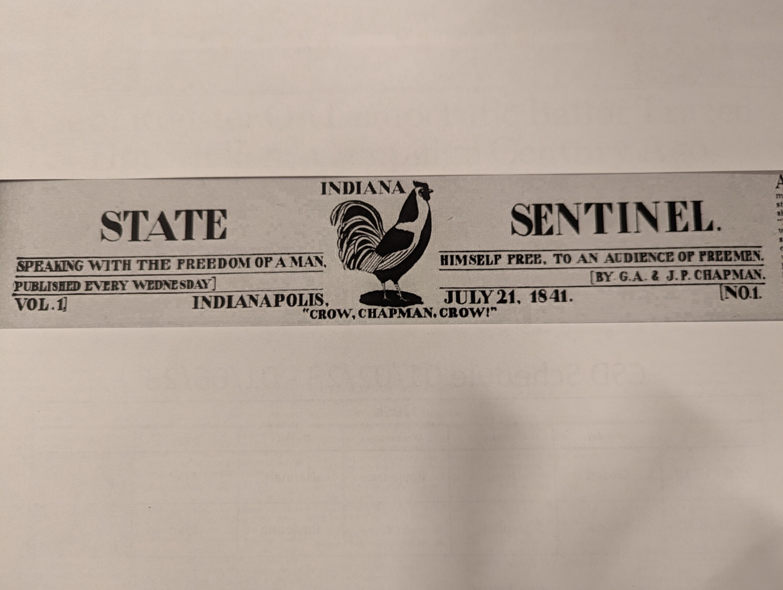
Hoosier State Chronicles, Indiana’s digital historic newspaper program operated by the Indiana State Library, will have rare newspapers from St. Joseph County, Noble County and Lake County added to its collection this year. The Walkerton Historical Society, Ligonier Public Library and the Whiting-Robertsdale Historical Society contributed to the project. More than 100,000 pages have already been added to Hoosier State Chronicles this year.

Brochure advertising Hoosier State Chronicles.

The Walkerton titles feature the St. Joseph County Independent, which later became the Walkerton Independent. This series spans widely from 1886 to 1962, when it would merge into the Independent-News.

Noble County’s long-running newspaper, The Banner, started as the National Banner and changed its name to Ligonier Banner in 1879. Originally published in 1866, John Stoll’s newspaper continued under several owners until 1950, when it lost its competition with its rival, the Leader. The series is a consistent resource for local research.

Later this year, the Whiting-Robertsdale Historical Society’s newspapers will be available in Hoosier State Chronicles. Originally the Whiting Times, the Lake County newspaper changed names to the Ben Franklin News, the Daily Times and finally the Times-Graphic. All iterations of Whiting-area news, from 1928 through 1974, will be provided in an open forum for genealogists and historians.

Veridian Newspaper Digitization Services, the organization that built the Hoosier State Chronicles platform, upgraded their site in January. The update should provide Hoosier State Chronicles users with greater website speed and intuitive functions. Researchers can now easily download and save a clear and crisp page of vintage Indiana newsprint. Visit Hoosier State Chronicles here.

This post was submitted by David Pleiss, newspaper librarian with the Indiana Division of the Indiana State Library. 

Weather data resources in Indiana

After this season’s early snowfall – followed by a long 10-day stretch of temperatures below 30 degrees – I thought it would be a good time to remind people of the weather data resources that we have right here in Indiana.

Let’s start with the Indiana State Climate Office at Purdue University. It has been in operation since the 1950s and is currently led by Dr. Beth Hall, the state climatologist. We frequently refer patrons to the office when they are searching for historical weather data for a certain geographic area in the state. Visit the website, and it immediately points you to several different places to start your search for current weather conditions and trends throughout Indiana. View current seven, 30 and 90-day Climate Maps for the state. You can find the monthly e-newsletter of Indiana’s CoCoRaHS, the Hoosier Observer, here as well. CoCoRaHS stands for Community Collaborative Rain, Hail, & Snow network, an organization made up of community volunteers who observe and report precipitation across the U.S., U.S. territories and Canada. View a slideshow about its history here. The office also allows you to submit a data request via the website if you are looking for specific weather data.

Picture of tire tracks on a snowy ground.

An affiliate of the State Climate Office is the Midwestern Regional Climate Center (MRCC), also at Purdue University. MRCC maintains data for Illinois, Indiana, Iowa, Kentucky, Michigan, Minnesota, Missouri, Ohio and Wisconsin. Its online data portal is called CliMATE. The interface has been updated and it is full of data tools for the region. Compare today’s data with the weather for the last 10 years – the precipitation, snowfall, snow depth and high/low temperatures for each day, or choose a date in history and compare the data for each year. Compare the snowfall on this date for your county for the last 20 years! Brown County had 7.2 inches of snow on Dec. 9, 2005.

The MRCC provides an Ag Climate Dashboard, in cooperation with the United Soybean Board, for agricultural research into current precipitation, temperature, soil, environmental and crop conditions. It also points to tools that predict the probability of a freeze or extreme heat. View the MRCC Snowfall Climatology Toolbox, an interactive map that allows you to see snowfall data back to 1880. Additional GIS-based tools from the Midwest Climate Watch include the Tornado Tracks tool (1950-2024), showing touchdown points and tracks by magnitude across the Midwest and the Climate Perspectives Tool which displays max/min/mean temperatures and precipitation in real time.

The Indiana State Data Center resource Statistics by Topic will lead you to federal and state sources for authoritative weather data such as NOAA’s National Weather Service (Weather.gov) and Climate.gov. Ball State University’s Bracken Library also has an excellent LibGuide on Meteorology & Climatology that points to resources from NASA and the World Meteorological Organization (WMO).

Indiana travel advisory map.

Travel advisory map.

Don’t forget to check your local news by phone, TV or radio before you leave home or the office. In Indiana, the weather can change at the drop of a hat, so to stay safe on the roads, you can check the DHS Travel Advisory Map for your county. INDOT TrafficWise 511.org also has the latest live road images of your area of the state. NWS provides links to road conditions for the surrounding states.

Stay prepared for Indiana weather in the new year!

This blog post was written by Katie Springer, reference librarian and director of the Indiana State Data Center. For more information, contact the Reference and Government Services Division at 317-232-3678, or submit an Ask-A-Librarian request.

Indiana history textbooks

The Indiana book collection at the Indiana State Library does not claim to be a complete representation of all textbooks ever used in our state’s public schools, but it has a decent sampling. The collection includes the history textbook Indiana Yesterday and Today that many fourth graders in the mid-to-late 1980s would have used, including myself. There are examples of the 1991 textbook Indiana along with the 2014 textbook Indiana Social Studies Grade 4.

Book cover.Book cover.Book cover.

Early schools in the United States used texts such as McGuffey primers and readers. In 1852, the Indiana General Assembly enacted the Indiana Free School Law and created the State Board of Education. The Board would improve education for all students with standards for teacher training, school buildings, curriculum and textbook selection. In the latter 19th century, textbooks were readily available at lower costs, making competition fierce among publishers to have their titles appear on state-approved lists.

In the early 20th century, the intensive study of state history was not in the recommended curriculum for lower elementary grades. Both Indiana history and state government were usually taught to seventh or eighth graders. Here are three examples of those texts:

Book cover.Book cover.Book cover.

By the mid-1960s, there was a shift in Indiana’s history curriculum, moving it to fourth grade. In response, authors of textbooks adjusted the reading level and gradually added more colorful graphics. Below are three Indiana history textbooks that were listed on the social studies textbook adoption list from the Textbook Commission of the Indiana State Board of Education [ISLO 379.156 no.3 1969]. The adoptions cover the five-year period beginning July 1, 1969. It was up to individual school corporations to choose which textbooks on the list best suited their students.

Book cover.Book cover.Book cover.

Explore the 19th through 21st centuries in the Indiana Collection through the Evergreen online catalog. You never know what will be listed.

This post was written by Andrea Glenn, Indiana Division librarian and state documents coordinator at the Indiana State Library.

Constitution and Citizenship Week at the Indiana State Library

The Indiana State Library just finished celebrating Constitution and Citizenship Week. Constitution Day and Citizenship Day are annually recognized on Sept. 17, on the anniversary of the signing of the U.S. Constitution by delegates to the Constitutional Convention in 1787. Constitution and Citizenship Week runs from Sept. 17 to Sept. 23. The observance day was initially established by Congress in 1952, replacing “I Am an American Day,” and was officially adopted the name Constitution Week in 1956 to encourage citizens to reflect on the rights and responsibilities of citizenship.

Painting of Constitution signing.The Indiana State Library partnered with a local chapter of the Daughters of the American Revolution (DAR) to create a U.S. Constitution themed display, located on the second floor of the library. The DAR organization has a long history of celebrating the Constitution, and has displayed a Constitution and Citizenship themed exhibit at the State Library for the last few years. In 1955, the group petitioned Congress to annually dedicate Sept. 17-23 for the observance of Constitution Week. The display will be up through the month of September.

Constitution Day display.The Indiana State Library also hosted a free Constitution Day Trivia event on Sept. 17. The event, which was open to the public, consisted of three rounds of questions on topics relating to the U.S. Constitution, U.S. Government and U.S. Census and Population. The winning team took home a Taste of Indiana gift basket. The Constitution Day trivia is the last trivia event of the year, but the Indiana State Library will be hosting future trivia events in 2026. The library also has pocket sized-constitutions, pens, bookmarks and Constitution-themed games and activity printouts for free for those interested.

Crowd watching speaker.

Constitution Day Trivia event.

The Indiana State Library participates in the Federal Depository Library Program (FDLP), whose mission of federal depository libraries is to provide local, free access to information published by the federal government in an “impartial environment.” The Indiana State Library serves as the Regional Depository for the state of Indiana and ensures the public access to government information and civic engagement.

This blog post was written by Indiana State Library federal documents coordinator Brent Abercrombie. For more information, contact the Reference and Government Services at 317-232-3678 or via “Ask-A-Librarian.”

Marquis de Lafayette

In recalling early American history, we are accustomed to remembering the founding fathers, battles of the Revolutionary War, Native American removal or the beginning of the fight for women’s suffrage.

Are you aware, however, of an early bond between the United States and the country of France, by way of Marquis de Lafayette, otherwise named Marie-Joseph Paul Yves Roch Gilbert Du Motier de La Fayette? This French courtier sought glory as a soldier, was a friend to the first U.S. President and inspired support for our new country.

Display case showing various Marquis de Lafayette items.

Marquis de Lafayette display on the second floor of the Indiana State Library.

After losing his father in the French and Indian War, Lafayette was very young, 13, when he decided to join the King’s Musketeers (Mousquetaires due roi) in his home country. The group is described as “an elite troop at the heart of power” in a 2023 thesis, “Les Mousquetaires due Roi,” by Julien Wilmart. Lafayette was officially accepted in 1771 and attended military training at Versailles, just one year after he inherited an immense fortune due to the death of his relatives.

These circumstances set into motion a tremendous push by one man to brave against the British on the side of the United States. The American Friends of Lafayette have created a timeline here about key events in his life.

I’d like to share the Government Information resources you can view online or in various institutions across the United States and France about Lafayette. These resources hold details of his relationship with the United States, his dedication to the cause of the American Revolution and the parallel history we share with the French Revolution.

The Palace at Versailles presents a brief biography online about him here.

The Library of Congress has several items showing his history, starting with A complete history of the Marquis de Lafayette published in 1826. It also holds a collection of Marquis de Lafayette papers, 1757-1990 in its Manuscript Division.

The National Archives makes available transcripts of original letters from John Adams to Lafayette, 3 February 1778, to Benjamin Franklin in 1779, from Thomas Jefferson to Lafayette, 16 June 1792, and many letters from George Washington from various collections. The Archives even capture statistics of the wounded and killed at Yorktown sent to Lafayette by Alexander Hamilton in 1781. The National Park Service details his experience at Yorktown here.

The Thomas Jefferson Encyclopedia entry on Marquis de Lafayette explains in detail Lafayette’s impact on both the U.S. and French Revolutions.

A key player in the French Revolution, Lafayette was imprisoned by the Austrian and Prussian governments, and wrote letters while in exile. These are available at the National Library of France (BnF) here: Lettres de prison et d’exil .

Not only did Lafayette establish himself as a friend of the Revolution and fight for the United States; he was invited by President James Monroe to return for a Farewell Tour in 1824-1825, where he made one stop in Indiana – at Jeffersonville, on May 12, 1825. The American Friends of Lafayette sponsored a bicentennial commemoration of Lafayette’s Farewell Tour in 2024-2025, featuring stops in the 24 states he visited then. View a map of his stops here.

Lafayette’s original accounts of the tour are available at the National Library of France (BnF) here Voyage du général aux Etats-Unis d’Amérique, 1824-1825.

A beautiful display on Marquis de Lafayette is now viewable on the second floor of the Indiana State Library, installed by Roxanna O’Bryant. Please come for a visit! For more details about the bicentennial commemoration of Lafayette’s Farewell tour of the United States, stay tuned for our Dec. 11 blog post.

This blog post was written by Katie Springer, reference librarian and director of the Indiana State Data Center. For more information, contact the Reference and Government Services Division at 317-232-3678, or submit an Ask-A-Librarian request.

Indiana Department of Workforce Development data

I’d like to introduce you to data from the Indiana Department of Workforce Development, one of the State Data Center’s long time partners in providing access to public data about Indiana. The Indiana DWD produces data and reports about state employment at multiple geographic levels using its website Hoosiers by the Numbers, or HoosierData.IN.gov. With assistance from another SDC partner, the Indiana Business Research Center, they have created dashboards and data visualizations to make it easier for us to understand the current state of employment and labor market in the state.

Let’s start with the county quick stats.

You can drill down immediately to county-level data on the first page of Hoosiers by the Numbers with a clickable map of all 92 counties. With one click, you’ll receive a county profile full of data highlights covering population, education, commuting, labor force, industry and income.

If you choose St. Joseph County in northern Indiana and click the tab for commuting, you’ll see that the total picture of this county in 2023 includes workers who came from the state of Michigan and also from Elkhart, LaPorte and Marshall counties in Indiana to work in St. Joseph. The majority of workers (84%) traveled by car/truck/van to get to work. Five percent of workers used a motorcycle, bicycle or walked to work. One percent took public transportation. Almost 10% of workers worked from home.

You can look county-by-county to see a comparison of where people came from to work in Indiana counties and how they traveled to get to work. You can download your results in Excel, Word or PDF formats.

If you choose the tab for industry, you’ll see the people who worked in various industries within each county. For Vanderburgh County in the southwest corner of the state, the majority of people worked in health care and social assistance services in 2023. Manufacturing, retail trade and food service round out the top four.

Under the income tab, you’ll see an industry breakdown with the average pay a person received. In Marion County, the top income in 2023 was in company management ($121,032), followed by Utilities ($115,447). The bottom industries in the county were food services ($27,629) and retail trade ($41,036).

To the right of the quick stats, you’ll find the workforce economy dashboard. Here, you can take a quick look at a real-time statewide picture of employment and how different indicators are increasing or decreasing by the month.

The Hoosiers by the Numbers website is designed to be navigated by a row of tabs at the top.

There are two ways to navigate the site by audience. If you are currently looking for a job, explore the job seekers resources to study up on the labor market you’re diving into and preview the employment outlook projections, as well as the hourly wage dashboard to see the average wage or salary for the different occupations across the state. If you are an employer or business owner, explore the employer resources.

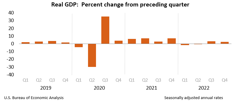
The tab for topics allows you narrow your search for workforce data by topic. For example, choose clusters to view Indiana data by industry cluster or choose economic indicators to look at the statewide indexes and monthly GDP growth chart. You can also view all of the data on the topic of occupations.

Under the tab for “Tools” on the main page, you can click on a variety of data tools, including infographics. For example, “What did Hoosiers study in college?” can show you how many people of varying generations studied a range of topics. But don’t stop there. Under the “Regions” tab, choose the business lookup tool to explore a listing of businesses in your county, georeferenced to pop up on the map. Each listing includes the name, industry, address, number of employees and annual sales.

The Indiana DWD produces current monthly county city, and MSA employment reports that you can access through this website.

Lastly, the DWD Data Request Portal allows you to request data directly from the agency and explains the difference between what is publicly available and what is restricted. Both are available upon request.

Please bookmark this website and plan to revisit it throughout the year, as it is continually updated with the most up-to-date labor market data in Indiana. As always, contact the State Data Center for more information about locating the data you need!

This blog post was written by Katie Springer, reference librarian and director of the Indiana State Data Center. For more information, contact the Reference and Government Services Division at 317-232-3678, or submit an Ask-A-Librarian request.

*A note on the terminology. When data is seasonally adjusted, this means the seasonal patterns are removed from the data using statistical techniques. This is done to smooth out the data and make a clearer picture of the employment data trends. For more information, see the Census Bureau webpage for time series and seasonal adjustment. The Federal Reserve Bank of Dallas also offers a good explanation.

Discover the wonders of the Indiana State Library

Have you ever wondered what treasures lie within the walls of the Indiana State Library? From interactive tours to diving deep into the state’s rich history, there’s something for everyone. Here’s a list of activities that will make your visit both fun and enlightening:

Clifford The Big Red Dog’s house

Families with young children will love visiting Clifford The Big Red Dog’s house in our Indiana Young Readers Center. It’s a delightful spot for kids to engage with their favorite storybook character. Did you know that Clifford the Big Red Dog’s adventures started right here in Indiana? Norman Bridwell, the creative genius behind this iconic tale, hailed from Kokomo.

Trace your ancestry
Are you interested in genealogy? Our Genealogy Division offers resources to help you trace your family tree and discover your ancestry. Who knows what you might discover about your past! If you’re new to genealogy or just starting out, don’t worry – we have you covered with our comprehensive genealogy FAQs.

Image credit: Map Collection, Indiana Division, Indiana State Library.

Learn about Indiana history
Dive into the rich history of Indiana with our extensive collection of historical documents, photographs and maps. Whether you’re a history buff or a curious mind, there’s plenty to explore. One of my favorite things to do is browse our online digital collection or search Hoosier State Chronicles, which contains 186,601 newspaper issues comprising 1,589,638 pages and 619,771 articles!

Explore maps, rare books, manuscripts and exhibits

Our library boasts an impressive collection of maps, rare books, manuscripts and rotating exhibits. Each visit can reveal new and intriguing finds. This year, to celebrate our bicentennial, a significant portion of our exhibit space will be dedicated to showcasing items from our collection. Don’t forget to check out our virtual exhibits online from the comfort of your home!

Learn about our State Data Center

Discover a wealth of information available at our State Data Center. It’s the perfect place for researchers and anyone looking to delve into data and statistics about Indiana. One of our State Data Center Director’s favorite resources is the original volumes of each U.S. Census return, located on the second floor of the library. These allow you to look at the original censuses from 1790 through 1870 and cover the entire United States. Indiana is covered starting in the 1810 volume (Indiana Territory).

Don’t forget to check out the DataPoint Newsletter, created for Indiana Data Users and subscribe for the latest Indiana Data news and lore, plus learn about professional development opportunities for data and GIS professionals.

Visit the Indiana Historical Bureau
Stop by the Indiana Historical Bureau, located inside the Indiana State Library, to learn about the Indiana Historical Marker Program and how it commemorates significant historical sites throughout the state. This year, some of the markers they will be dedicating include William P. Jungclaus, Riley Hospital for Children, Bess Sheehan and the Piankashaw Tribe. Don’t forget to check out their podcast Talking Hoosier History and their blog Untold Indiana.

Attend programs and conferences
We host a variety of programs and conferences throughout the year. From author talks to educational workshops, there’s always something interesting happening at the library. Check out our library calendar to see our upcoming events.

Whether you’re a student, researcher or just someone with a thirst for knowledge, the Indiana State Library has something to offer. Your Indiana State Library is free and open to the public, so plan your visit today and discover the many wonders waiting for you!

This blog post was submitted by Michelle Sharp, collections and outreach manager at the Indiana State Library.

Small business data resources

Data research goes hand-in-hand with business research. Though small businesses are a small percent of the data requests we receive at the State Data Center @ the Indiana State Library throughout the year, this data makes up an important part of the landscape of patrons served by our nationwide SDC network.

The U.S. Census Bureau recently released an annual data product called Nonemployer Statistics. What is a nonemployer, you might ask? Don’t worry! I ask this question all of the time. It turns out that this is the Census Bureau’s fancy way to say: “This business is run by one person only – the business owner. They don’t pay anyone else to run the business with them.” Here is the Nonemployer Statistics Glossary definition for the term:

A nonemployer business is one that has no paid employees, has annual business receipts of $1,000 or more ($1 or more in the Construction industry), and is subject to federal income taxes.

A nonemployer business is by nature considered a small business, and this is why I’d like to share the Small Business Resources you have at your fingertips through the State Data Center network. If you are a librarian or teacher, you can share these with your patrons and students, in hopes that their enterprising spirits are inspired during this year’s busy holiday season.

Federal Resources
Census Bureau’s State Data Center Program
There is an SDC in every U.S. State and major territory. You can request data – including economic and business data – and assistance from local experts using each statewide network here.

Census Bureau’s Census Information Center Program
The SDC’s companion program, the CIC Program, works closely with local data users to provide local communities of practice and policy analysts with training on using census data. Their statewide network can be accessed here.

U.S. Small Business Administration
The SBA can help you obtain funding for your small business by way of helping with research for loans and grants. Find information about business planning, running your business, and disaster planning here. View this current SBA blog article for “5 Small Business Trends for 2025.”

The SBA Indiana District Office is in Indianapolis and serves the entire state.

SCORE
A partner with the SBA, through SCORE.org, find a business mentor, plus access to free learning resources for starting and growing your small business.

State Resources
Indiana Secretary of State
Indiana’s INBIZ service lets you do research on current businesses, file to register your business, find state forms and answer questions about legal requirements.

Indiana Business Research Center
The IBRC at Indiana University’s Kelley School of Business is a partner of the State Data Center Program. Carol Rogers, a long time friend of the SDC, can assist data users in answering Indiana’s economic quandaries.

Center for Business and Economic Research, Ball State University
Ball State’s CBER is a partner of the State Data Center Program. The research team at CBER is dedicated not only to the Muncie area, but statewide coverage. Its director, Michael Hicks, is a frequent contributor to current literature about Indiana’s economy.

Indiana Economic Development Corporation
The Indiana Economic Development Corporation network has 10 regional Small Business Development Center offices and a University Center at the Purdue Center for Regional Development.

I hope you find these resources useful!

This blog post was written by Katie Springer, reference librarian and director of the Indiana State Data Center. For more information, contact the Reference and Government Services Division at 317-232-3678, or submit an Ask-A-Librarian request.