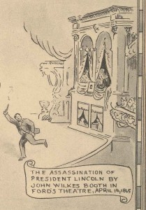
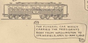
As April 14 approaches, we remember that 150 years ago President Abraham Lincoln was assassinated. In the Indiana Division’s Map Collection, we have an interesting illustrated map entitled, “Abraham Lincoln, a Pictorial Outline of the Life of the Sixteenth President of the United States” [Map Rm-s] ISLZ 912.77 NT65S 1865 (1934). Karl Smith was the cartographer and illustrator of this map which includes events of Lincoln’s life from 1809 through 1865. Events of April 1865 include Lincoln’s Assassination at Ford’s Theatre and the Lincoln Funeral Train. These small sections from the map are included below.
John Speed of Louisville, Kentucky provided the historical data used in this map. The Speed family of Louisville, Kentucky had a connection to Abraham Lincoln as described in the book, Louisville’s First Families : A Series of Genealogical Sketches (1920). The Speed Family biographical sketch notes, “It was to ‘Farmington’ that Abraham Lincoln came before the Civil War to visit his friend, Joshua F. Speed, the fifth son of Judge Speed. The friendship, which was one of Lincoln’s strongest attachments, was the result of a meeting in Springfield, where Joshua Speed spent seven years in his early manhood.” The sketch continues by explaining that “James Speed, born in 1812, was Attorney General in Lincoln’s cabinet….and was mustering officer for the United States army in the Civil War. All the Speeds were loyal Unionists.” An illustration of Farmington, the Speed home, is also included in the map.
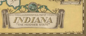
The Indiana Map Collection [Map Rm-s] ISLZ 912.772 I34S (1934) contains another map created by Karl Smith, “An Historical and Geographical Map of the State of Indiana ‘The Hoosier State.’”
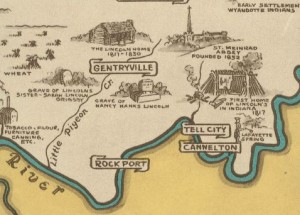
The grave of Lincoln’s older sister, Sarah Lincoln Grigsby is noted, as is the grave of his mother Nancy Hanks Lincoln. A speculative rendering of the Lincolns’ first lean-to style home is marked. A drawing of a log cabin represents what may have been several evolving residences along Little Pigeon Creek. The nearby town of Gentryville is labeled, although it was not platted until 1854, long after the Lincolns moved to Illinois in 1830. The Spencer County community was settled by James Gentry, Sr., the farmer and merchant who hired Abraham Lincoln in 1828 to transport merchandise by flatboat to New Orleans. The site of the Lincoln log cabin was known much later as Lincoln City, presently an unincorporated area.
Karl Smith created a number of illustrated maps including a 1953 variation of the Lincoln timeline map. Commissioned by the J. B. Speed Art Museum in Louisville, Smith created illustrated maps of several states, including Kentucky. More of Smith’s maps can be viewed on website of the David Rumsey Map Collection. According to Smith’s memorial on Find A Grave, he was also known as the creator of the The Little Colonel Game, a board game and promotional tie-in to the 1935 movie starring Shirley Temple.
The two Karl Smith maps described in this article are among the many interesting illustrated maps we have in our Indiana Collection.
This blog post was written by Andrea Glenn, Indiana Collection Librarian, Indiana State Library. For more information, contact the Indiana Collection Division at (317) 232-3670 or “Ask-A-Librarian” at http://www.in.gov/library/ask.htm.


