
It seems true that the most informative maps to use for local history and genealogy research are maps with the greatest amount of detail. The three most recommended, and requested, maps at ISL are these large scale varieties: plat maps, Sanborn Fire Insurance maps and the 7.5 minute topographic map series. Coverage varies for these maps, but you will certainly find the area you are investigating on at least one of these maps. To the great advantage of researchers (and preservationists) these maps are increasingly being made available online.

The USGS 7.5-mintue topographic maps cover every inch of Indiana ground with editions dating back to the late 1940s. One inch represents 2000 feet, so perhaps they are better described as medium-scale. Regardless, they are detailed enough to pin-point a neighborhood and figure out what the landscape of grandpa’s farm looked like. They are offered multiple places online. You can find them at the USGS Store and also at the USGS’s new online viewer. The maps are free to download either way you go at it.
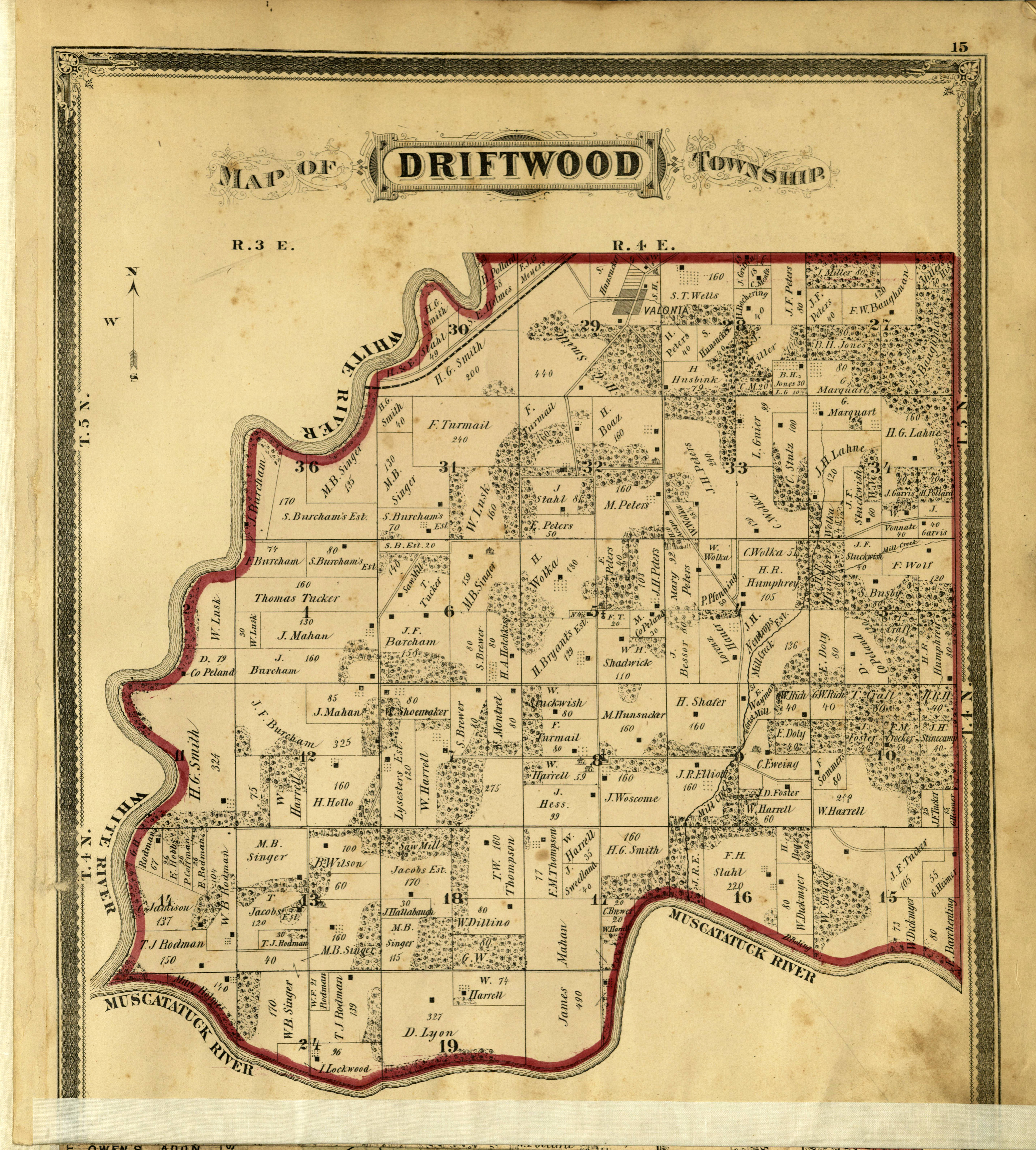
An Illustrated Historical Atlas of Jackson County, Indiana; Driftwood Township. Map Collection, Indiana Division, Indiana State Library.
Showing even more detail of grandpa’s farm (perhaps even the cows, pigs and grandma, too) are the historical plat atlases. Most of Indiana’s historical plat atlases are available online. Not all of them are online yet, but ISL is working to fill the gap! IUPUI, Ball State, Ancestry and the Indiana State Library are making an effort to digitize these helpful maps. The atlases were published by county, with individual maps of each township. These often have some biographical and statistical information as well. These are great for rural areas. Try looking for plat maps at the following sites:
Indiana State Library Map Collection
IUPUI Historic Indiana Atlas collection
Ancestry.com has a collection called U.S., Indexed County Land Ownership Maps, 1860-1918. This collection includes maps from across the county and covers about 60 of Indiana’s 92 counties.
The Sanborn Fire Insurance maps are the most detailed maps you will find of developed areas. IU Bloomington has a nice collection of pristine pre-1924 Sanborn maps available online: https://libraries.indiana.edu/union-list-sanborn-maps
IUPUI has digitized the state library’s Indianapolis volumes and they host them in their Indianapolis Sanborn Map and Baist Atlas Collection.
And of course, don’t forget there are thousands more maps that haven’t yet been digitized. Investigate the thousands of print maps we hold in the Indiana State Library Map Collection.
Happy hunting!
This blog post was written by Monique Howell of the Indiana Division at the Indiana State Library. For more information, contact the Indiana State Library at (317) 232-3670 or “Ask-A-Librarian” at http://www.in.gov/library/ask.htm.